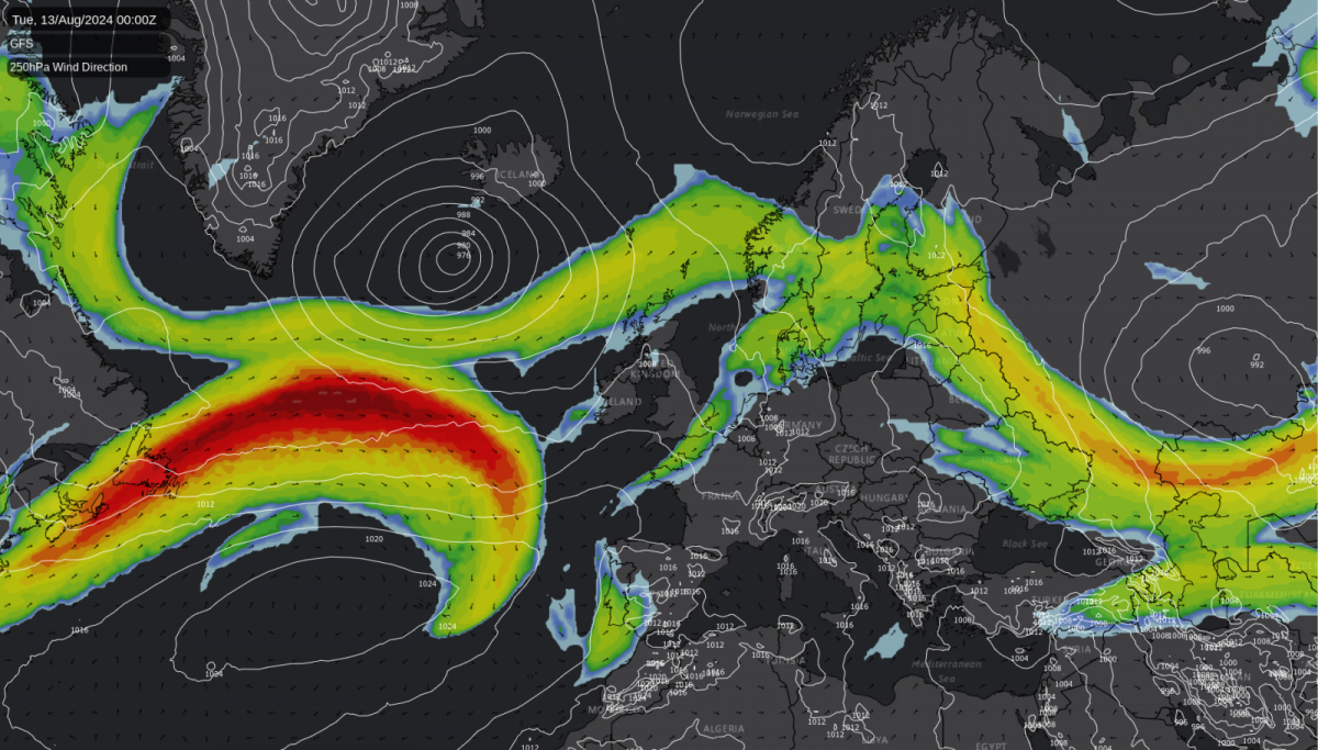
After the hot weather last week, we've settled into a cooler and less settled pattern this week, with more of that to come during the next few days. However, with ex-hurricane Debby shaking things up in the Atlantic, the Jet Stream is set to move north later this weekend and into next week, bringing an increasing likelihood that another pulse of hotter air will move northwards towards the British Isles.
It's the south and southeast of the country likely to see the highest temperatures, with the low, perhaps mid-thirties Celsius not out of the question. Even other parts of England and Wales are likely to experience a warmer, more humid feel. The dividing line between the hotter air in the south and cooler air further north is tricky to call at the moment, though. Along that divide, there could be some heavy bursts of rain, with showers in the cooler zone as well.
The Forecast Jet Stream for Friday
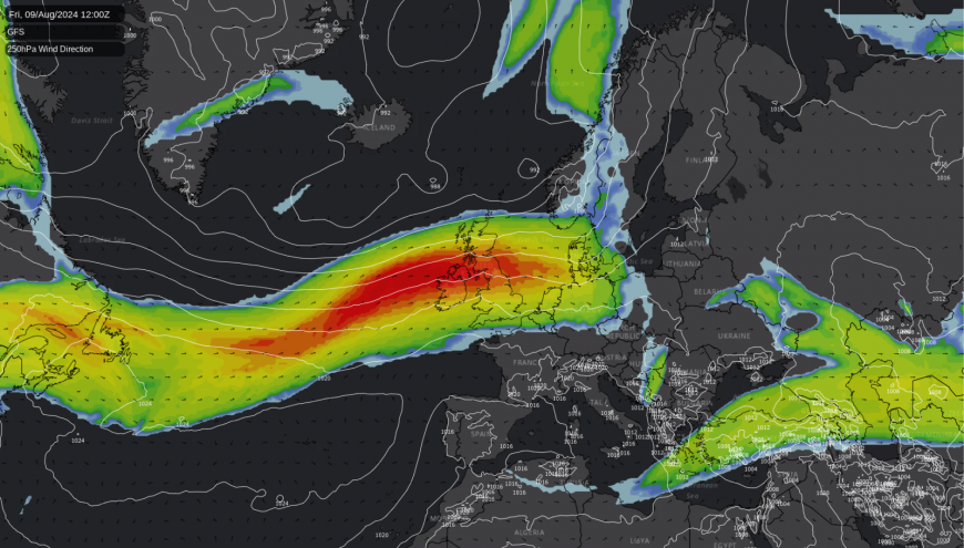
During the early part of next week, the hot air will likely be squeezed ever further south and east, with some sharp showers or thunderstorms possible during that process. By midweek, it then looks probable that less hot, less settled weather will be back countrywide - although it's fair to say that there is a lot of uncertainty around the whole process from the weekend onwards.
The Forecast Jet Stream for next Tuesday

At shorter range, a spell of rain will be inbound from the southwest during Thursday, bringing some heavy bursts as it moves through. Western regions, Northern England, Southern and Central Scotland are likely to be the wettest spots. As has been quite typical lately, though, the southeast corner of the country will stay quite sheltered, with the rain becoming patchy and lighter as it moves through into the region from late morning.
The first band of rain will eventually clear the northeast during the evening, but another batch of mostly showery rain will have moved into western regions in the meantime, slowly moving southeast overnight and into the first part of Friday. Behind this, there will be sunny spells and a scattering of showers - these mostly affecting Scotland, Northern Ireland and the far north of England.
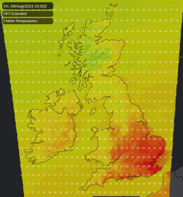
Temperature-wise, with the cloud and rain on Thursday, 17-22C will be the typical maximum. More sunshine on Friday will see a bit of a jump upwards for central and southern regions though, with highs of 22-26C, and 17-20C elsewhere.
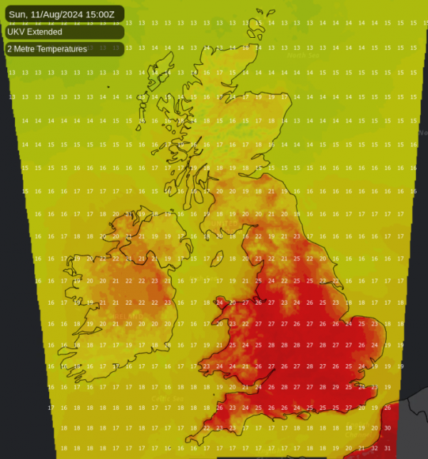
Into the weekend, another period of wet weather will swing in from the west later Friday, zipping through quite quickly on Saturday to ultimately leave us in a similar position to Friday by the afternoon. Then on Sunday, temperatures will be on the rise - hitting the high twenties, maybe even low thirties in the south and southeast of England, with a muggy feel in most parts of the UK.
Some rain will be lurking out to the west, though, which may threaten parts of Ireland and Western Scotland before the day is out.
More on the weekend and the heat potential into the early part of next week tomorrow.
Loading recent activity...