Hurricane Beryl has been quite the Tropical Cyclone. Reaching the Windward Islands, it passed between Barbados and Tobago making landfall over Carriacou Island as a Cat. 4 on the 1st of July. It then skirted along the southern side of Jamaica on Wednesday 3rd, throwing heavy rain over southern Haiti and passing to the south of the Cayman Islands on the 4th. By Friday 5th, Beryl had reached the Yucatan peninsula of Mexico before reaching southern Texas on Monday 8th with landfall near Matagorda as a low-end Cat. 1 hurricane.
Beryl reached category 5 hurricane status on its Caribbean journey. It was the earliest cat 4 and cat 5 on record in the Atlantic and the easternmost Atlantic hurricane to form in June. Beryl intensified from a Tropical Depression to a Cat3 in 42 hours, then to a Cat 4 within 48 hours. This is “unprecedented”. There have been extremely high ocean heat content levels, closer to values expected in September rather than late June. SST Sea Surface Temperatures in the region have been high for over a year, month on month.
“We need to be especially vigilant this year due to near-record ocean heat in the region where Atlantic hurricanes form and the shift to La Niña conditions, which together create the conditions for increased storm formulation,” said Ko Barrett WMO Deputy Secretary-General who coordinates the World Meteorological Organisation’s contribution to the UN Secretary-General’s initiative ‘Early Warnings for All’.
“With human-induced climate change leading to more extreme weather conditions, the need for early warning systems is more crucial than ever. Systems that warn people of impending storms, floods or droughts are not a luxury but a cost-effective tool that saves lives, reduces economic losses, and provides a nearly tenfold return on investment. “
But major gaps still exist, especially in small island developing states and least-developed countries: “Small Island Developing States in the Caribbean still suffer disproportionately,” said Ko Barrett.
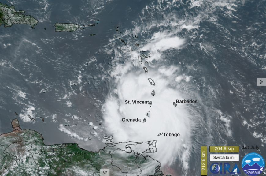
The small Caribbean islands felt the main force of this cyclone. ReliefWeb reported; 98% of houses and infrastructure were heavily damaged or destroyed in Union Island, St Vincent and Grenadines. 100% of homes were destroyed in Canouan, St Vincent and the Grenadines. 98% of infrastructure was destroyed in Carriacou & Petite Martinique, Grenada. The loss of small boats and damage to airstrips continue to hamper the delivery of aid.
Beryl also impacted Barbados, “208,200 people were affected by the storm, representing almost 74% of the total population.” Barbados Red Cross. ‘In terms of livelihoods, all boats at the Bridgetown marina sustained damage, and several completely sank due to large waves’ impacting the local fishing industry.
After leaving the Windward Islands, Beryl strengthened to Category 5.
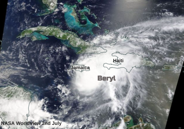
As Hurricane Beryl impacted Jamaica as a category 4 cyclone, there was widespread damage and destruction. The island is mountainous which enhances the risk of flash flooding and mudslides. There was damage to roads, power supplies and communications, many houses lost their roofs and blackouts continue. The heavy rain caused flooding, there were damaging waves with a large storm surge as well as destructive winds. Once more in the Caribbean, islands are left with widespread damage, the need of water, food, reconstruction and recovery, looking for international aid. “Jamaica's southern parishes faced substantial disruptions in agriculture, livestock, and health services, with over 400,000 people affected by power outages.” ReliefWeb
Hurricane Beryl moved close to the Cayman Islands but to the south on the 4th.
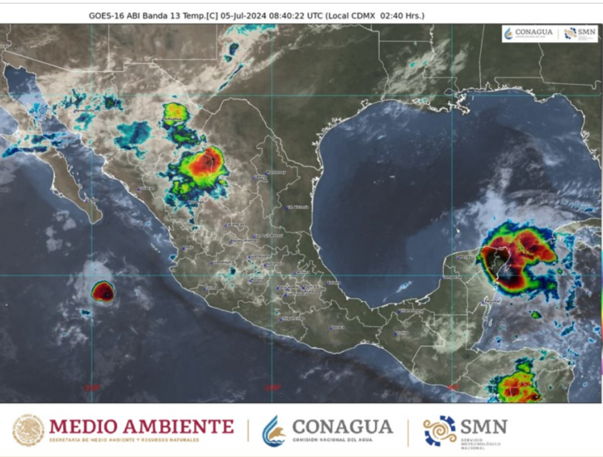
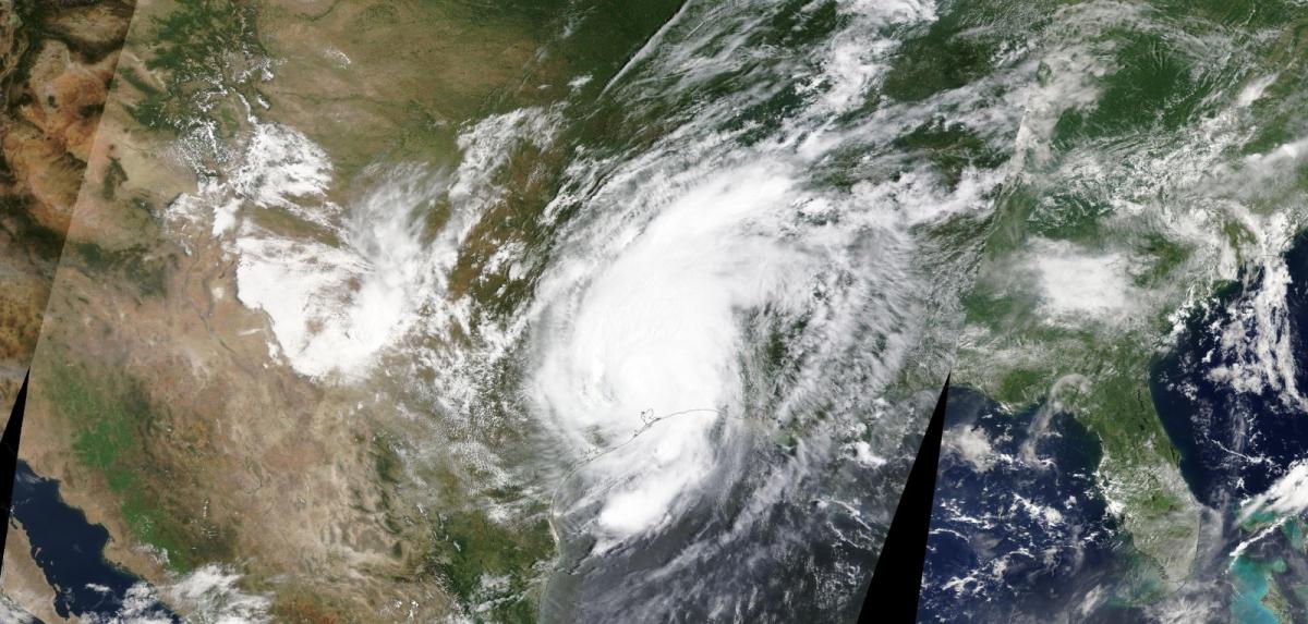
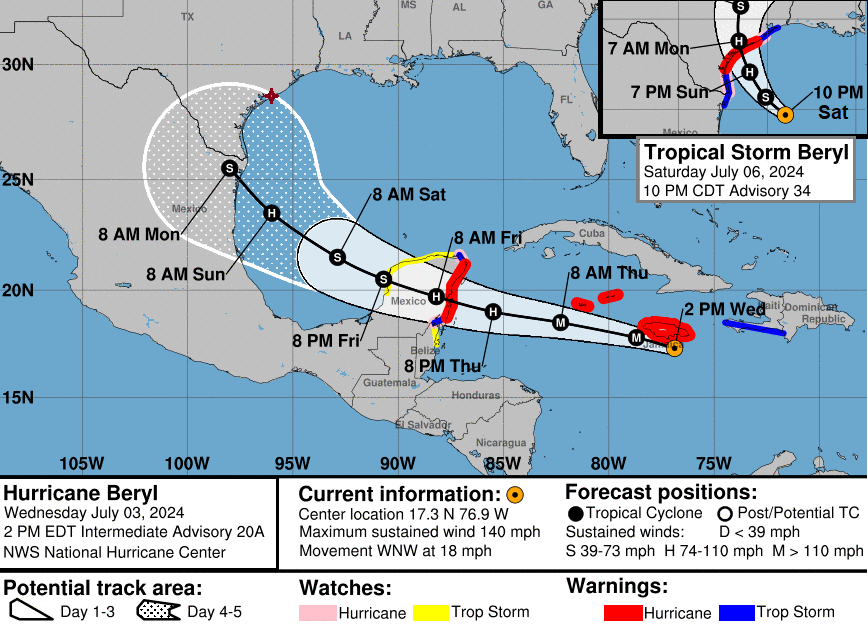
Next was the Yucatan peninsula of Mexico on Friday 5th July as Beryl neared as a Cat3. Landfall occurred north of Tulum as a Cat2 with torrential rains, the risk of landslides and flooding, large waves and swell. Heading northwards, a weakened Beryl moved back over the warm waters of the Gulf of Mexico and rather than another Mexican landfall, its path began to shift further north with Texas in its sights.
There was a fair change in the path from some early predictions but on Monday 8th July Beryl made landfall, once more as a hurricane near Matagorda, TX early in the morning with maximum sustained winds of 80mph. There were wild winds with lashing rain, a storm surge and large waves. Highways were flooded and oil ports had to close with many flights being cancelled too. Power to around 2.7 million homes and businesses was knocked out. There were 110 tornado warnings issued, an incredible number for one day. The dangers from a hurricane are varied and severe.
What next?
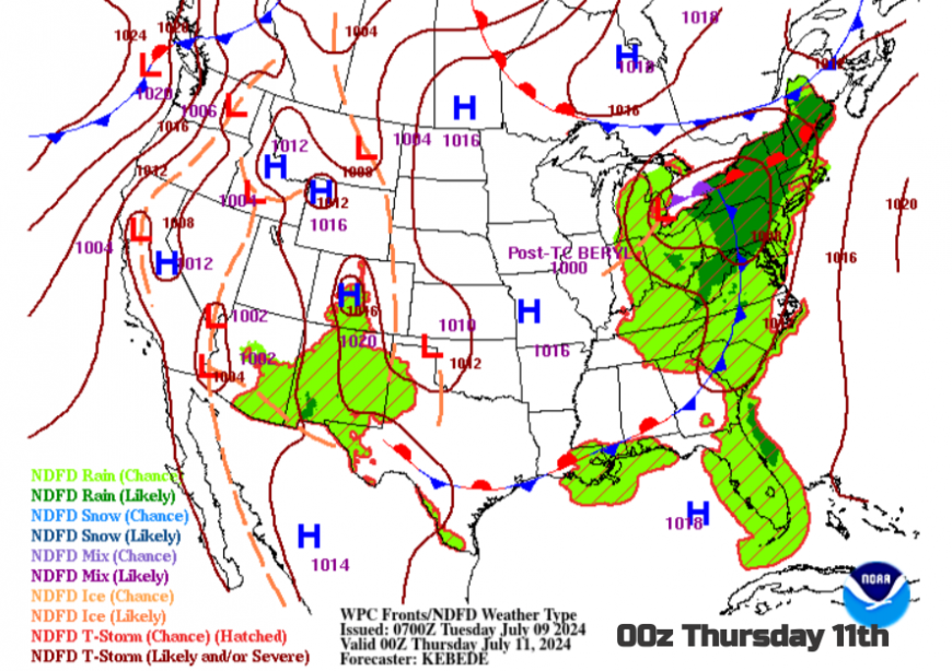
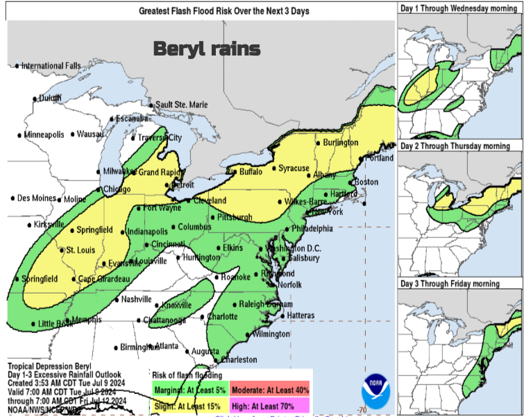
Beryl is now a Tropical Depression and will soon become post-tropical. The forecast path is north/NE towards the Great Lakes with plenty of heavy rain and the risk of flash flooding. Western USA is in the grip of heatwaves with warnings of ‘extremely dangerous heat’ in some counties. Beryl will move through the Lower Mississippi Valley to the Ohio Valley before reaching the Lakes midweek. The rain warnings are widespread with the risk of thunderstorms and will reach upstate New York and New England with a risk of flash flooding here.
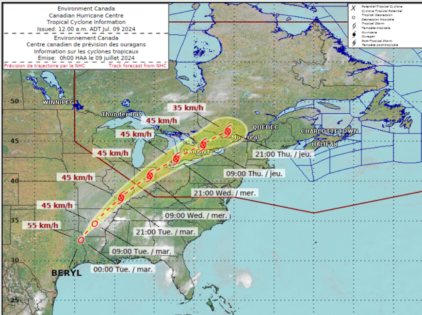
The Canadian Met Service has issued a Special Weather Statement on Tues 9th
Potential for heavy rainfall due to the remnants of Hurricane Beryl on Wednesday and Thursday. Hazards: Torrential downpours giving rainfall rates of 20 to 40 mm per hour at times. Localized rainfall totals possibly well in excess of 50 mm. Timing: Beginning late tonight or Wednesday, and continuing into Thursday. Although confidence in the exact track of the weather system is low, these types of systems in the past have given very high rainfall rates in torrential downpours.
These ex-hurricanes can get caught up by the jetstream and make their way across the North Atlantic, adding their tropical energy to systems that then bring heavy rain towards the UK and NW Europe. In autumn we can see stormy weather result with odd warm air but there isn’t a signal for an extra-tropical low to move out of northeastern Canada next weekend. Here in the UK, high pressure will build to the west and we will be watching thundery developments over France and the Low Countries rather than across ‘the Pond’.
Hurricane Beryl discussion and chat in the Netweather Forum
Loading recent activity...