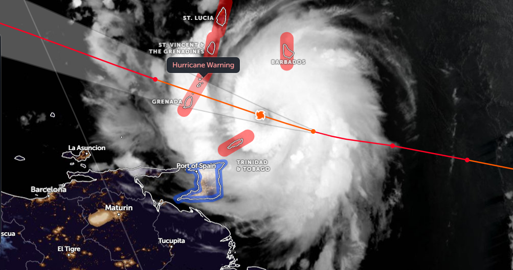
Hurricane Beryl, has weakened slightly and been downgraded to a category 3 storm, with maximum sustained winds of 120mph & higher gusts, thanks to an ERC (Eyewall Replacement Cycle) that has occurred. Beryl is tracking west around 20mph and approaching the Windward Islands (Lesser Antilles) where it is expected to make landfall early afternoon but the storm surge is already arriving.

Beryl, as of around 10am UK time, is just south of Barbados and will head over Grenada and The Grenadines and potentially could clip the north side of Tobago. These islands don't usually experience major hurricanes. Beryl could be the strongest hurricane to hit the islands since Ivan in 2004.
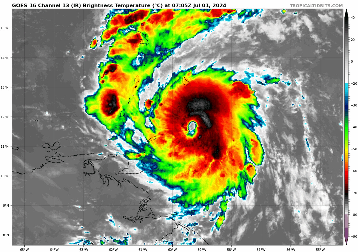
Despite Beryl weakening slightly, there appears to be some re-intensifying, now that the eyewall cycle is close to completion and the vertical wind shear remains low, with an increase of strong convection in the eastern quadrant of the hurricane. So there is potential that Beryl could restrengthen into a low-end cat. 4 just before moving over the Windward Islands.
Beryl rapidly intensified into a Category 4 hurricane Sunday after first becoming a tropical depression on Friday, tropical storm early Saturday morning and first hurricane of the season Saturday afternoon. Beryl intensified from a tropical depression to a 105kt (120mph) category-3 in 42 hours, and 115kt (130mph) category-4 in 48 hours, which appears to be unprecedented.
Beryl is the easternmost hurricane and "major hurricane" (Category 3+) to form in the tropical Atlantic during the month of June and is the earliest calendar year Atlantic Category 4 hurricane on record. The previous Atlantic record for earliest Category 4 hurricane was Hurricane Dennis on July 8, 2005.
Wow! Here's a clip from a Saint Michael, #Barbados Live Cam just now as #StormSurge from #HurricaneBeryl inundates the sand barriers. #Hurricane #Beryl pic.twitter.com/EA5hNaA88Z
— BirdingPeepWx (@BirdingPeepWx) July 1, 2024
A Hurricane Warning is in effect for Barbados, St. Lucia St. Vincent and the Grenadine Islands, Grenada and Tobago. Here are the key messages for the likely impacts to the Windwars Islands of Hurricane Beryl today:
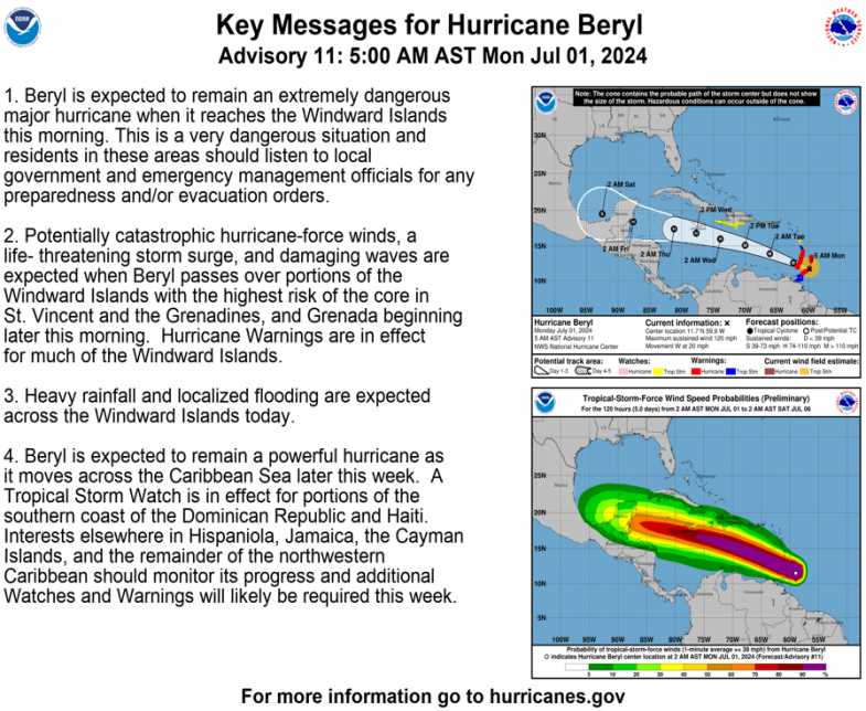
After moving over the Windward Islands today, Beryl will continue to be steered west-northwestward across the Caribbean Sea by a large area of high pressure to the north through the middle of this week.

After Beryl crosses the Windward Islands today, it is forecast to continue west / northwest over the Caribbean Sea, the core passing perilously close to the south of Jamaica on Wednesday, some ensemble members take Beryl over the island, but generally guidance takes it south. As it continues west-northwest it may impact the Cayman Islands, Belize and Mexico's Yucatan Peninsula later this week. However, there's uncertainty in the track by then, as shown in the model forecast track map below.

There is uncertainty over how much wind shear Beryl will face in the Caribbean Sea further west. Typically, at this time of year, Caribbean wind shear is strong enough to weaken or completely kill tropical systems approaching from the east. However, model forecasts have hinted that wind shear could be lower than usual, while higher-than-historical-average water temperatures in Caribbean Sea. could both allow Beryl to maintain its hurricane intensity longer in the western Caribbean Sea later this week.
There is smaller chance that high pressure to the north could be weaker than expected, that may allow Beryl to track further north towards the southern USA, but this seems less likely than a track into Mexico – where it could make two landfalls.
Loading recent activity...