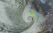
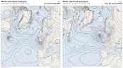
We will be reaching the mid-point of meteorogical summer early next week, but other than a brief hot spell back in late June, culminating in 30C being reached, the weather has been generally changeable and often on the cool side.
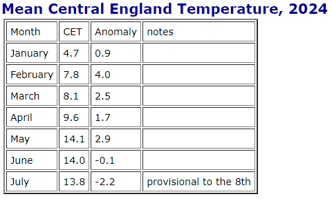
For the first half of June the jet stream tracked southwards leaving the UK in unseasonably cool air, with temperatures a couple of degrees below the monthly average. But during the second half of the month, the jet stream shifted further north, allowing warm and humid conditions, culminating in 30C being reached in SE England on the 25th. This very warm or hot weather lifed temperatures above the June average by day and night. So in the end, despite the below average first half, the UK average temperature for June recovered to 0.4C below the average and the Central England Temperature (CET), as series that goes back to 1659, was 0.1C below the 1961-1990 long-term average for June.
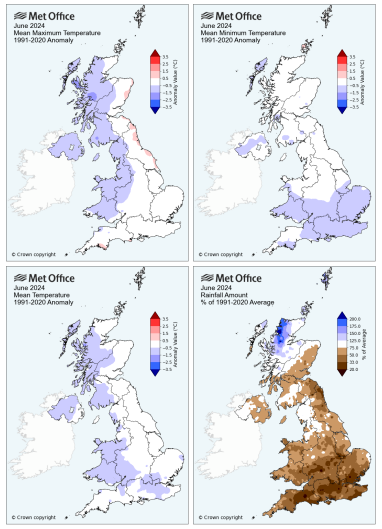 Source: Met Office
With the jet stream back south to the south of the UK, July has started cool and changeable, like last month, with the average temperature running below average. Interestingly, the CET up the the 7th is 0.2C below the June 2024 CET, which itself was 0.1C below the May CET. So July, so far, is cooler than May. Not often this happens.
Despite June being a cool yet sunny month, it was also dry. The UK, as a whole, recorded 29% of the long-term average, but it was Wales and the south of England that received much lower-than-average rainfall amounts, while Northern Scotland recorded above average amounts.
However, July has begun on a rather wet note, more especially in the south. Rainfall accumulation map below since the beginning of July shows a large swathe of southern Britain from SW England and south Wales across to East Anglia seeing 50-70mm of rain, with some spots in excess of this, recording over the monthly average in the first 8-9 days already.
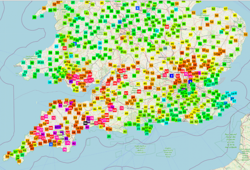 Rainfall accumulation from 00z 1st July to 12z (noon) 9th July. Data from Starling Roost Weather
So what's the outlook for the rest of the month, will summer make an appearance or will we continue with the autumnal cool and sometimes wet weather?
Unfortunately it's not looking too promising for the next 7-10 days if it's heat you're after, with most model ensemble guidance suggesting a continuation of cool conditions for the time of year, with the jet stream to the south of the UK.
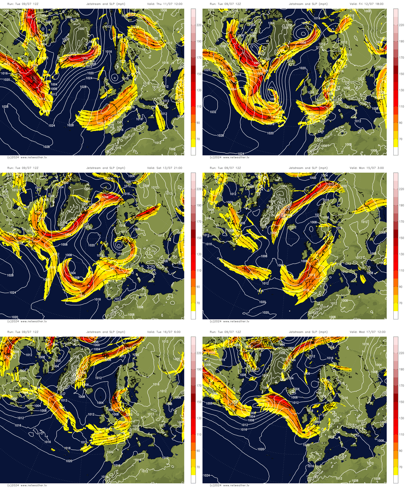
The rest of the working week will remain changeable and on the cool side, though after heavy rain clears eastern Scotland tomorrow, there will be just a few showers around, rather than the downpours of recent days. However, persistent and perhaps heavy rain may return for a time across the far south on Friday.
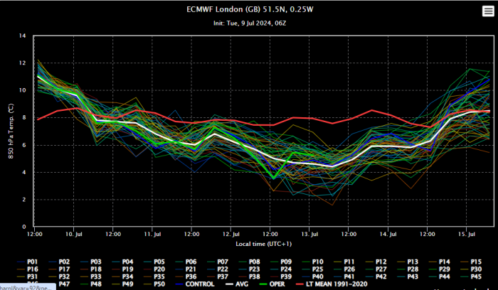
00z ECMWF ensembles show 850 hPa temperatures over London staying below average unti mid-month
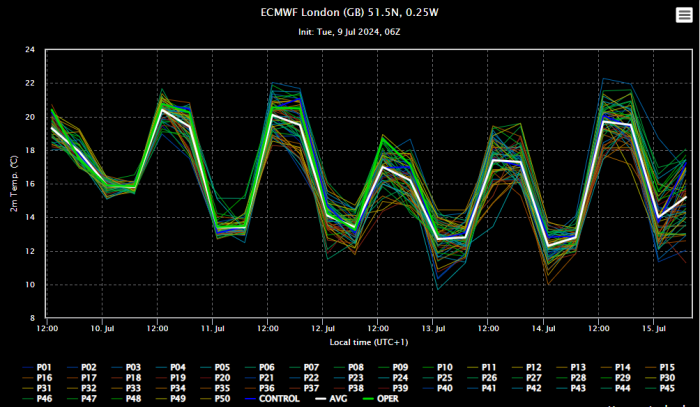
Surface temperatures in London staying on the cool side too until mid-month, reaching 20C at best, the average high is 23C in July.
The good news is, although it will stay on the cool side, there is a drying trend over the weekend for most, as a ridge of high pressure builds, though there could be a few isolated showers around.
Next week, it looks to turn unsettled again from the west and southwest - while remaining on the cool side, as the jet stream sinks to the south of the UK and areas of low pressure move in off the Atlantic, bringing rain or showers at times across many parts, through the week, however, there could be some drier more settled interludes later in the week towards the south, with high pressure not far away.
Beyond next week, there are hints that the Azores High may have more influence, at least across the south, but it's too far out this signal to have confidence in, with the risk that the current cool and changeable weather may continue.
Loading recent activity...