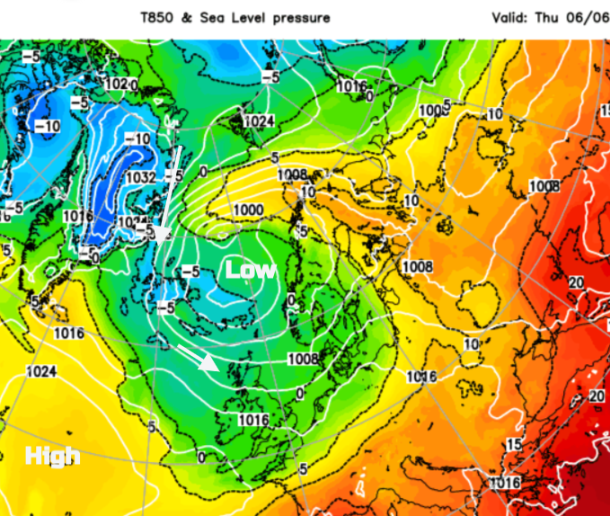
This week cooler air reached the UK. In the strong June sunshine, and away from the breeze, it can still feel pleasantly warm but this is not summer heat. If a shower passes by or in the wind or the shade, it does feel cool, even nippy. This air originates near the Arctic and has brought snow to the mountains of Scotland.
This isn’t unheard of but with three days of wintry showers, it is a bit unusual to see another day with a fresh dusting. At lower levels, there have been heavy rain showers, hail and lightning with dramatic cumulonimbus clouds even wintry bits for the Scottish Islands.
Fresh snow has fallen on the high peaks of Scotland for three consecutive days now. The is very unusual, having happened only a handful of times in the last thirty years.
— Iain Cameron (@theiaincameron) June 6, 2024
The record for fresh snowfall in June is nine days (total), which occurred in 1977 and 2012. pic.twitter.com/ITV3uJpzCP
Snow has appeared even further south in previous Junes. June 1975 started in a wintry way before moving to a heatwave.
On 2 June 1975, snow an inch thick covered the pitch at Buxton …Snowflakes even briefly fell on the Lord’s cricket ground in London.
Raw Arctic winds swept across the UK that day with -3.3C (26F) recorded at Gleneagles, in Perthshire, more like the depths of winter than early summer. Sleet was even reported as far south as Portsmouth, and although the snow melted quickly across southern areas of Britain, it lingered on the ground for a few days in parts of Scotland. Guardian Mon 1 Jun 2020
That same day, Nunraw in East Lothian recorded the lowest daily maximum for the UK in June, only 5.1C on the 2nd. The highest June maximum is 35.6C in (London and) Southampton in 1976 but much later in the month. For overnight minimums, Santon Downham recorded -5.6C twice in early June 1962
This week
Southern England saw top temperatures on Wednesday of 17 or 18C whereas in northern Britain the maximums were 14 to 16C at best. The day had begun with a few inland spots recording only 1 or 2C and Wednesday was also chilly in the north. For Thursday night it will be southern England feeling a bit nippy.
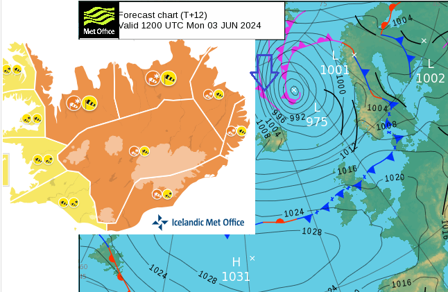
Iceland snowstorm
This cold air brought a snowstorm to Iceland on its way south. There have been orange warnings for snow and gales with resorts seeing drifting.
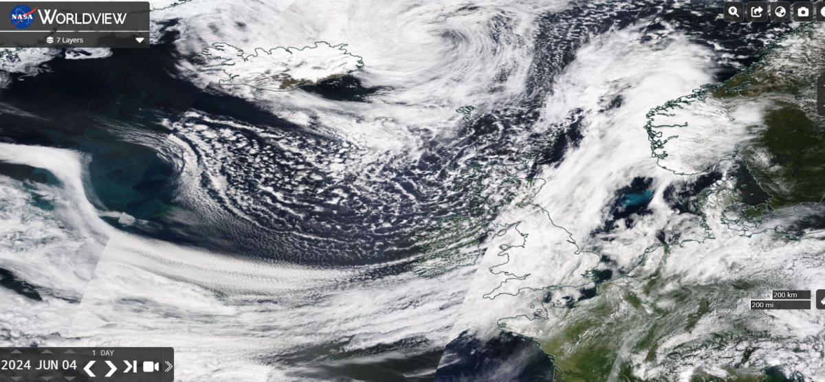
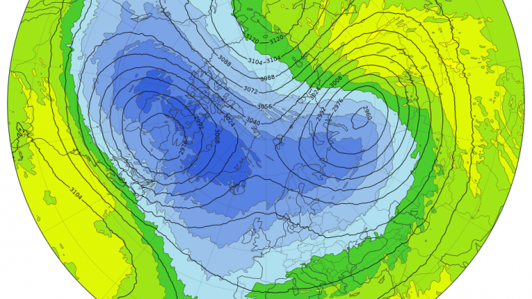
A low pressure has remained in the Norwegian Sea for a few days and it is this stationary setup which has made the snowy weather event unusual. A cold front from this low passed across the UK earlier this week and has swept across northern Europe
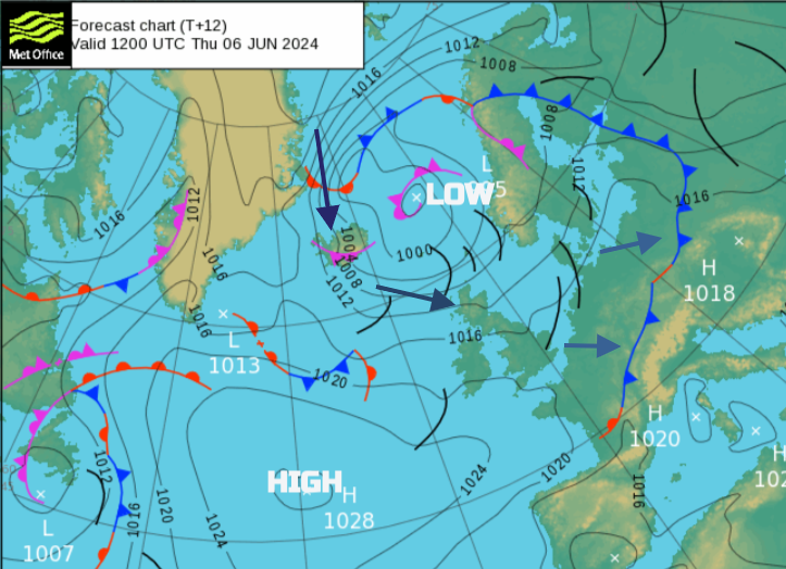
This cold Arctic air is moving over less cold waters on its way south. There is cold air aloft and once it reaches Iceland or Scotland the land is warmer thanks to the May and June sunshine. By day, the solar radiation heats the ground and the air at the surface warms, and lifts and in the unstable setup, we see shower clouds towering up, or thunderstorms with hail. The brisk west or northwesterly flow has been whisking these across Scotland and Northern Ireland in the middle of the week. As it has been much colder further north, Iceland saw a dumping of snow.
The chance of a few more snow showers for the Scottish mountains continues into the weekend. When is it going to warm up, have a look at the Summer Forecast.
June 1975 - summer snow - June 1909 - very chilly
Top image NASA worldView 4th June showing open convection cells in unstable cold flow from the NW towards UK
Loading recent activity...