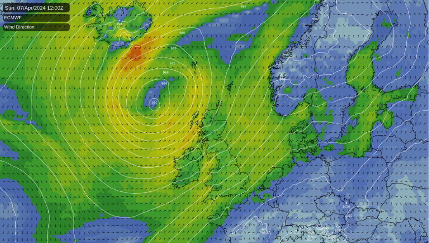
Yesterday was the warmest day of spring so far, but it was also very windy, with storm Kathleen nearby. Today is cooler, with blustery showers. Flooding remains a concern, with more unsettled weather ahead.
Despite the blustery conditions, Santon Downham in Suffolk reached 20.9°C yesterday, the highest temperature so far this spring. However, storm Kathleen also made it very blustery, with gusts of wind of 40 to 50mph and in excess of a damaging 70mph in the West.
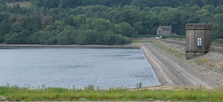
Whilst today won't be as warm, temperatures will still be well above average. However, the main concern remains the continuing wet weather, with many flood warnings again, especially for the West. More showers are likely into the coming week, although there are signs of drier conditions, especially in the South towards next weekend.
Meanwhile, storm 'Kathleen' now off North West Scotland, continues to give a severe southerly gale across Highland and the Western Isles, where there'll be further gusts of 60 to 70mph for a while in a day of sunny spells and blustery showers.
Some will be heavy, giving local hail and thunder. We have already had some thunder across Wales, with the showers tending to come in bands moving eastward across the country. As is the case with showers, some will see more than others. However, as a general rule, the bulk of the showers will be in the North and West, some squally and prolonged over West Scotland. Meanwhile, sheltered parts of East Anglia and the South East could miss them altogether and get away with a dry day.
A fresh or strong South to South Westerly wind remains blustery, with gusts to gale force in the heavier, more squally showers. The top temperatures of 17°C in the East and South East, although still rather warm, will be down on yesterday's values, with 12 to 15°C being more likely for most.
As storm 'Kathleen' begins to move away to the North, winds will decrease, but in the far North and North West, there'll continue to be gales for a while and further blustery showers. Elsewhere, the showers may briefly fade into the evening, with some places primarily East of the Pennines becoming mainly dry. However, further bursts of rain move into the southwest, spreading to many mostly western areas overnight. It'll be another mild night, though, with temperatures unlikely to fall below 6 to 11°C.
The new working week sees outbreaks of rain move North, probably reaching all but the far North of Scotland before the day is out. There'll be heavier bursts mainly across Northern Ireland and in the West, while the East should see the rain lighter and more patchy before the South East and maybe parts of East Anglia turn wet through the day. A southeast or southerly wind may freshen again but not as much as on Sunday, with top temperatures of 11 to 16°C.
With a depression in close residence, it remains unsettled into the evening and overnight. There'll be further outbreaks of rain before freshening North-Westerly winds bring more broken skies, although still with blustery showers to Northern Ireland and the West and South before morning. Although probably feeling colder in the freshening wind later, temperatures shouldn't fall below 6 to 10°C.
Loading recent activity...