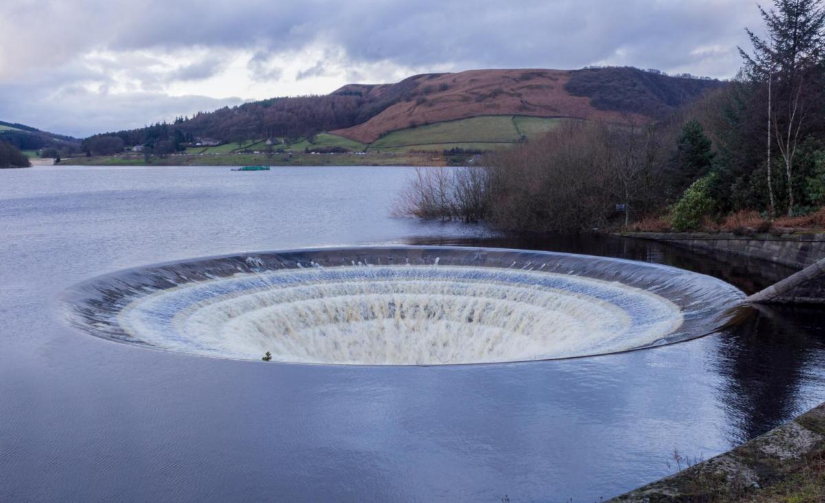
Unsettled weather continues with more rain on the way. Flood warnings remain in effect and are particularly likely to come to the fore again later in the week, as heavy downpours return. Sunny spells and scattered showers will be the theme today.
After a weekend of mixed weather, widespread flood warnings persist in areas with saturated ground and high river levels. This unsettled pattern will continue this week, with Atlantic weather systems pushing in from the southwest and bringing periods of heavy rain. Flooding, therefore, will remain a significant risk.
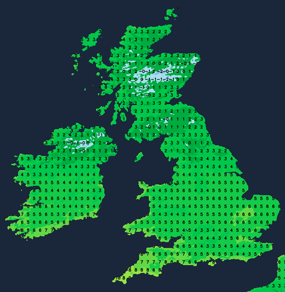
England and Wales can expect some sunshine today after a potentially frosty start. A few showers may linger in the east, affecting East Anglia and the Southeast this morning before dissipating. Later, showers will develop mainly in the west, though not every location will see rain. Northern Ireland and Scotland face more frequent showers, some heavy and blustery, especially in the west. Snow is likely over the hills here, while sheltered eastern areas will enjoy sunny intervals.
A southwesterly wind will freshen at times across Northern Ireland, western Scotland, and exposed parts of the Highlands, where gusts will be strong. Temperatures will generally feel chillier, with highs ranging from 6 to 8C in the north and 8 to 10C in the south.
Northern Ireland and northern/western Scotland will see blustery southwesterly winds and additional showers (wintry on higher ground). Elsewhere, showers will fade, making way for clear spells that could result in mist, fog, and a touch of frost where skies remain cloud-free. Temperatures will generally range from 2 to 5C, possibly dipping close to freezing point in clear areas. Cloud cover in the southwest will increase, bringing patchy rain by morning.
The north and west of Scotland will still continue to see showers and hill snow blown in on a blustery southwest wind. After a cold start elsewhere, mist, fog, and frost will clear with a lull in the weather as a ridge of high pressure briefly brings lighter winds and some sunshine. Sadly, this respite will be short-lived. A warm front will push cloud cover and light rain from the southwest steadily northeast throughout the day. However, northern areas should remain dry with southwesterly winds. Highs of 5 to 7C are expected in the north, turning milder in the south with temperatures potentially reaching 11 to 13C later in the day.
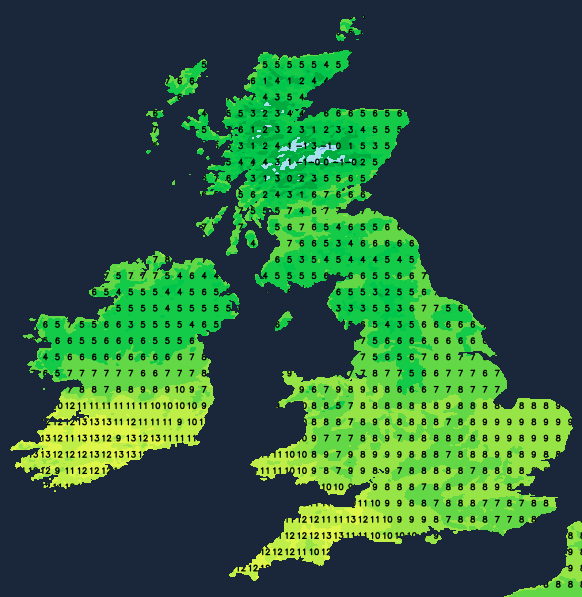
Showery rain will affect Northern Ireland, most of England, and likely even into the central belt of Scotland by morning. The far north of Scotland might hold onto dry conditions but expect milder temperatures throughout the country, remaining between 8 and 11C overnight, thanks to a freshening southerly wind, which may feel almost balmy but will also bring occasional drizzly rain with it.
The latter half of the week offers more unsettled weather, remaining mild and windy. Further periods of rain, especially on Thursday and Friday, will unfortunately heighten the risk of additional flooding.