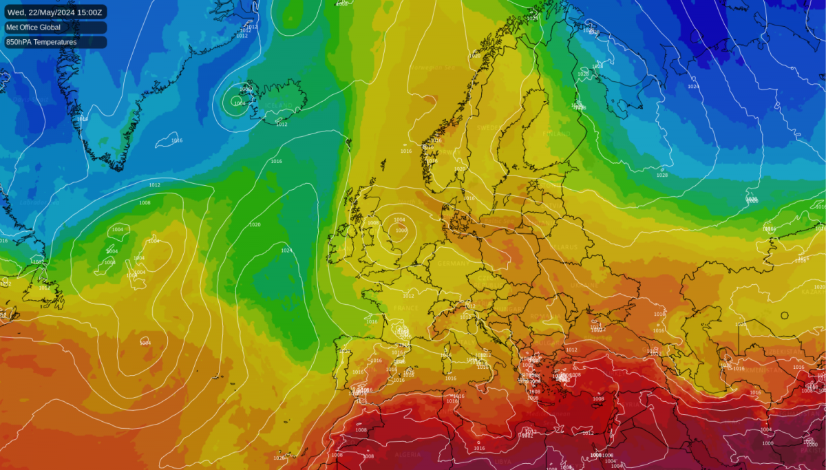
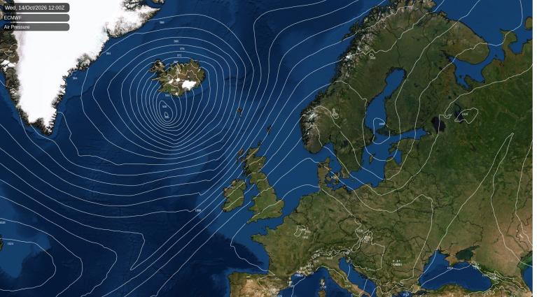
Wet and windy weather is going to rotate over the UK during the middle of this week. Low pressures over central Europe on Tuesday are already producing very unsettled weather and one low centre will roll up the North Sea towards the UK. This is an unusual direction for us and it will bring slow-moving heavy rain and a blustery northerly. This midweek change will disrupt the steady conditions we have been experiencing recently; the mix of warm sunshine, stubborn low cloud and very light winds.
Before this shift, the UK again has a risk of heavy showers and homegrown thunderstorms. These have been the only localised interruptions to the generally fine and quiet conditions. On Monday, Ireland saw thunderstorms with lightning and heavy rain. For Tuesday, the main risk areas extend into Northern Ireland and also Wales and southwest England.
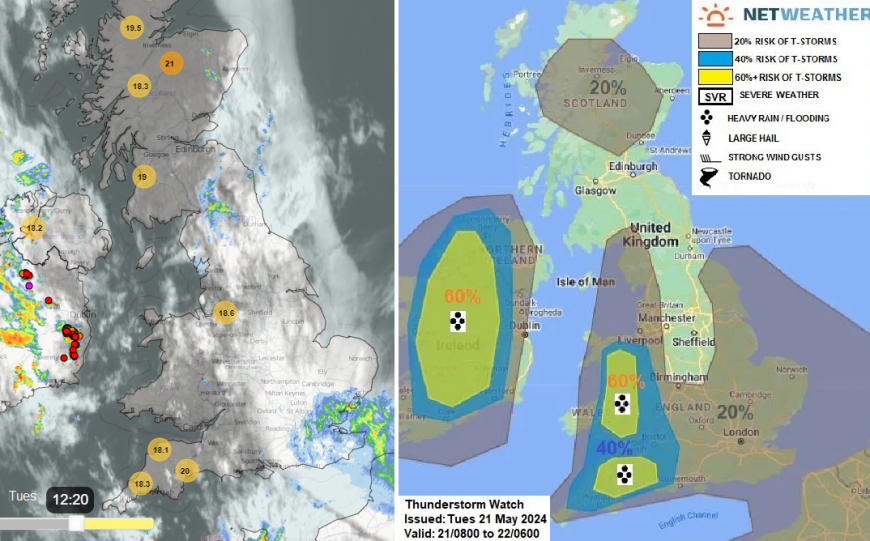
“(the) slack pressure pattern will encourage breeze convergence zones to develop inland … which combined with surface heating, will support the development of heavy showers and scattered thunderstorms to develop ... Elsewhere, heavy showers are expected to develop…where sunny spells/surface heating develops, which may also produce isolated lightning.” Convective forecast
These downpours will be slow moving and so again there is the risk of surface water issues.
There Met Office thunderstorm warnings which also cover SE England this afternoon and evening for elevated action and lower risk of surface-based convection “Elsewhere, heavy showers are expected to develop across S England, E Anglia & N Scotland, where sunny spells/surface heating develops, which may also produce isolated lightning.
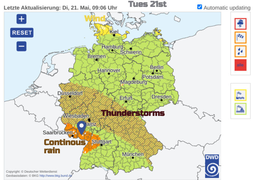
France, Italy, Switzerland, Austria and the Benulux countries all have warnings for thunderstorms, rain and flooding today. Germany has another high-level weather warning, this time for Severe Thunderstorms for Tuesday afternoon into the night. The jetstream is split in two with a stronger jet way north closer to Iceland and Lapland, and the other arm closer to Sicily.
The low pressure for the UK will be drawn up from the Netherlands on Wednesday, bringing a lot of moisture with it and engaging the northern arm of the jetstream as it slowly plods towards northern Scotland by Friday. The GFS model has it deepening slightly, the UKV doesn’t so there is still uncertainty about where in the UK will get the heaviest rain.
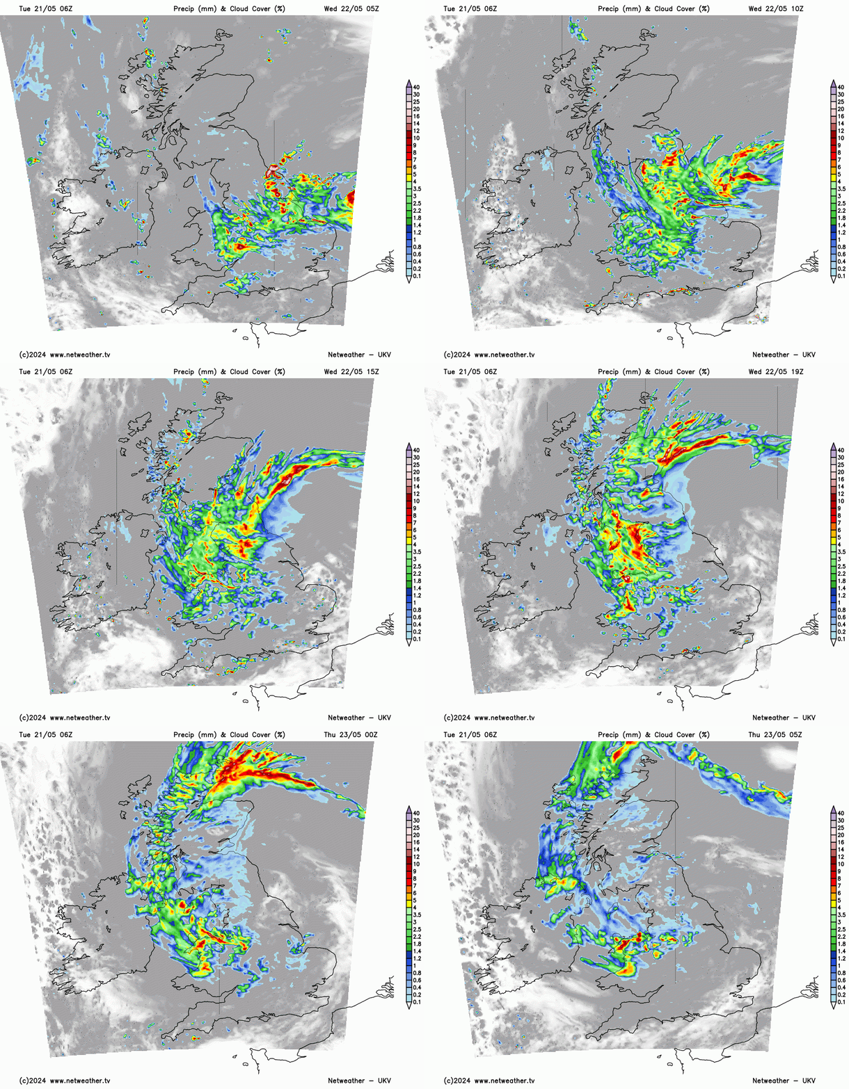
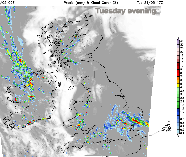
For Tuesday night, the main showery activity is over southern England, into the Midlands and East Anglia. As the winds begin to back around the incoming low, the rain will reach into Wales and over northern England ready for Wednesday morning. In the north to northeasterly flow, it will feel cool as the rain sets in. Sharp showers continue along the south coast from Cornwall to the Isle of Wight. By the afternoon, there will be a scattering of heavy showers over southern Egnland away from the main frontal rain.
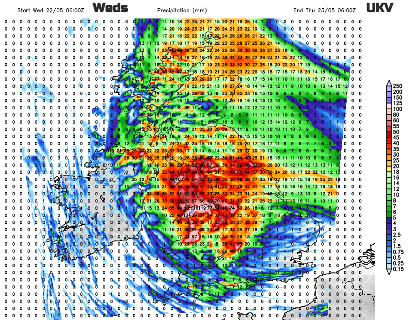
There are yellow rain warnings from the Met Office, running throughout Wednesday and into the early hours of Thursday for England. There are also concerns and a separate rain warning for eastern, central and southern Scotland as the frontal rain swings westwards off the North Sea. Again this brings the risk of localised flooding.
For some central areas, it could be very wet. For Wales, particularly in the north, the Isle of Man, eastern and northern counties of Northern Ireland, northern England into SW Scotland but particularly Cumbria and the Peak District across to Merseyside. There is uncertainty around how far west the heaviest rain will reach.
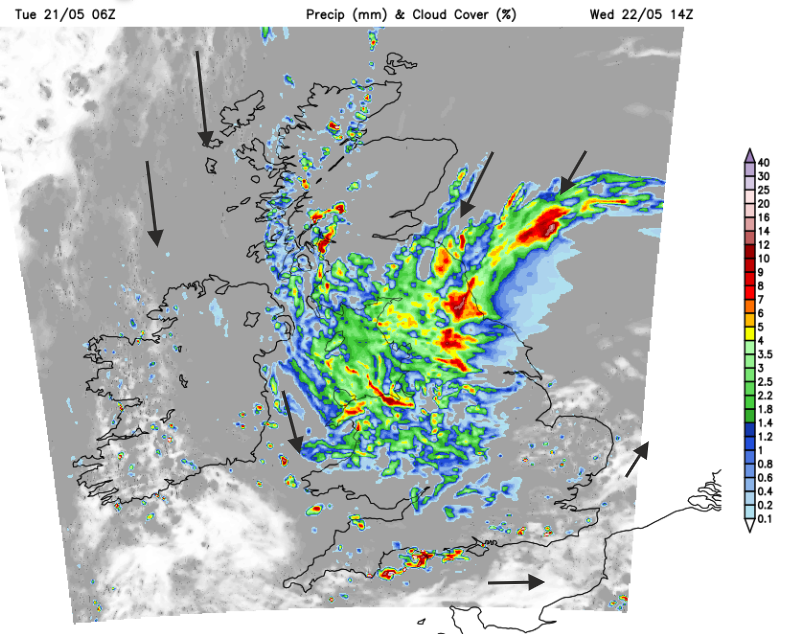
There will be areas which miss the worst of the wet weather such as western counties of Northern Ireland. And a chance of brighter spells appearing in the south and east of England later on Wednesday. There will be a noticeable dig of cooler winds from the north for Ireland and Wales by the evening.
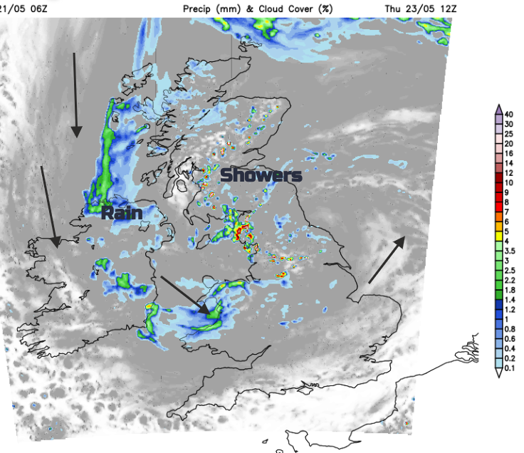
By Thursday, there will still be a band of cloud and rain swirling around the UK but with clusters of showers in the middle and a few bright spells. The north wind will continue to make Northern Ireland and the west coast of Britain feel cool. The weather does settle and dry up later on Friday.
Loading recent activity...