Mild air in the south, cold Arctic air in the north taking hold with Scottish snow showers. In between, uncertainty midweek if, and where, a rainband might turn to snow
The Daily Star front-page print headline on Monday 5th is "Bonkers Britain - Three seasons in one week!” with the gleeful mention of 15C spring warmth, autumnal floods and sub-zero winter whiteouts. Inside they decide to go off-piste with “seven inches of snow” and the whole thing is chaotic reading, but the themes hold up. Yes, there will be snow showers for northern Scotland, but there is great uncertainty about a frontal rainband on Thursday. Where, if and when it will turn to snow? Rain looks more likely for most; the high ground in the Midlands and northern England have better odds for snow later this week with Yellow Snow warnings appearing now from the Met Office.

Yesterday, Pershore in Worcestershire saw 14.9C as part of a mild weekend, with 15.9C on Saturday, but it should be closer to 7C by Wednesday. Southern Scotland, northern England, and Northern Ireland all start Monday around 9 or 10 Celsius with 7 or 8 further south. There is a frontal band across Scotland which is continuing to feed in persistent rain from the Atlantic. This river of water has affected western Scotland through the weekend with a yellow rain warning from the UK Met Office and SEPA (Scottish Env. Protection Agency) warning of possible flood impacts through until Tuesday.
“Persistent and at times heavy rainfall bringing some disruption, especially to travel” MO
There are speed restrictions on several rail routes for safety reasons, and it has been very windy at times, too. There has already been over 100mm of rain over the mountains, with cancellations to some routes in the Highlands.
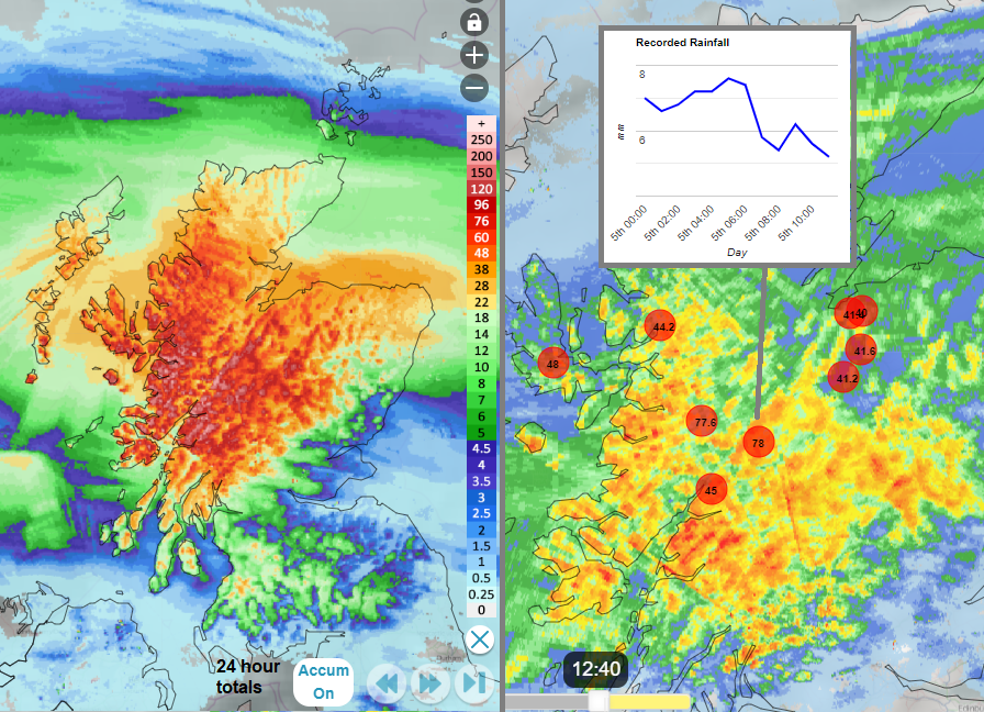
Netweather Extra Radar 24 hour accumulated totals and radar at lunchtime Mon 5th with highest rainfall totals in mm so far today
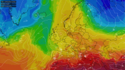
This rain band has been the main frontal boundary across the UK since last week. To the south, there has been mild air with high pressure over western mainland Europe. The south of France saw temperatures in the mid-20sC yesterday. On Monday, there is the brisk westerly flow, but a change will be coming by midweek. On Tuesday, the rainband will edge southwards, soaking Northern Ireland, NW England, Wales and parts of the Midlands with embedded line convection on what becomes an active cold front. This will continue to sink southwards during Tuesday night and fade away to the southeast on Wednesday morning.

Groundwater levels in southern Britain are still high from the winter/autumn rains, and there are flood alerts for central southern England and Newmarket in Suffolk.
“Local river and surface water flooding is possible on Tuesday for parts of the North of England and the West Midlands, with local river flooding possible for parts of the West Midlands during Wednesday.” EA
If you are driving on Tuesday or Tuesday night, it will be worth keeping an eye on this band of rain as it moves southwards. A quick check on the Netweather Radar to monitor its progress and see where the thin, brighter banding is. This will give sudden torrential rain with squally winds and gusts, poor visibility and difficult driving conditions. The intense line usually lasts only 5 to 10 minutes and then returns to the usual rain. That will eventually clear, and the colder air will start to dig in.

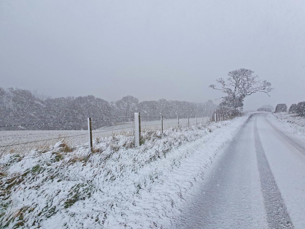
For the start of the week, it will only be mainland northern Scotland seeing snow. This will be later on Tuesday as sleet and snow showers arrive from the northwest. There will be freshening chilly northwesterly winds with severe gales possible for Orkeny by Tuesday evening.
There will be frost and the risk of ice in northern areas on Wednesday morning where it will be clear and calm. As the colder Arctic air reaches down through the UK, there will be clusters and bands of snow showers extending through Scotland. Many areas miss these but a more wintry picture for northwestern Scotland and it will feel like snow is possible in the north. The Met Office 12Z Wednesday pressure chart shows a small low pressure developing in the flow, heading over Scotland. There could be a more organised area of sleet and snow but there is low confidence around that currently.
The frontal boundary, that rain Scotland doesn’t leave us. Southern England will stay in the milder air with the same rainband soon returning and pushing north again.

We then have uncertainty. Mild air and frontal rain from the south, giving miserable conditions for England and Wales on Thursday, which could reach Northern Ireland and even southern Scotland later in the day but might just stay over Wales the Midlands and Yorkshire. To the north, the cold Arctic air with snow showers for the far north of Scotland and where it will meet the southern precipitation. Which adds the possibility of the frontal rain turning to snow across a swathe of Britain. The main risk looks to be the higher ground of northern England, so the Peak District, Yorkshire Dales, and North Yorkshire Moors, possibly reaching northwards to Pennine Routes and Cumbrian Fells, maybe the Southern Uplands.
 The ECM model is showing heavier snow for Wales and Ireland early in the day and then that risk extends across the Midlands into northern England. The Argpege takes the low further north as the UKV slides the front and low centre eastwards with most of the precipitation over central Britain. We will have to watch how the models respond in the next few runs. The UKV leaves much of the UK in a cold easterly flow for Friday with brighter skies and a scattering of snow showers off the North Sea for northern Britain. Further uncertainty for southern Britain with more cloud, messy lingering precipitation and perhaps some wintry bits in the mix with the cold air taking hold for Friday night.