The Bank Holiday Weekend is looking mostly dry, though there will be some rain in the far west Saturday, while showers can't be ruled out elsewhere for the rest of the weekend, but most of the time it will be dry with some warm sunny spells.
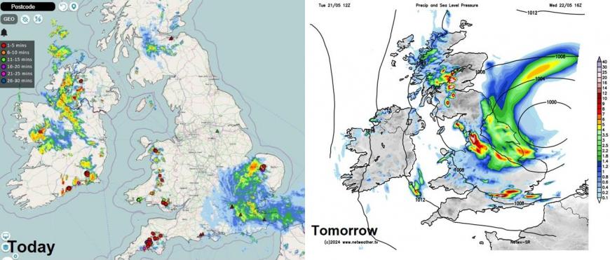
Despite a warm and sunny start to the week, the weather has taken a downwards turn for some today and doesn't look any better tomorrow. A cooler feel today with heavy showers and thunderstorms in western areas while towards the southeast of England and East Anglia we’ve seen cloudy skies with longer spells of rain today. Tomorrow see further rain, becoming heavy, spread north across eastern and northern areas on Wednesday.
Fortunately today and tomorrow's weather is not an omen for the Bank Holiday weather

So what are prospects for the Bank Holiday Weekend? Will it stay cool and unsettled or will it be a rare warm, dry and sunny one? The good news is, it looks far from a washout, with many places staying dry most of the long weekend, some rain in the west Saturday afternoon and evening and perhaps a few showers elsewhere for the rest of the weekend.

We are likely to see a change in direction from weather our weather is coming from. Over the past week, the weather patterns have been stuck in a rut and very slow-moving, with low pressure close-by over mainland Europe and high pressure to the west over the Atlantic and also over Scandinavia. This has meant generally light winds, some warm sunshine but also some heavy showers and thunderstorms in places, but many places in the east and north have stayed dry. Most of any rain falling in the west. Though this will change over the next 24 hours, as heavy rain spreads northwest from the near continent across eastern and northern areas.
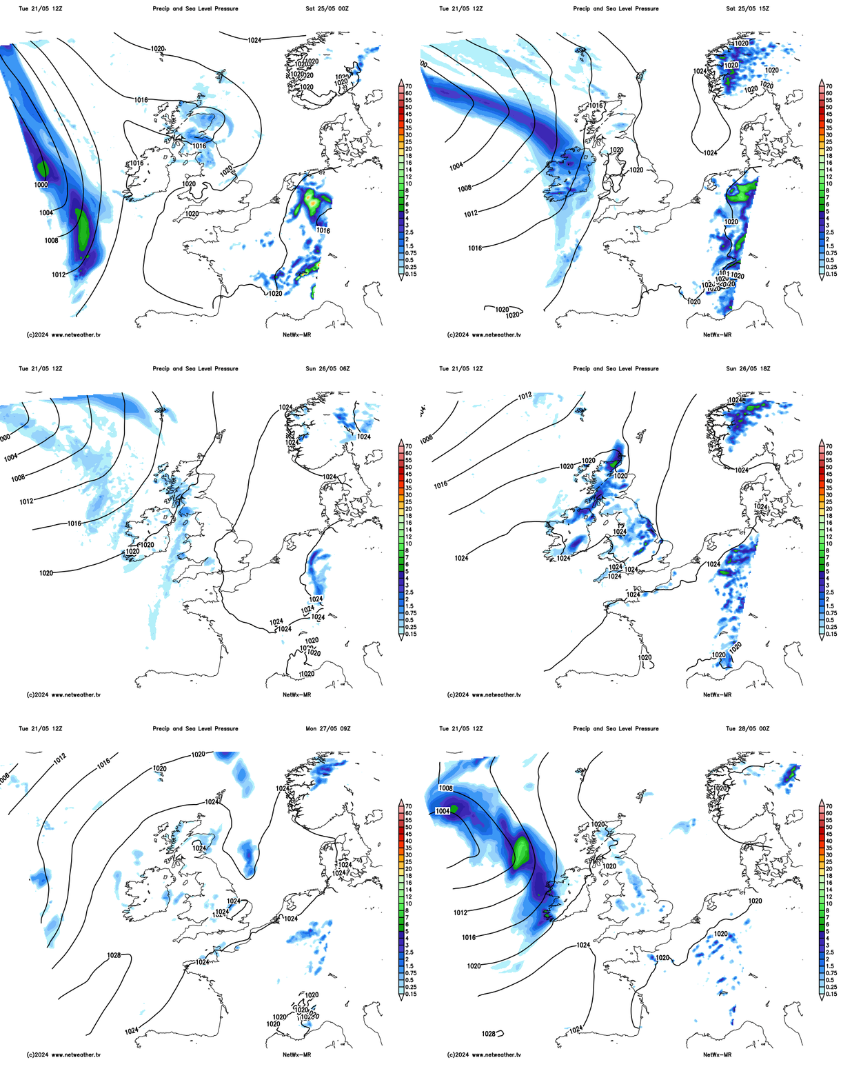
By the weekend, we will start to see a shift away from current and recent pattern, as we look to the west for our weather. A weakening Atlantic frontal system will move in from the west later on Saturday -bringing cloud and some increasingly patchy rain in from the west. But this shouldn’t spoil what looks to be a mostly dry and sunny Saturday for many, only really the far west that see rain arrive in the afternoon. Some uncertainty how far east the front gets on Sunday, so the day may start cloudy with patchy rain before clearing to brighter conditions but with a few showers developing in the afternoon. Bank Holiday Monday looks to be mostly fine and dry, as a ridge of high pressure builds in from the southwest, though a few isolated showers can’t be ruled out.
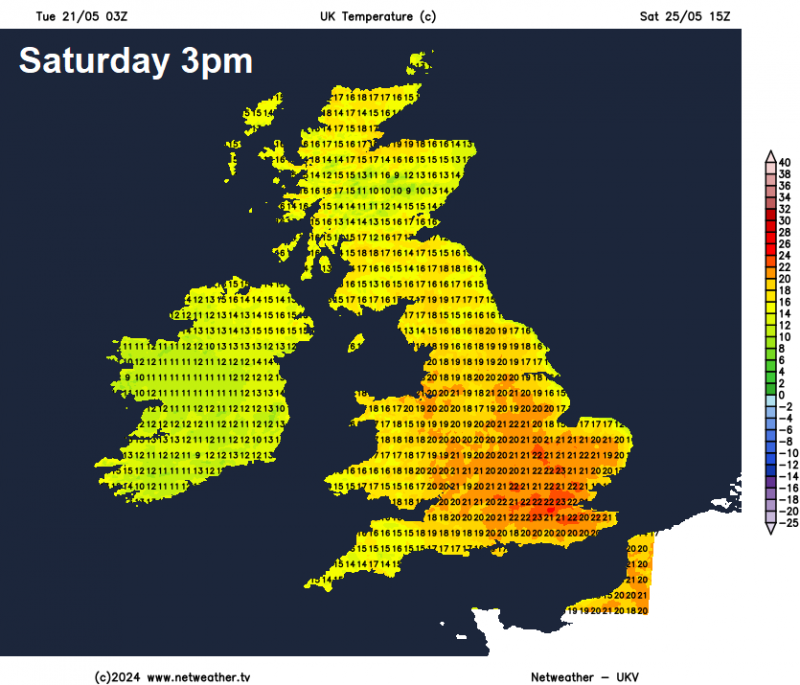
In more detail, Saturday is looking mostly dry and fine with sunny spells for the majority of the UK – temperatures generally reaching the high teens in the sunny spells, perhaps 20-22C across SE England and East Anglia. However, a frontal system will move in from the west bringing cloud and a band of rain in across the Republic of Ireland, N. Ireland, west Wales and far SW of England during the afternoon, then shifting into western Scotland in the evening, but perhaps fragmenting further south as it moves across Wales and SW England.

Thicker cloud and patchy rain spreading east with a weakening front Saturday night into Sunday morning, which may linger for a time across eastern areas before clearing, then perhaps brightening up from the west with sunny spells developing across all parts, but scattered showers may develop into the afternoon, the odd sharp one here and there, but many will miss them and stay dry with sunny spells. Warm with any sunshine, temperatures reaching the high teens, perhaps low twenties Celsius across southern and eastern England.
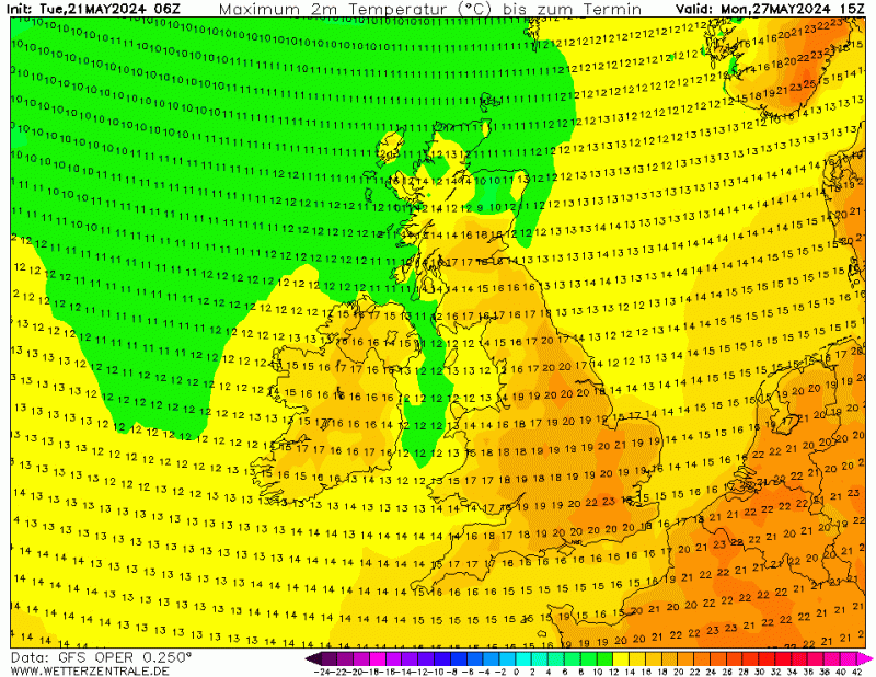
An upper level ridge looks to build aloft while surface pressure also rises on Monday, so for many it should be a sunny day, with some warm sunshine, temperatures perhaps a degree or two higher than Sunday too, reaching 21-23C in the south. Cloud will bubble up and like Sunday, there could be a risk of showers developing, but hopefully they will be isolated with most places staying dry.

Signal from the models is quite mixed giving an uncertain picture for rest of the week. There is potential for a spell of rain to move through Tuesday or Wednesday, but high pressure may or not build in thereafter, with either fine weather for the rest of the week or more unsettled conditions continuing off the Atlantic. On balance it looks to turn drier after the mid-week for much of England and Wales, but risk of rain for Scotland and Ireland. But in any case, it will be warm in any sunshine, with temperatures generally remaining a little above average.
Loading recent activity...