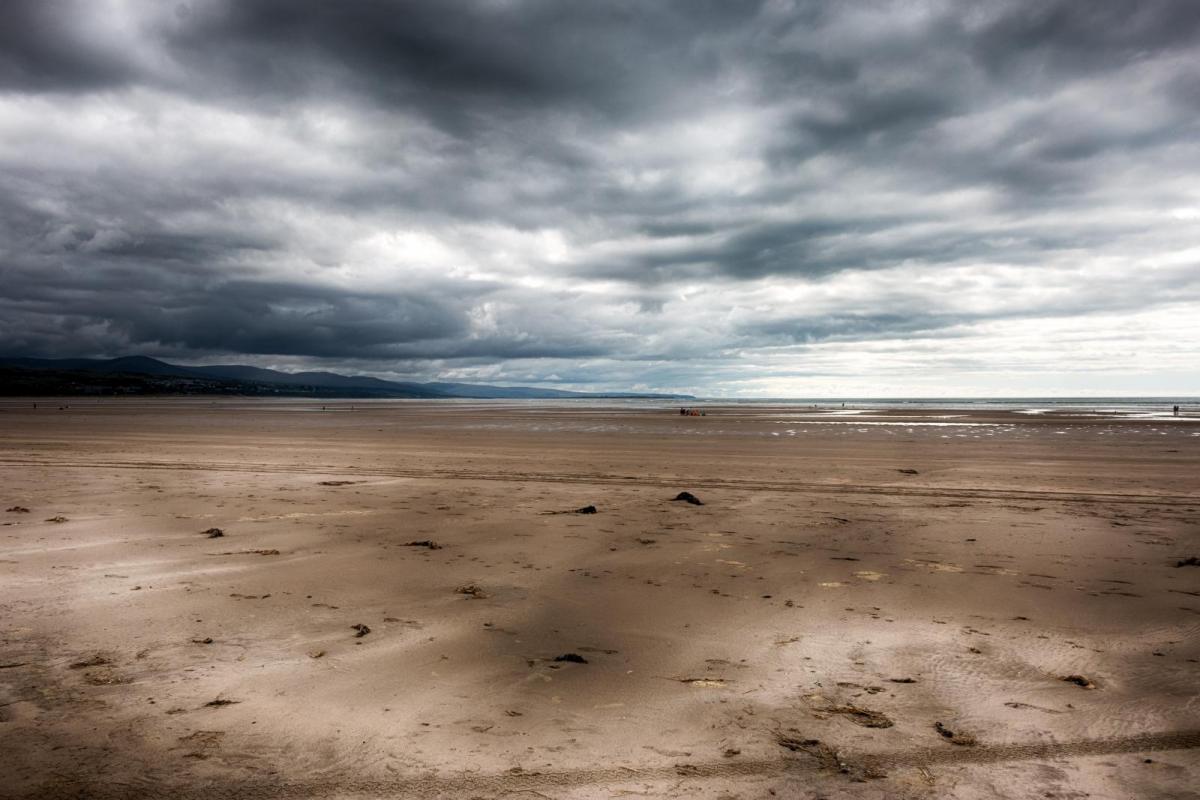
This weekend is set to be mild and cloudy for the majority of the UK, although some sheltered eastern counties, especially in East Anglia and in north-east Scotland, have started the day with some sunshine. During the next ten days or so, high pressure will remain very stubborn to the south and east of Britain, keeping us in a west-to-south-westerly type. There will be a northwest-southeast split in the weather, with northwestern Britain seeing frequent rain coming in from the west, while in southern and eastern England, there will be some rain at times, but rainy days will be fewer and further between, with frequent drier interludes and more chance of seeing a fair amount of sunshine at times.
For the longer term, we are watching for the potential for a marked pattern shift around 5-10 February, when there is strong support from long-range forecast models for the high pressure to the south weakening and high pressure developing to the northwest of Britain, which would result in winds becoming predominantly northerly, resulting in much colder weather with potential for snow in some areas. The forecast models often struggle with blocking highs around Greenland and Iceland, so this is not a certainty at this range, but the medium-range models, such as the ECMWF and GFS, are increasingly tending to show potential for northerly winds to set in after around 5 February.
Today's (Saturday) weather will be mild and dry for most, with some sunshine coming through at times in sheltered eastern counties, with north-east Scotland, East Anglia and south-east England probably seeing the most sunshine. Western areas will be predominantly cloudy. Some light rain will spread through Northern Ireland during this afternoon. Rain will also affect north-west Scotland for most of the day, and during the afternoon and evening this will spread to many other parts of Scotland, although south-east Scotland, south of the Central Lowlands, should stay dry. Temperatures in most parts of the country will reach between 8 and 10°C, with the highest temperatures likely to be found in north-east Scotland.
Overnight, the rain in Scotland will gradually fizzle out, and so by dawn it will be dry almost everywhere, but again away from sheltered eastern areas there will be plenty of cloud. Temperatures will mostly be mild for the time of year, falling no lower than 5 to 7°C, but in eastern England, particularly East Anglia and the south-east, there will continue to be some clear spells, which will result in temperatures falling to around 2 or 3°C in places, resulting in some areas seeing a slight ground frost.
Sunday will be a similar day, dry, mild and cloudy for most but with some sunny spells in places, particularly to the east of high ground and in East Anglia and south-east England. It will be wet in the west of Northern Ireland and in north-west Scotland, and it will also be very windy in north-west Scotland with potential for gale force winds, especially during the afternoon and early evening. The rain will spread to most other parts of Scotland during the evening, although sheltered eastern coastal areas may stay dry.
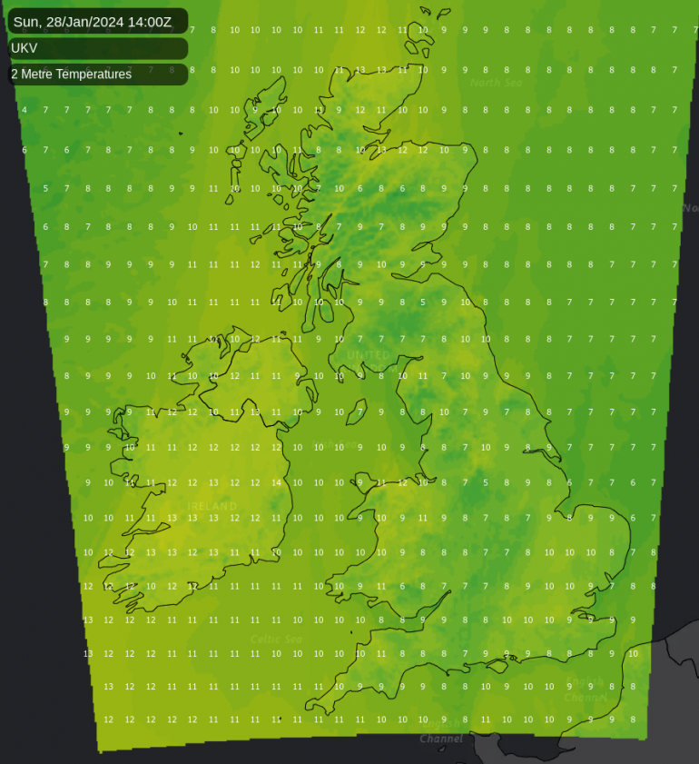
Temperatures will generally be above today's, with most places seeing a maximum temperature of between 10 and 12°C. It will generally feel mild for the time of year in inland parts of England and Wales, with winds being mostly light to moderate.
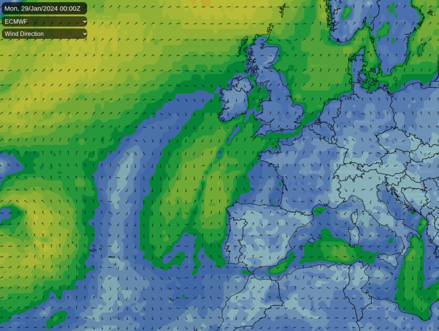
During both Sunday and Monday, we will be pulling air masses in from a long way south, which means that we are forecast to see falls of Saharan dust in places, especially in the north and west on Sunday, which will transfer to southern areas on Monday as cooler air temporarily pushes south-eastwards.
Monday will see a rain band will push south-eastwards into southern Scotland and northern England, possibly getting as far south as the Midlands and north Wales (though there is some uncertainty over how far south the band will get). To the north of it the weather will turn colder and somewhat brighter, while to the south of it, it will remain mild and generally cloudy but with some sunshine in places, chiefly East Anglia and south-east England. Temperatures of up to 13 or 14°C are likely in the south.
Into Tuesday, the rain will clear away north-eastwards, with dry and sunny weather spreading from the west into all parts of the country. After a day of light winds on Tuesday, from Wednesday onwards, we can expect a strong west to south-westerly airflow to dominate, with frequent rain for western Scotland (especially north-west Scotland) and the west of Northern Ireland, with some high totals associated with orographic enhancement over high ground. For most of England and Wales and eastern Scotland, it will be generally dry, with plenty of cloud coming in off the North Atlantic, but sheltered eastern counties, particularly East Anglia and the south-east and in counties bordering the North Sea, there may be plenty of sunshine.
Into the following week, we see the potential for the aforementioned pattern change, with an increasing likelihood of winds turning northerly. I'll be looking more closely at this in my month ahead forecast on Monday
Loading recent activity...