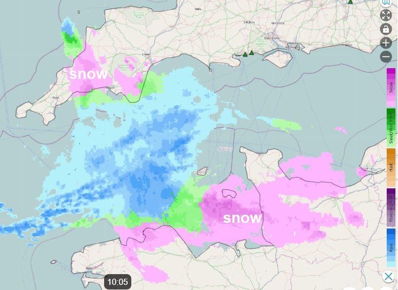
The second week of 2024 has got off to a wintry start, with high pressure across the north pulling in cold air from a very cold eastern Europe. A strong easterly wind across southern Britain beneath the high brought some snow showers across southern England and south Wales yesterday, bringing a covering in places. This morning, a separate area of snow moving west across northern France, bringing snow to Paris yesterday evening, is now bringing sleet and snow across the Channel Islands, parts of Devon and Cornwall this morning,
However, today, the easterly flow will become drier and sunnier from the east across the south, but still strong so making it feel bitterly cold. High pressure centred across the north will bring lighter winds in the north. The high bringing the fine weather today will drift a little further west tomorrow, which will allow more in the way of cloud to spread down from the northeast across northern and central areas, sunniest in the south. The rest of the week is looking largely cloudy and turning less cold too, as slightly milder air feeds in around high pressure close to the northwest.
Watch how less cold air spills down from the north around high pressure throught the rest of the week
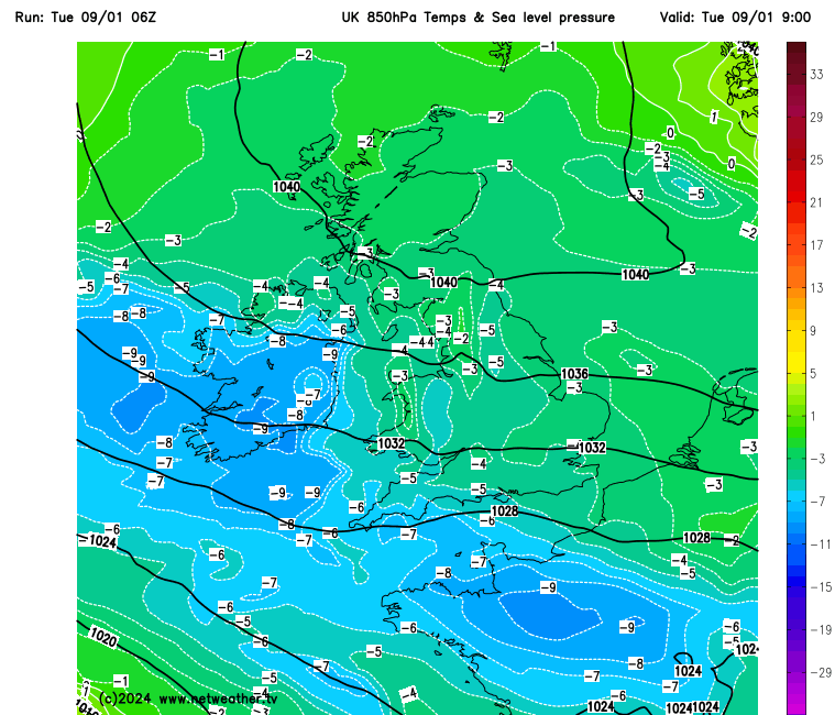
For now, a cold start for many, the coldest spot overnight was Aviemore, which fell to -10.6C overnight. Temperatures widely below freezing to start the day away from coasts and temperatures aren’t likely to rise much, despite the sunshine across many parts. There is more in the way of cloud this morning across SW England, which is bringing some light snow across parts of Devon and Cornwall, but this should clear west through the morning to join most areas to a sunny day with patchy cloud. The exception will be northeastern coastal areas, which will hang on to more in the way of cloud with some patchy drizzle or light rain, wintry mix over hills. Temperatures today reaching 3-5C at best, but with the windchill across the south in the strong easterly wind it will feel more like below freezing.

Clear skies for many tonight, leading to a widespread frost to develop, but more in the way of cloud across eastern Scotland and northern England moving in from the northeast will hold temperatures above freezing, the cloud thick enough for some showers, wintry over high ground.
More in the way of cloud spilling southwest for Scotland and northern England on Wednesday, perhaps spilling in across the Midlands, north Wales and N. Ireland too. Cloud thick enough to produce some showers. To the south, more in the way of sunshine. Still feeling cold, especially in the south in the brisk easterly wind, though temperatures a little up on the last few days. Temperatures reaching 5-7C.

Cloudier and less cold for many areas on Thursday and Friday, but staying mostly dry away from northeastern coasts – which may see a few light showers. Best chance of brightness or sunshine across the far west and N. Ireland.
The weekend looks to start off cloudy, with some patchy rain spreading south across northern areas on Saturday, though some brightness or sunshine possible in the south. A cold front looks to sweep south on Sunday, with cloud and patchy light rain, but behind it much colder arctic air surging south, reaching the south coast by the end of the day. Snow showers moving in across northern Scotland and coasts in the north.
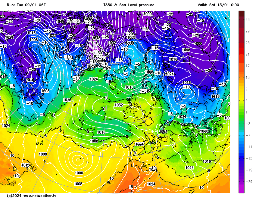
This will herald a cold start to next week, as cold arctic air establishes from the north. But there is a signal for milder air with Atlantic low pressure systems to try and push in from the south next week, where the boundary between cold and mild is could see some significant snow, but a great deal of uncertainty how far north this boundary will get for now. Stay tuned and we'll update on the potential for some wintry weather with snow for some next week...
Loading recent activity...