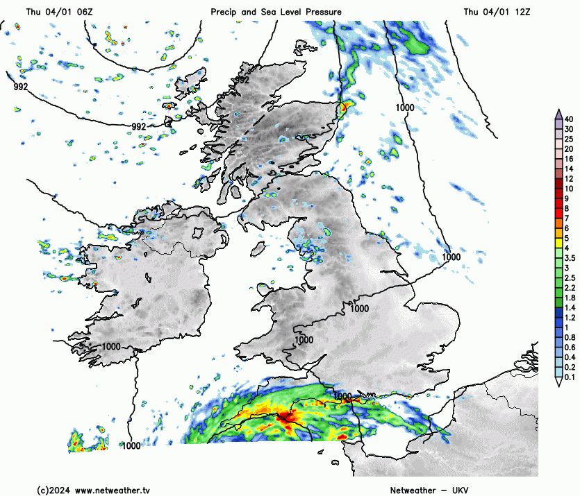
After Storm Henk’s wind and rain, there was a change on the horizon, with the model charts showing drier, more settled but colder conditions. That will take hold next week but for Thursday 4th there is yet another Atlantic low pressure to contend with. Its rain has already arrived, with more expected over southern Britain today and gales through the English Channel tonight. It is wet enough already!
“Much of the country (UK) was wetter than average in the year (2023), with Northern Ireland having its third wettest year on record in a series from 1836…England had its sixth wettest year on record (series from 1836)” Met Office”
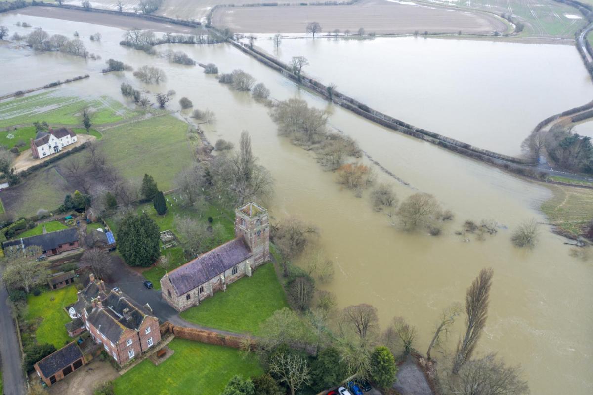
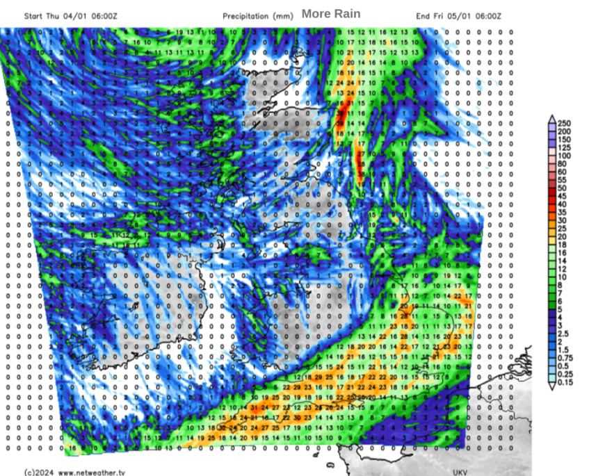
There are many flood warnings after the recent rains with saturated ground, high river levels and water everywhere. The UK Met Office has a yellow warning for rain across southwest England, southern England into East Anglia which mentions 10 to 40mm of rain. It runs from lunchtime until the small hours of Friday as the main focus of the rain shifts across southern Britain to The Wash.
“Impacts are more likely due to the current very wet ground across the region. Strong winds may also accompany this heavy rain across southern and particularly southeast England this evening and overnight.”

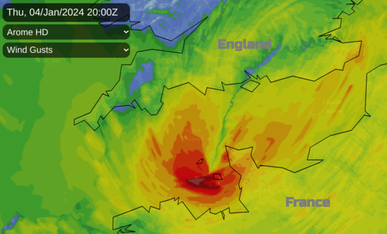
By mid-morning the rain had set in for Cornwall, south Devon and the Channel Islands. As the low centre makes its way along the English Channel today and reaches Kent by midnight it will throw more rain over southern Britain. This little low is running in and across the south and will be away by Friday. There has been a more sedentary low sitting off NW Scotland. The frontal boundary dangling off that low will bring more rain to Aberdeen and Peterhead into the night, gradually linking down the east coast of England to the southern low as it clears into the North Sea after midnight.
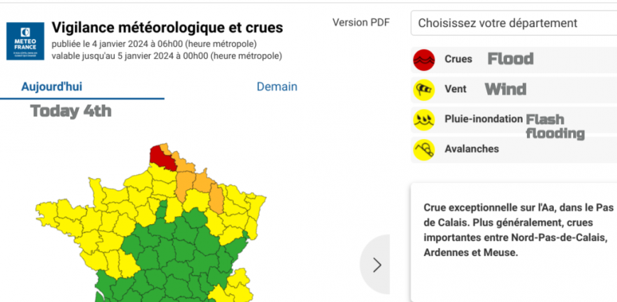
Northern France has also been particularly badly hit by heavy rains in recent months. There have been ongoing flood warnings since mid-October, with record rainfall over Pas de Calais in the far northeast. This region will also be looking forward to a shift in the weather next week but for now, there is a red warning for exceptional flooding on the River Aa and other amber flood warnings locally. Also yellow wind warnings across a wider area of northern and northwest France.
The Channel Islands are also in for a wild night with gales and high gusts. Around the low pressure, there will be cyclonic winds moving eastwards through the evening. Southeast veering southerly ahead of the low and north backing northwesterly as the low moves long.
Night ‘SW to W strong F7 to gale F8, perhaps briefly severe gale F9 at first with gusts to 60mph, veering W to NW strong F6, decreasing moderate F4 to fresh F5.’ Jersey Met
Parts of southeastern Britain will see a dramatic change in the weather today after a fair start. The Met Office matrix for the yellow rain warning mentions “Low likelihood and medium impact”. Keep an eye on the radar if you are driving home later today, or travelling by train and if you can maybe leave before the next bout of rain arrives.
Further discussion about Thursday's low pressure
Loading recent activity...