


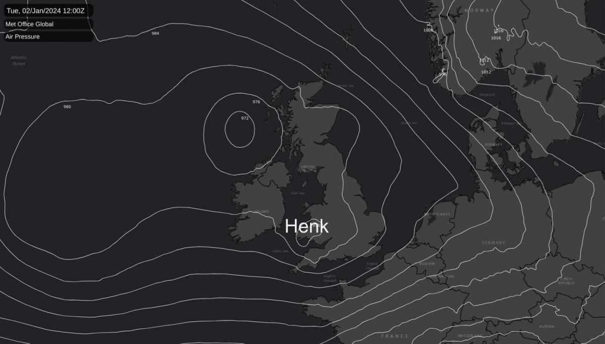
Storm Henk arrives today, bringing another bout of very wet, very windy weather. There are changes on the horizon though.
At last, there are signs of change on the way, with the current circulation pattern altering to a more anticyclonic type, bringing somewhat colder, drier conditions. However, patience is needed as it will be a few days yet before this change arrives, with more wet and windy weather on the way today thank to Storm Henk.
The Met Office has issued an amber wind warning for parts of the UK due to the arrival of Storm Henk, expected to bring severe weather conditions today. The strongest gusts, which could reach up to 80mph, are anticipated around southwest England and south Wales during the late morning and early afternoon. As Storm Henk moves northeastwards across the south of the UK, the strongest winds will also move eastwards, affecting the south Midlands, Home Counties, and East Anglia through the afternoon and evening. Inland gusts could reach up to 60-70mph in some places. This warning is in place from 10 am until 8 pm on Tuesday.
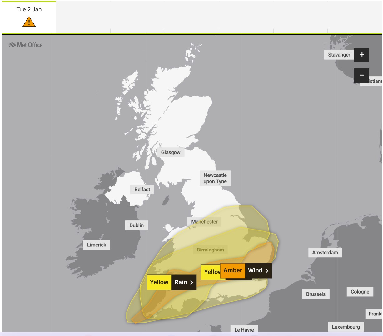
In addition to the wind, a yellow weather warning for rain is in effect across a large area of England and Wales until 9 pm on Tuesday. Some places could see rainfall totals of 15-30mm, with 35-50mm in a few locations. The worst of the rain is expected to clear southwestern areas of England and South Wales by around midday but could last into the evening across the northeast of the warning area.
The Met Office advises that these conditions could lead to travel disruptions and "flying debris," which could pose a danger to life. They recommend staying updated on the latest advisories and exercising extreme caution during this period.
This follows yesterday's deluge and is likely to add to the 108 flood warnings and over 250 flood alerts already in effect.
Elsewhere, overnight rain and hill snow are still affecting Angus, Aberdeenshire, and Moray, but this will clear by the morning. However, in the far north, these conditions will persist, where a raw east to northeast gale could bring some snow to Shetland later. Across the rest of Scotland, there will be sunny intervals but also showers, some heavy, moving in from the west. Winds will be somewhat lighter here, but gusty during sharper showers. Top temperatures are a relatively mild 7 to 9°C, but only 2 to 4°C in the far north.
It will be mildest in the south today, where brighter intervals could briefly lift temperatures as high as 13 or 14°C, although 10 to 12°C will be more typical across England and Wales. Further north, it's still relatively mild for much of the north of England and Scotland, with highs of 7 to 9°C, but only 2 to 4°C in the far north, where ice could be an issue, especially first thing.
The rain will clear from the north and east of England during the evening, but strong and gusty winds will persist for a while. This will leave most areas in a showery regime overnight, with the showers being most frequent and heaviest in the west and north. Across Northern Ireland, in the west, and over the north of Scotland, the showers could be lengthy and wintry over hills, while sheltered eastern areas will see fewer showers and clearer intervals.
Although decreasing somewhat, a west or southwesterly wind will remain fresh and blustery in the south and may also affect Northern Ireland. However, despite perhaps feeling a little chilly, temperatures generally should not fall below 4 to 7°C, except in the far north.
It remains unsettled into Wednesday, with a depression to the west of Scotland bringing a day of sunny intervals and showers. Some eastern areas may well start fine and dry, with the showers tending to come in bands spreading from west to east across the country. A few places might miss them, but it's unlikely, especially in the west where the showers could be heavy and possibly thunderous.
A southwesterly wind will continue to be blustery, with gusts of gale force still possible along exposed coasts and in any heavier, more squally showers. However, it will stay on the milder side, except in the far north, with top temperatures in the range of 7 to 11°C.
After dark, west Scotland and Northern Ireland will see the bulk of the showers, which may turn wintry on hills. Elsewhere, there will be fewer showers, with sheltered eastern areas seeing the best of the clear intervals. The lowest temperatures will mostly be in the range of 4 to 7°C.


.jpg?w=350)


.jpg?w=175)