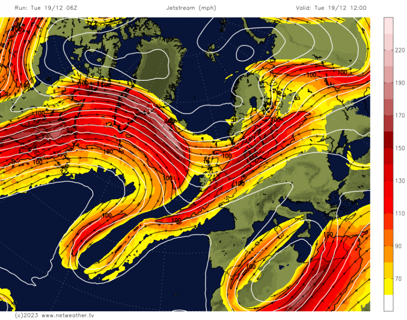
With a stark pressure difference between the Azores high and depressions near Iceland, a strong Jet Stream is expected to bring lively weather to our shores in the coming days. Severe gales later in the week will likely produce damaging storm force gusts exceeding 60mph, particularly in the North and West.
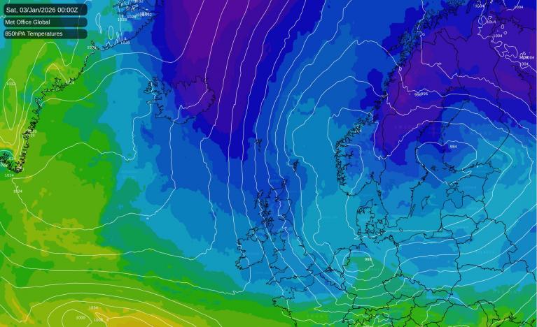
Although it will be mostly mild in the run-up to Christmas, especially in the South, colder air from the North may occasionally intrude. This will bring wintry showers, primarily to Scotland, before the cold air is displaced again by a strong westerly jet.
Today, we're seeing a wet start from the Humber to North Wales southward, with rain soon extending to drier parts of the South East. However, brighter weather will soon move in from the North West, finally clearing Kent and the South coast around dusk. Behind this, there will be sunshine interspersed with showers, mainly over Northern Ireland and Scotland. Some showers will be heavy, particularly in the North and West, bringing hail, potential thunder, and snow on the Scottish hills, primarily in the North.
A westerly wind, blustery in the North, will make it feel cold and rather raw, with temperatures generally around 6 or 7C, dropping to just 4C in the far North. In contrast, the far South will be milder, with temperatures initially around 12 or 13C, before falling to 8-11C as the weather clears.
In the North and West, particularly in Scotland, further blustery showers are expected after dark, turning wintry on hills, before briefly easing. However, more Atlantic systems will soon follow, bringing rain to Northern Ireland before midnight. Most areas, except possibly the North of Scotland, will see showers or increasing cloud before dawn. However, any rain south of the Midlands will be light and patchy.
While sheltered northern and eastern parts of Scotland may briefly experience a touch of frost, for many, a westerly breeze will prevent this. Temperatures will rise later in the night as milder air arrives, with the lowest values beforehand about 2-4C in the North and 6-8C further South.
Wednesday will be dull and murky at times for most but milder, with some rain, possibly preceded by a short spell of snow on Scottish hills in the far North. The rain will be heaviest and most persistent across Highland and the West of Scotland, potentially causing local flooding and travel issues. Further South, the rain should be lighter and more sporadic, with sheltered areas leeward of hills perhaps seeing a few brighter intervals. A blustery west or south-west wind will become fresh or strong, with gales likely in the North and North West. Despite this, temperatures should reach 10-13C quite widely, perhaps locally 14C in the South.
After dark, the wind will intensify, with severe gales expected in the North and West. Otherwise, conditions will remain similar, with occasional rain or showers, heaviest in the North. Despite the turbulent weather, it will stay mild, even very mild, with temperatures ranging between 8-11C.
Loading recent activity...