We will see a change from a mild westerly to a cold Arctic flow during this week. Depending on your location, north to south in the UK, you will certainly feel the difference later on Thursday or by Friday. Wednesday night will be mild everywhere but Scotland will experience further strong gusts on a westerly wind. The Inshore Waters forecast around the Northern & Western Isles mentions severe gale even storm-force winds and Very Rough to High seas. Northern parts becoming increasingly windy for Wednesday night into Thursday. This will add to the chill as the Arctic air appears. Further south, it has been calmer with a mild Thursday.
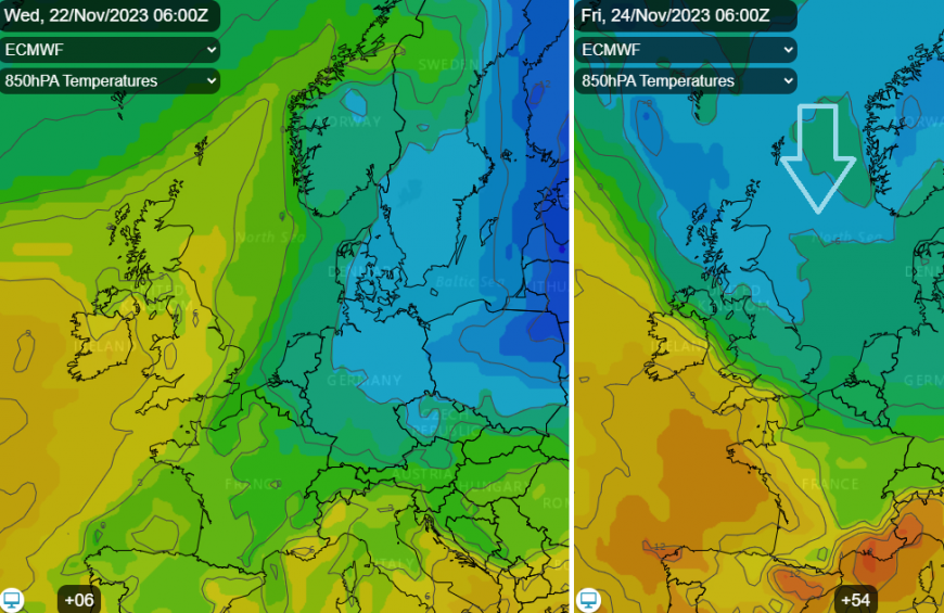
The main thrust of the cold air is down the North Sea towards Denmark but this change will be felt over Scandinavia, the Baltic Sea and into mainland Europe. The frontal boundary will stretch from France, to the Alps and across to southern Ukraine by Friday lunchtime.
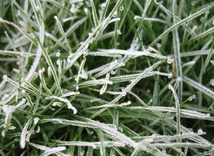
After such a mild and wet autumn, it’s almost hard to remember how wintry conditions feel. This is the time to adjust your clothing, getting out a winter coat, gloves and hat, thinking about frost and ice. Saturday morning will be cold for those waiting for the bus to work, going for a run or watching sports from the sidelines. Maybe leave a bit extra time to defrost the windscreen and demist rather than speeding to catch up. Northern and eastern Britain will have had a taster on Friday morning with a chilly northwest wind and temperatures around -3 to +3C to start the day.
This dig of cold air will mainly be accompanied by dry weather with a fair amount of cloud. Northern Scotland, mostly over the hills and mountains looks to be the focus area for any snow showers. It all looks patchy with just a few cms settling for Highland and Grampian. There might be the odd bit of icy rain and fleeting snow for eastern England Friday night into Saturday. Nothing that warrants even trying to remember where a sledge might be stored, let alone getting it out. Ignore the LBC headline "Exact dates snow to fall over 8 days in 'wintry blasts' as Brits set to shiver in -2C". I'm not clicking on the article, so I won't find out those exact dates, all eight of them.
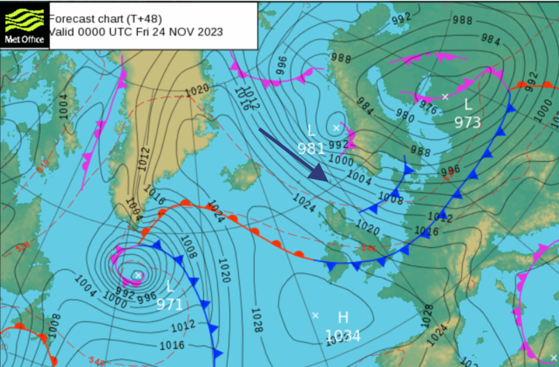 The main uncertainty over the weekend is around the timing of the cold air fading away as milder Atlantic air returns from the west. It’s the low pressure close to the tip of Greenland and it’s weather fronts that will edge in during Saturday. Behind that we have a different air mass coming around the top of the high pressure and that milder air will seep across Ireland and then Britain during the weekend. It will take its time to reach SE Britain, so another single-figure temperature day is likely here.
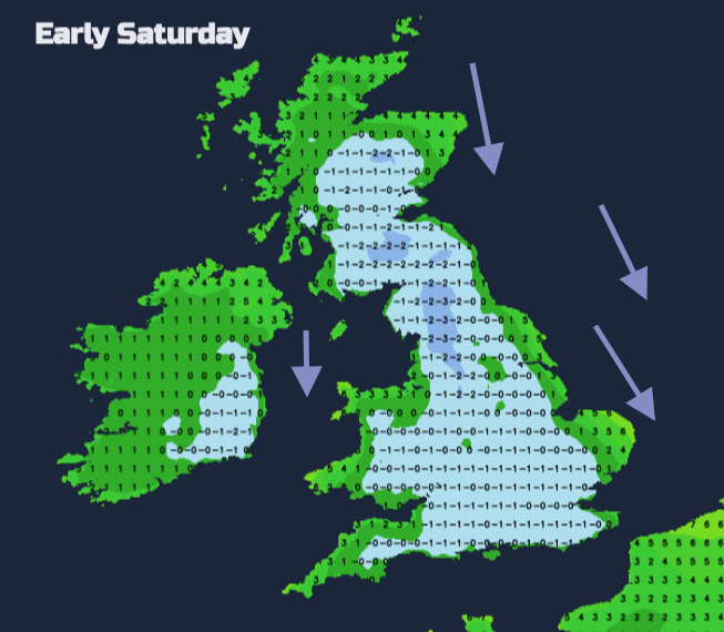
If you are out on Friday evening, take a big coat. It will be cold and dry. It will turn frosty but with a brisk, chilly north or NW wind and just a few more snow showers for the far north of mainland Scotland. The winds ease during Saturday but daytime temperatures will struggle, for inland areas around 4 to 8C. There will be a nippy north wind clipping East Anglia and Kent and making it feel colder.
Overnight, the winds will be light and the frost will return.
The models vary on how long the frontal band takes to edge in from the northwest. This will bring more cloud, some patchy rain and be accompanied by a southerly wind. Depending on its progress, there could be another cold and frosty night for Britain.
Overall Saturday is looking chilly but dry. There will be grey skies with occasional bright spells, glimpses of sunshine at best. The air is cold but it will feel better once the wind eases down. Changes are on the way for Sunday with with low confidence around the timing and extent of the rain from the west. The UKV and ECM show frontal rain over Scotland on Sunday and possibly damp, grey weather for Northern Ireland and Irish Sea coasts.
Loading recent activity...