The week ahead won't see any storms, so won't be as wet or windy as recently. Low pressure will be nearby but as the wind will be from the west it will be western areas seeing the most showers
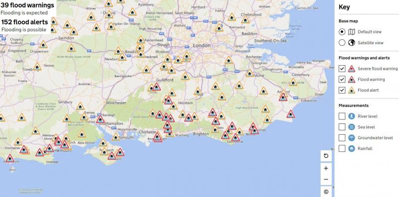
Although the weather for the week ahead continues to look changeable, southern, central and eastern parts England that have seen a lot of rain recently and where there are 39 flood warnings and 152 flood alerts in force, do at least look to be drier over the next few days.
Although low pressure will remain in control through much of this coming week, because the wind will be blowing from the west or northwest Monday and Tuesday, this will favour western coastal areas to see showers, while central and eastern areas remain largely dry and sunny. Wednesday looks to see an Atlantic frontal system move east, bringing a band of heavy rain across all areas, following that will be increasingly windy conditions with sunshine and showers on Thursday and Friday, though most of the showers look to be around western and southern coasts. So, all-in-all, no prolonged rainfall anywhere this coming week, just a spell of rain moving through Wednesday and, otherwise, showers around western coasts and southern coastal areas later in the week. However any heavy showers across the south could bring the return of some flooding.
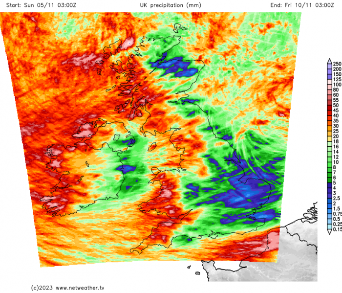
Rainfall accumulations until Friday - western areas seeing most rainfall.
Yesterday saw the centre of Storm Domingos, named by the Spanish Met Service AEMET for the strong winds it was to bring to northern Spain and western France, cross southern England overnight. Like Storm Ciaran on Thursday, pressure was unusually low for the south of England, around 964 hPa. The storm brought very strong westerly winds on its southern flank across western France and the north coast of Spain. There was a 96mph gust at Bares on the coast in the far NW of Spain, 94mph gust at Cap Ferret on the Atlantic coast west of Bordeaux in France, 87mph gust at Cognac, France well inland from the coast.
Winds weren’t really a feature with this system for us, though lots of heavy showers or longer spells of heavy rain affected south coastal counties, some rain gauges around Hastings in East Sussex and coastal south Kent recording 44-46mm in 24 hours, long term November average is around 96mm for this part of England. As a result, there are quite a few flood warning in along coastal counties of southern England. Fortunately, here it looks to be drier over the next few days, just a few showers grazing southern coasts.
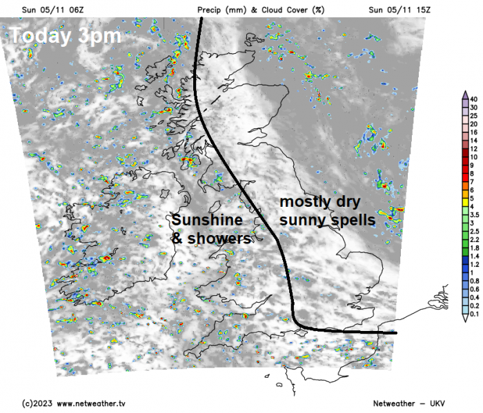
For today, a chilly start earlier across central and northern areas, temperatures fell below freezing across northern Scotland overnight. A brisk westerly wind across England and Wales today, which will blow in showers across western coastal counties of mainland Britain and N. Ireland, some getting inland across SW England and Wales. Some showers heavy with hail and the odd rumble of thunder. Generally dry with sunny spells elsewhere, though the odd rogue showers can’t be ruled out. Temperatures reaching 10-13C generally, perhaps 14C in the far south.
Monday will see further showers across the west, some of these heavy with the odd rumble of thunder, some sunny spells in between showers. The best of the weather across the eastern side of the UK, staying mostly dry here with sunny spells, though some showers may filter through to the east across England in the afternoon. Temperatures reaching 9-13C.
Similar story on Tuesday, sunshine and showers across the west, some reaching the east across the north, central, southern and eastern England mostly dry with sunny spells. Temperatures similar to Monday.
Then on Wednesday, a deep area of low pressure a long way to the northwest over the North Atlantic will push a frontal system east well ahead of it across the UK, bringing a band of rain eastwards across all parts, rain locally heavy – particularly over higher ground of the north and west. This rain shouldn’t linger and will be followed by brighter but blustery conditions in the afternoon, with showers in the northwest.
Low pressure moves in closer to the northwest on Thursday, bringing a windy and showery airstream, most of the showers in the west and the south, where they could be heavy with hail and thunder. Temperatures 9-12C.
That low to the northwest on Thursday looks to move southeast across southern Britain on Friday, bringing a showery day on Friday over England and Wales. Another low close to northern Scotland bringing showers here too. Winds turning northerly Friday night and with skies clearing there could be a frost in places.
Calmer and drier with a cool northerly breeze and a brief ridge of high pressure building in to start next weekend, but later in the weekend it looks like milder, wetter and windier weather will return from the west off the Atlantic.
Loading recent activity...