Officials in Jersey and Guernsey are warning islanders to stay at home and not to travel unless absolutely necessary on Thursday 2 November.
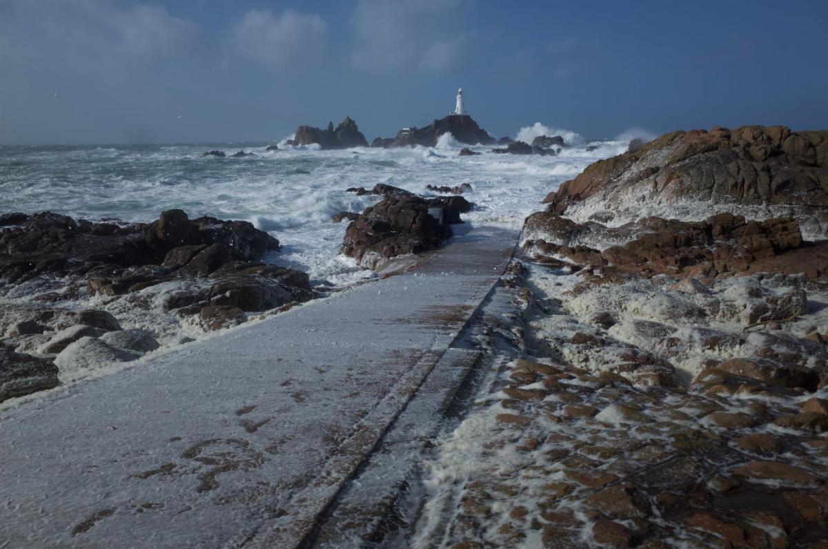
Meteo France has issued red warnings for NW France and southern counties of England and Pembrokeshire have Amber warnings for the potential impacts of high winds from Storm Ciaran. The Channel Islands face an onslaught of south, southwest and westerly gales, and stronger. Like the UK, northern France has saturated ground from ongoing heavy rain and there is a risk of flooding and large waves but it is the raging winds which are the main concern around the Channel from Storm Ciaran.
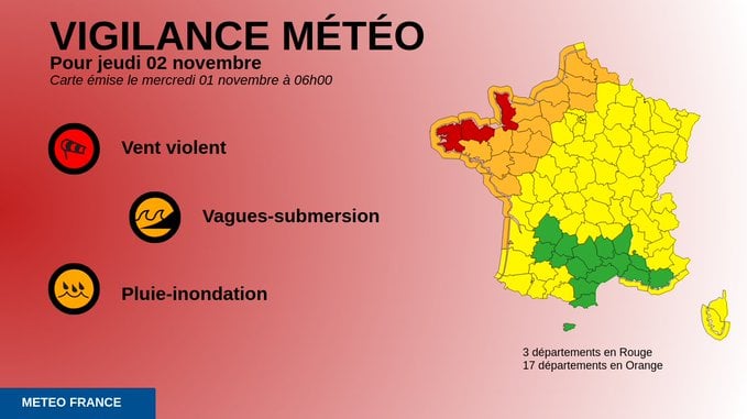
Meteo France “Dangerous phenomena of exceptional intensity” ‘violent winds, heavy rain and strong waves…Very violent gusts during (Wednesday) night and Thursday morning between Brittany and Cotentin’ (the Cherbourg Peninsula)
The sea area forecasts are alarming. Channel Islands- Sea area Portland GALE WARNING Issued: 03:54 (UTC) on Wed 1 Nov 2023
Southerly gale force 8 veering westerly and increasing violent storm force 11 later
WIND Southwest 6 to gale 8, becoming cyclonic severe gale 9 to violent storm 11
SEA STATE Moderate or rough becoming very rough, becoming high or very high later except in east.
WEATHER Thundery rain. VISIBILITY Good, occasionally poor.
The Plymouth sea area to the west mentions - “violent storm 11, perhaps hurricane force 12 later.” “Atlantic low 988 expected Plymouth 954 by midnight tonight.”
Dover sea area includes a Severe Gale in this period but that is only until 06Z Thursday, the storm will continue east through Thursday.
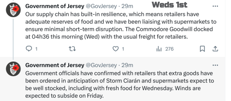
For the Channel Islands Residents, particularly those in coastal areas, are encouraged to continue to prepare their properties for the storm. To secure any loose items, ensure that drains and gutters are clear, and make necessary repairs to any areas that could be damaged by high winds.
The Inshore waters for CHANNEL ISLANDS coastal waters up to 12 miles offshore - in the next 24 hours includes (Weds 06Z - Thurs 06Z)
“backing south to southeast 7 to severe gale 9 in the evening, with gusts to 60kt, then veering southwest to west gale 8 to storm 10, perhaps locally violent storm 11 with gusts to 90kt later.” “ very rough by midnight, locally high in the west later.”
And for Thursday- WIND Westerly gale 8 to storm 10, perhaps locally violent storm 11 with gusts to 95kt, decreasing 7 to gale 8 after midday Friday, further decreasing 5 to 6 by midnight. SEA STATE Rough to very rough, increasing very rough to high, locally very high around mid-morning, gradually decreasing rather rough to very rough by midnight Friday.
This is an incredible forecast for the Channel Islanders. Already the Government has said that; All schools and colleges will close, islanders are being asked to stay at home. To only visit the hospital if it is an emergency. No planned home births. All Gov Jersey sports facilities will close on Weds eve. The airport will close for commercial flights. Boat owners are being asked to secure their vessels securely. Also to buy responsibly.
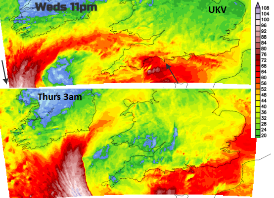
There will be another update about the impacts of Storm Ciaran on the UK weather, but the worst of the winds will be for the south coast of England overnight in a southerly flow. Cornwall before dawn in the northwesterly barrage as the southerly gales pickup for the eastern end of the English Channel.
There will be a south to SW wind for SE England, the NW wind for SW Britain and ongoing westerly winds for the Channel Islands on Thursday morning. The focus of the westerly gales will shift to the eastern end of the Channel by the afternoon.
Loading recent activity...