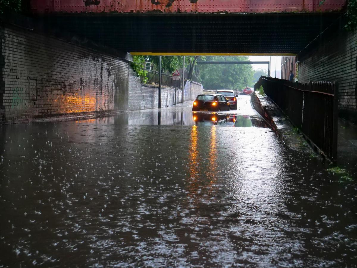
Yes, we have another storm this week. Babet will be remembered for the huge rainfall totals and days of flooding. October has been very wet and we've seen significant spring tides this weekend. Storm Ciaran has the potential to bring damaging winds to southern Britain and NW France. There will also be more heavy rain around this storm adding to the already saturated ground across the UK. There are other rain warnings to start this week including an amber rain warning for Northern Ireland.
"Further rain will affect Northern Ireland…25-50 mm of rain falling widely and as much as 75 to 100 mm over hills, this falling on already saturated ground. The rain will ease from the south through Tuesday morning." MO
This is even before Ciaran forms and moves across the Atlantic to reach us on Wednesday night and Thursday.
At the moment there is a low pressure centre over Ireland which has been sending severe weather into the Bay of Biscay. This low has been named Storm (Tempête) Céline by Meteo France and there are wind, wave, flood and thunderstorm warnings from this. Heavy frontal rain will move from eastern Spain and eastern France to the Alps and Corsica tonight.
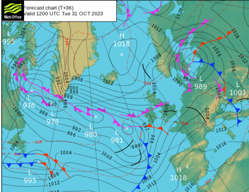
During Tuesday another Atlantic low moves towards Ireland and parks itself out west. This will throw rain and wind over the UK, but it’s not yet Ciarán .
Early on Tuesday morning, the low that will develop into Storm Ciarán will move to the south of Newfoundland. It is forecast to move across the Atlantic and the forecast models have shown a strong, signal for a significant deep low to be over the UK by Thursday.
The pressure charts suggest a centre around 952hPa early Thursday, deepening rapidly from the 975hPa of Wednesday.
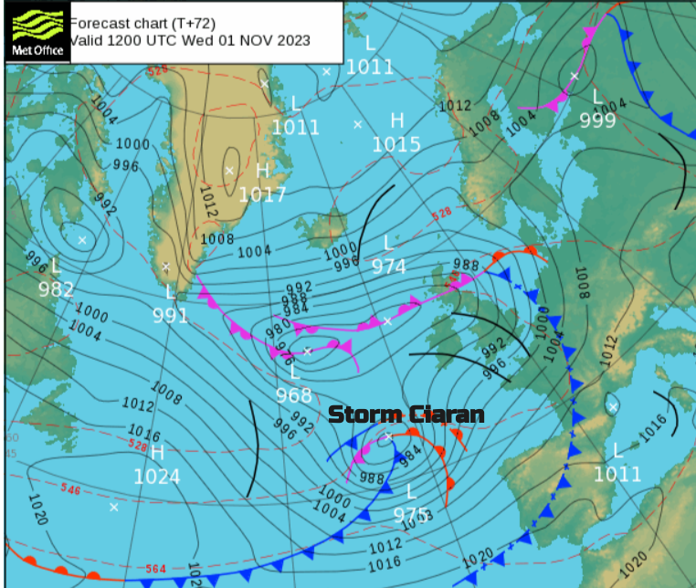
The Met Office Thursday 12Z pressure chart has Ciarán centred near Cardiff but it will be the south side of the low which will see the strongest winds. The yellow warnings for wind and rain from the UK Met Office are an early “heads-up”. Amber warnings will follow when needed as model confidence increases. It might be that the worst of the gales impact northern France. Brittany looks vulnerable.
Storm Babet will be remembered for the huge rainfall totals and widespread disruption from flooding. Windstorm Ciarán is different in that it is the potential gales and high gusts which could impact southern Britain (the Channel Islands and northern France) but there will also be more rain.
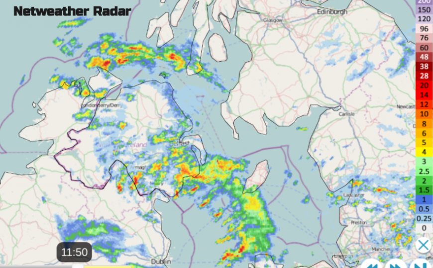
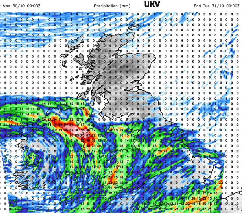
Each day this week has a yellow warning from the Met Office. Monday sees Northern Ireland affected by even more wet weather. Southern and southeast England keeping their rain warnings along with river and surface water flood warnings
“Frequent and heavy showers may cause flooding and disruption to travel. “ MO
The layering of rain warnings over Northern Ireland is building up, but just to say that the risk of flooding continues. By Wednesday evening, we see the first warning for Storm Ciaran, across southern Britain,
“Heavy rain associated with Storm Ciarán is also likely to bring further disruption.” And for Thursday,
“Very strong and potentially damaging winds associated with Storm Ciarán are possible on Thursday.”
Just keep in mind that there is still uncertainty about where could see the worst of the winds. And that at this time of year, most of the trees still have their leaves, with more surface area to be buffeted, the ground is sodden and the falling leaves will block drains.
There are ongoing flooding concerns with all the rain so far this month. Also, the weekend spring tides caused issues around the coasts and there are high river levels. The environment agency has numerous flood warnings for Monday and there will be plenty more popping up this week.
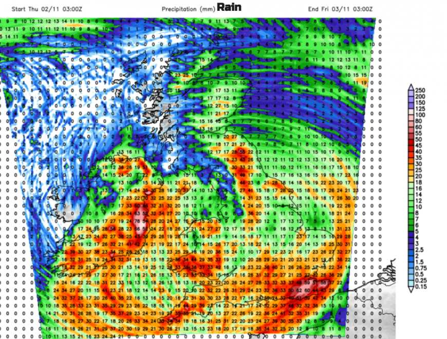
“Local flooding from rivers and surface water is possible on Wednesday and Thursday across parts of the South of England due to heavy rain, with potential for flooding more widely.Properties could flood and there could be travel disruption,” Env Agency.
It is going to be a wet and unsettled week but the developments of Storm Ciaran will be worth keeping an eye on, for the winds in the south and even more heavy rain in sensitive areas. There is the possibility of severe gales with gusts over 80mph along the English Channel coasts and another low pressure for Saturday.
More discussion and chat about Storm Ciaran
Loading recent activity...