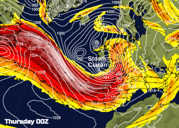
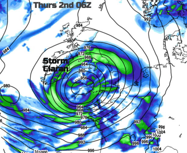
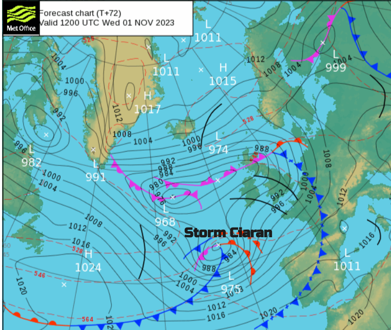
The UK Met Office has named Storm Ciaran, for potentially very windy weather Wednesday night and on Thursday with even more rain. There are plenty of rain warnings before that too.
We have a week full of weather warnings and the next named storm “Ciarán”
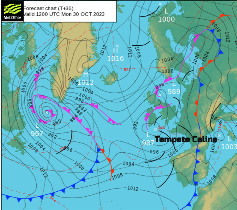
A deep low pressure will develop as it swings up and in from the Atlantic to an existing unsettled picture over the UK. Meteo France has already named the low pressure over southern Ireland for the impactful weather around the Bay of Biscay. France and Spain have weather warnings this weekend for heavy rain and flooding, large waves and thunderstorms.
The UK and Ireland have rain warnings for the start of this week from further downpours and due to the existing sodden ground conditions.
France and Spain belong to the Southwestern Storm Naming group. The UK and Ireland belong to the Western group and the UK Met Office has named Storm Ciarán.
A yellow early warning for rain has been issued for southern Britain.
“Heavy rain associated with Storm Ciarán is also likely to bring further disruption.” MO
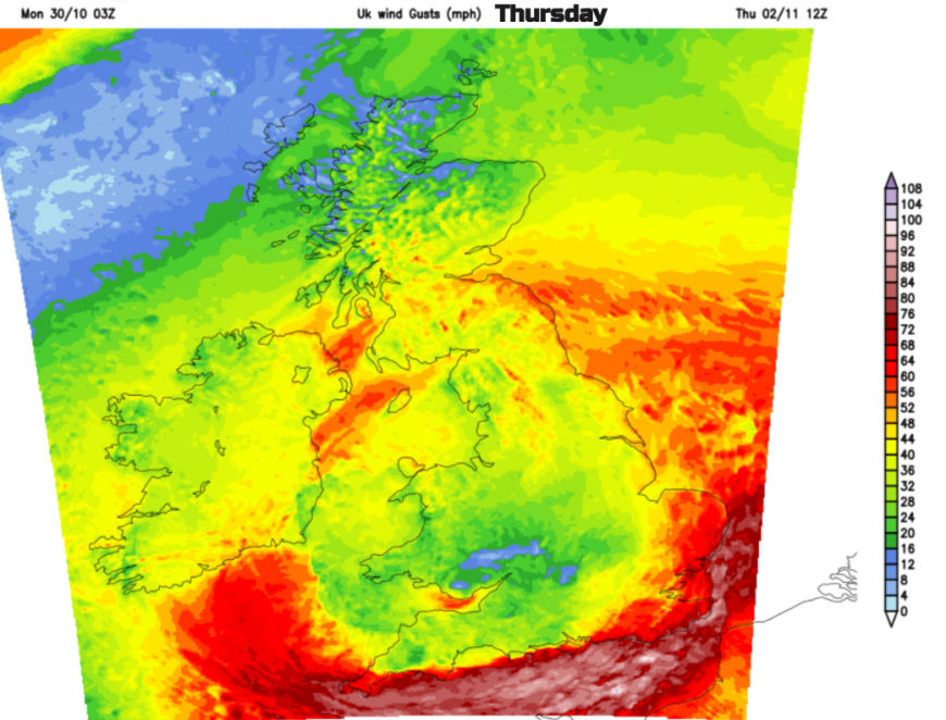
And a yellow wind warning on Thursday, these will be added to as the week progresses but are the focus at the moment.
“Very strong and potentially damaging winds associated with Storm Ciarán are possible on Thursday.” MO
It is half term in some parts of the UK, people will be making travel plans so this is just a heads-up at this stage about a strong signal for this deep low pressure and the likelihood of impactful severe weather.
This low pressure hasn’t even formed yet so changes in the model output will happen and other areas could be affected, so do keep an eye on the forecast.
Even as this deep low moves through, there is no let-up in this barrage of wet weather. Another low pressure looks to follow behind, probably moving over the UK for another weekend. More rain, and possibly more strong winds.
More discussion and chat about this week's storms in the Netweather community forum
Loading recent activity...