A high pressure system centred to the northeast of Britain will keep the weather fine and warm today, an easterly or southeasterly breeze will pick up around southern and western coasts and hills after mostly light breezes yesterday, so the sea perhaps not quite as calm as yesterday for those going to the beach.
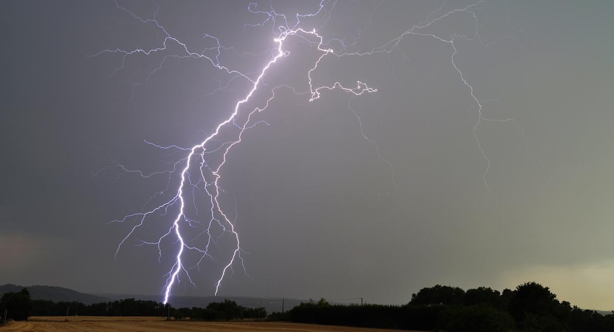
However, the fine weather looks to break down on Friday. A band of heavy showers and thunderstorms looks to develop across SW England and Wales tonight, before moving northeast across England Friday morning, then fizzling out. Becoming drier and sunnier for a time, warm and humid too, but trouble brewing to the west, as a deepening low approaching from the southwest looks to move north across Ireland Friday night, with a more extensive band of heavy rain and thunderstorms spreading north and northeast across the UK Friday evening and night. Gales look to develop across western areas Friday night / early Saturday, as the low moving over Ireland tightens isobars over the Irish Sea, worst gusts possibly over Wales, with over 60mph possible over exposed coasts and hills
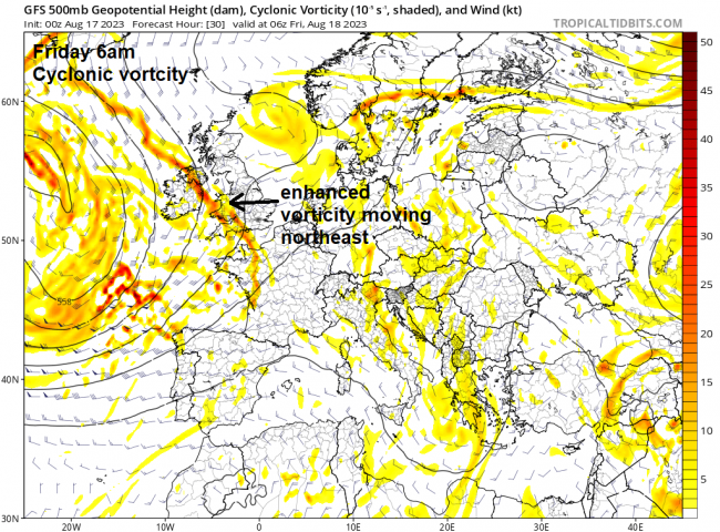
The breakdown triggered by a shortwave trough, rotating around the southern and eastern side of a fairly deep upper low to the west of Ireland, swings northeast then north across western then northern areas on Friday. Upper level divergence and surface convergence created by the combination of the shortwave trough and also the left exit region of jet streak arriving from the southwest looks to allow a secondary area of low pressure to develop and deepen to the southwest of the ‘parent’ low pressure west of Ireland.
.JPG?w=870)
The weather models still diverge on how much to deepen this secondary low, UKMO / UKV (high res) has been keen to deepen it most and that remains the case this morning, other models less so. But there is potential for wind gusts of 50-60mph along western coasts and hills, perhaps up to 70mph with exposure across SW and west Wales coastal areas and hills.

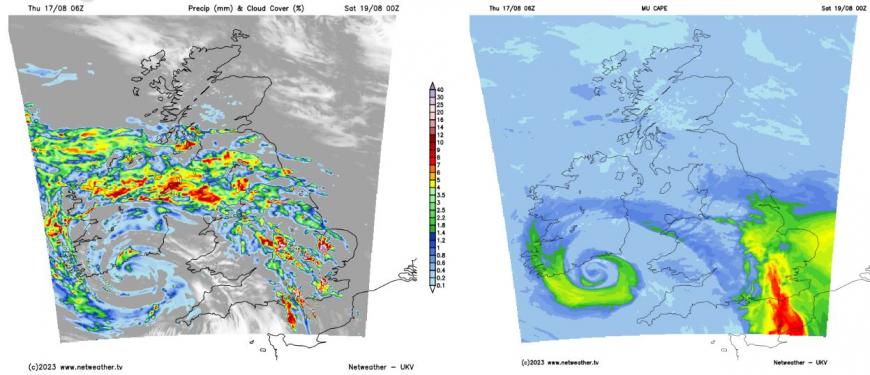
There will also be bands of heavy downpours and thunderstorms moving north across the UK and Ireland through Friday ahead of this low, as high pressure retreats to the northeast. The first band of heavy showers and thunderstorms looks to develop across SW England, Wales and across the Irish Sea into parts of Ireland tonight / early hours of Friday along a lobe of vorticity / trough moving northeast. Lift of warm moist southeasterly flow, characterised by wet bulb potential temperatures (theta-w) of 16-18C, along the area of enhanced vorticity will support elevated convection with heavy showers and thundertorms developing and moving northeast from SW England and Wales across the Midlands and southern England during the morning before the forcing relaxes as it heads across northern and eastern England, with showers weakening. Following will be some warm and humid sunny spells for many but becoming increasingly breezy or windy.


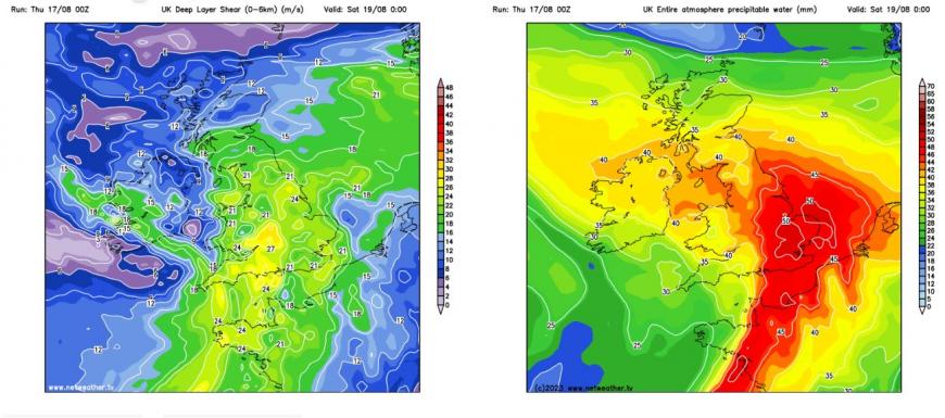
Then during the afternoon and early evening, an occluding frontal system, arriving from the southwest ahead of the developing secondary low, will bring a more extensive area of heavy rain and some embedded thunderstorms in across Ireland, SW England and Wales during the afternoon and early evening, before spreading north and northeast across N. Ireland, Wales, England and into southern Scotland during late evening and overnight. The risk of thunderstorms will tend to be highest towards SE England – where there will be greater instability as very warm and humid air with steep lapse rates is tapped into from northern France ahead of approaching cold front. There is potential for thunderstorms here to perhaps bring isolated severe weather due to strong vertical shear and CAPE forecast aiding in the organisation of storms into clusters – which could produce strong wind gusts, large hail, flash-flooding and frequent cloud-to-ground lightning. GFS shows precipitable water shows up to 50mm across SE England.
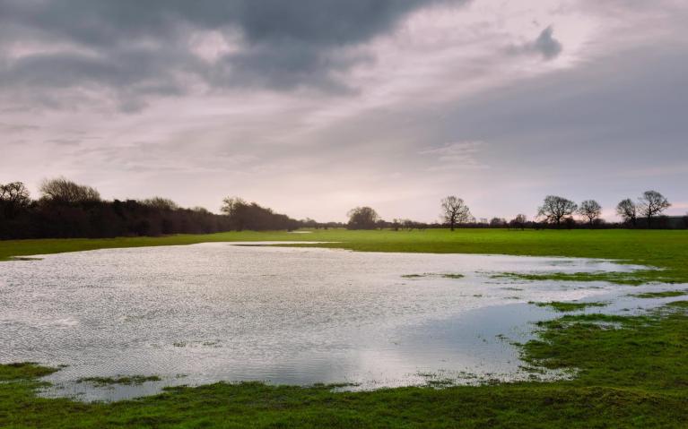
Some embedded thunderstorms are possible elsewhere too – these and generally the heavy rainfall bringing a risk of flash-flooding too.
But it’s the strong winds developing across the west overnight and early Saturday that will also be of concern, 03z UKV indicates a swathe of strong gusts (60-70mph over coasts and hills) developing over the Celtic Sea and moving up through the Irish Sea, SW and west Wales in the early hours of Saturday. Other models not as strong, 50-60mph still possible with exposure, but risk of south to southwesterly gales generally pushing north up over the Irish Sea and along adjacent western coasts and hills of Britain and eastern areas of Ireland overnight and Saturday morning. Obviously with summer holidays still in full swing (for England and Wales) – campsites will be full with a risk wind damage to tents, while branches and a few falling trees may also be hazard. Irish Sea will also likely have large swell and waves Saturday morning – which may overtop sea defences at high tide.

The strong winds look to transfer north across NW England and over southern and western Scotland during Saturday, on the eastern flank of the low tracking north to the west of Scotland, gusts of 45-55mph possible over coasts and hills. So again a risk to tents vulnerable to the wind, falling trees or branches and rough seas. Overnight heavy and thundery rain should clear northern Scotland during the morning, then most places will become dry with sunny spells but windy, some blustery mainly light showers across the far west. Still warm and humid towards SE England and East Anglia – where temperatures could reach 25C.
Loading recent activity...