The last time the UK saw 30C was back in early July, when Chertsey in Surrey reached 30.2C on the 7th. Since then, the weather has been changeable and on the cool side at times. It did turn very warm briefly during the second half of last week, Thursday the warmest day, with Wellesbourne in Warwickshire reaching 28.4C.
However, it’s getting warmer in the next few days and, although the heat may not build this week to make it to 30C, thanks to heavy and thundery rain moving through on Friday, after a mostly dry and comfortably warm weekend for a change, heat may build stronger early next week – with potential for 30-32C next Tuesday.
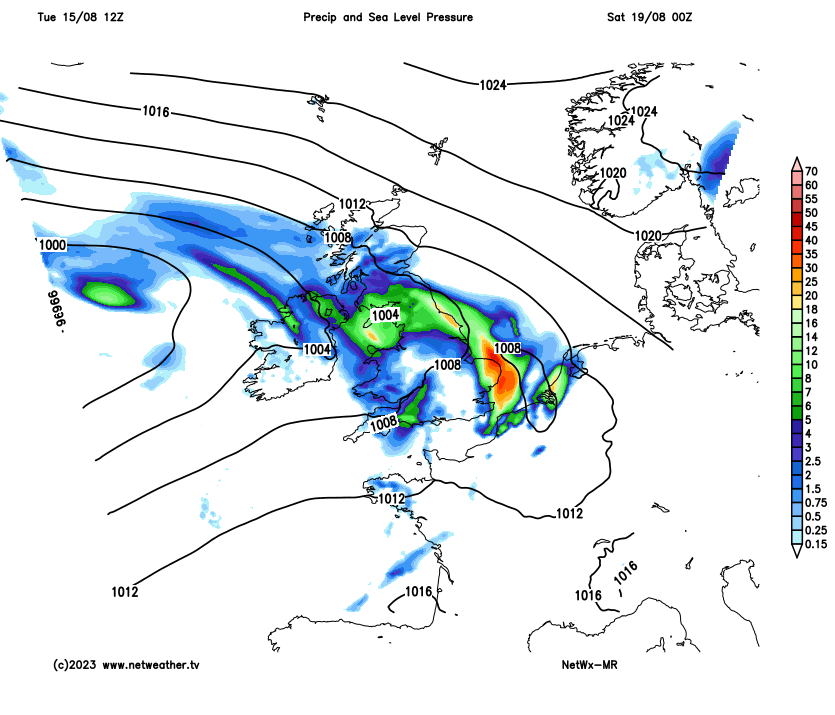
Low pressure that brought unsettled conditions with spells of rain or showers for many over the weekend and to start the week finally drifts away east over the North Sea today. This will allow a ridge of high pressure to build in from the southwest – settling the weather down and bringing mostly fine, dry, sunny and increasingly warm conditions. A southeasterly flow will draw in increasingly warm and humid air in from the near continent.
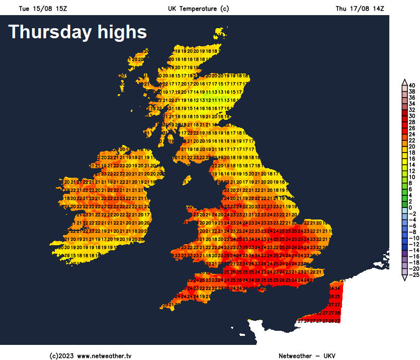
Warming up during the second half of this week, Thursday may now be the warmest day, and increasingly humid too:
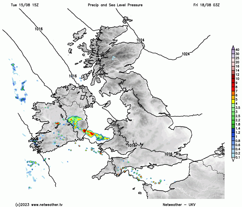
However, the ridge of high pressure building across the UK will be transitory. So although it looks to turn very warm and increasingly humid Thursday and Friday, a low pressure system winding up over the Atlantic to the west of Ireland will throw a thundery trough of low pressure and associated fronts northeast during Friday – bringing some heavy showery rain and thunderstorms with it across England and Wales. One band of heavy rain and thunderstorms may make an appearance as early as Friday morning across southern areas before moving northeast across England and Wales before weakening across northern England. Before another more widespread area of heavy rain and thunderstorms follows from the southwest across England and Wales in the evening and overnight, associated with an area of low pressure and frontal system moving in from the southwest. This thundery rain reaching Scotland early Saturday.
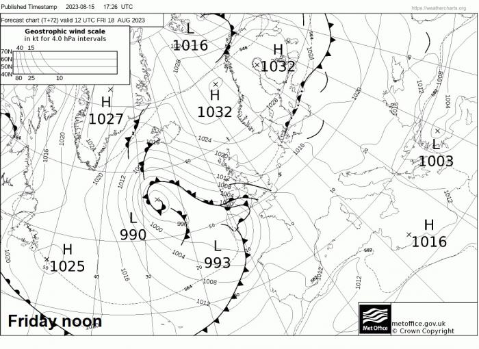
Following the second area of thundery rain clearing northeast Friday night will be slightly cooler and fresher air off the Atlantic for the weekend, but with pressure rising from the south and the flow from the southwest, it should be mostly dry away from the west, where we may see a few showers, and it looks to remain pleasantly warm in the sunny spells both Saturday and Sunday. Which makes a change from the last 5 weekends – which have been unsettled.
Drying out over the weekend after a wet and thundery Friday night for many, with high pressure building from the south:
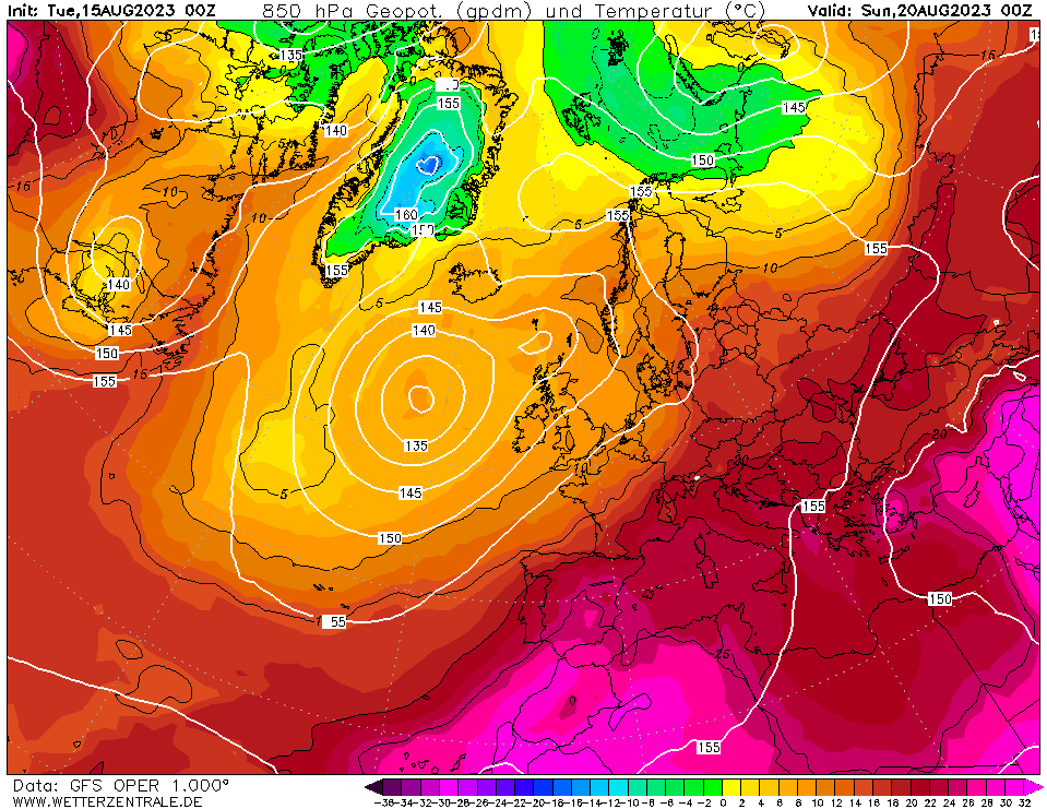
In the meantime, a heat dome looks to build across Iberia before extending northeast across France, Low Countries, Germany and western Alps early next week. The edge of this heat dome may clip SE England too by Tuesday. So with pressure rising from the south in response to this heat dome spreading northeast, temperatures look to rise early next week across southern Britain in response to increasing sunshine and very warm air pushing in from France. Models are indicating temperatures could peak in the low 30s centigrade on Tuesday towards SE England. Before temperatures drop again from mid-week, but still very warm.
Heat dome builds northeast across western Europe by early next week, clipping SE England:
Tuesday's highs:
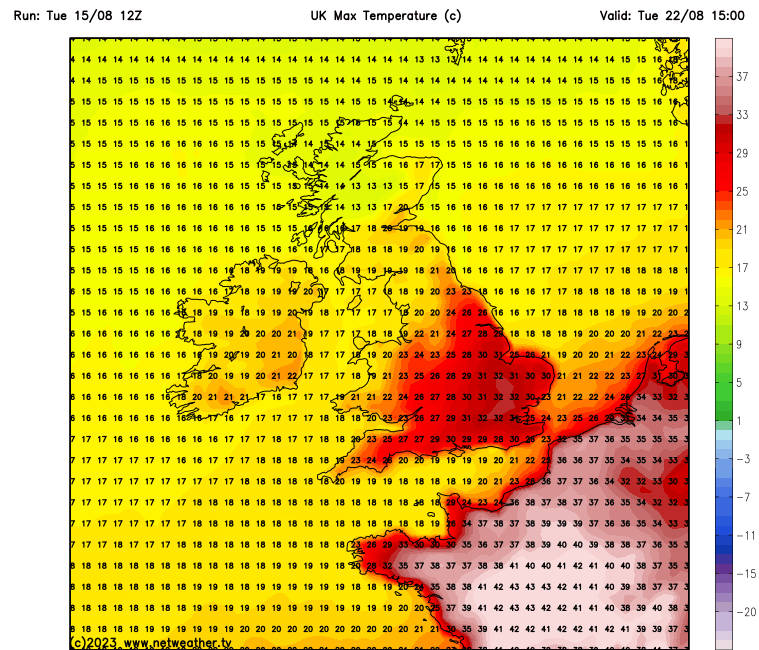
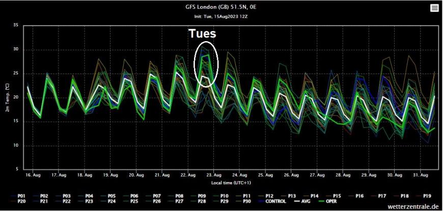
Next Tuesday is still far enough away for there to be some uncertainty over it getting as hot as low 30s, after all, it looked like this Friday could see 30C, but temperatures, although still possibly reaching the high 20s, may be just shy of 30C. A look at the ensembles shows that the 12z GFS operational run was at the warm end of the ensemble spread, while 00z EC ensembles mean only touches 25C next Tuesday, the deterministic lower, though some members do reach 30C. So it remains to be seen if it will get as hot as GFS paints, but certainly a possibility.
However, it only looks like southern, central and eastern England may see very warm or hot conditions early next week, perhaps turning more unsettled across northern and western areas keeping temperatures more average here.
Loading recent activity...