Temperatures on Friday and Saturday could reach, even pass, 30C for parts of Britain. It will feel hot and humid before showery rain with thunderstorms and heavy downpours moves across the UK.
Wednesday saw a fresh westerly flow with warm sunshine and a scattering of showers, some heavy but with other areas staying dry. After a cool night, Thursday will feel a bit warmer with more areas creeping into the high teens and low 20s Celsius and a light south-westerly wind. This will freshen and back to a southerly through Ireland and for western Britain by teatime on Thursday. Northern Ireland and western Scotland will have a wet and windy end to the day.
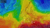
Warmer air will reach up through the UK during Thursday night and then hotter and more humid air is forecast to spill up from France on Friday. Temperatures will rise widely into the 20s Celsius and towards 30C in the south.
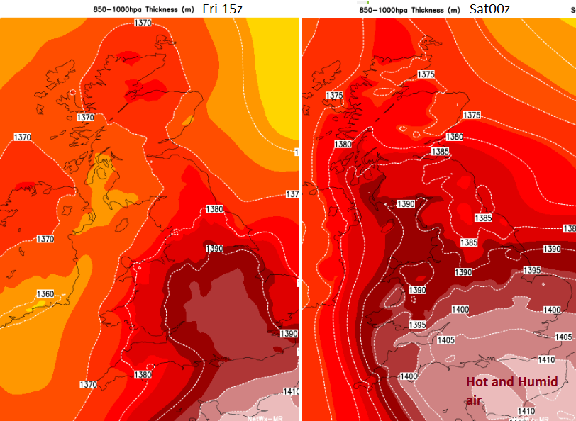
This heat stays for Friday night which will feel sultry and then lasts into Saturday morning. Parts of southern England, perhaps along the M4 corridor could record a ‘Tropical Night’ where the minimum temperature does not fall below 20C. There will be a gradual clearance from the southwest on Saturday as fresher feeling air moves in off the Atlantic. This will take most of the day to reach northern Scotland and the hot humid air could still be over eastern England on Saturday evening.
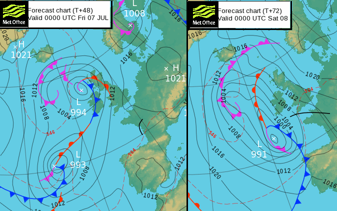
The heat and humidity might not last too long as the two low pressures out west begin to move across the UK. The first one will bring rain and strong winds during Thursday night to the far northwest. The linking frontal band will wave across Scotland and Northern Ireland with more cloud and outbreaks of rain during Friday, which should gradually retreat westwards. The heat will build across the UK. Northern Ireland could see some sharp showers on Friday evening. The second one, further south, takes until Saturday to swing up towards Ireland and it is the cold front which will change the airmass over the UK. Ahead of this, the heat remains and eastern Britain could be even hotter than on Friday.

Current westerly flow with warm sunshine but fresh feeling air midweek. A change is on the way, briefly.
There will be heavy and thundery downpours with the risk of hail, high gusts, sudden torrential downpours and flooding. Early on Saturday, Southwest Britain looks more at risk of showers. Don’t be despondent at this stage if you are looking at a weather app that has a thunderstorm symbol in the time slot that is important to you. It’s too far ahead to firm up the detail and as always with showers, some places will see rain and others miss out. Currently, it looks like bands of thundery rain will spread north and east during the day with temperatures reaching 30C for parts of eastern England, before the cloud and rain arrives. It looks like western mainland Scotland and around the Solway Firth could see a good amount of rain whereas southeast Britain will have to see how the bands hold together on Saturday. The day starts with an easterly flow which veers to a southerly for Ireland and west coast Wales by the evening.
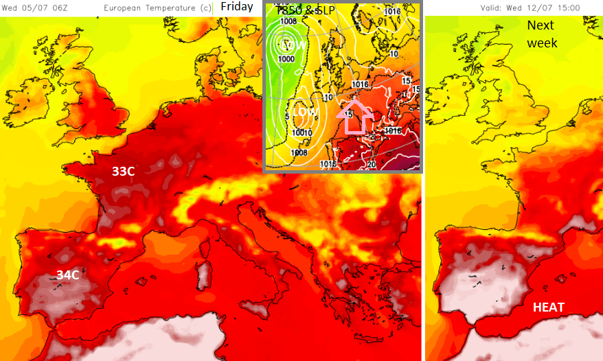
For Sunday, the frontal cloud and showery rain will still be over northern Scotland in the morning. It is a more mixed and messier picture with showers showing for Northern Ireland and Wales on the UKV model and it won’t be as hot or humid by then. NW Europe loses the heat but SW Europe and the western Mediterranean sees it build early next week.