We are into the second half of March so I will look at the weather prospects for rest of the month.
It was a colder-than-average first half to the month. Up to today, the UK average temperature is 3.3C, 2.4C below average. The Central England Temperature was 4.4C up to the 14th, with is 1.4C below 1961-1990 average. It was also a wet first half, the UK average was 118mm, 139% of the average. The rain much needed though, as England had its driest February for 30 years, with rivers levels, groundwater levels and reservoirs running low to start the month during a time when winter rains are needed to replenish water levels.
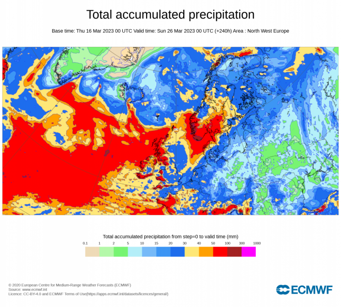
Model ensemble guidance over recent days has signalled the current unsettled conditions will continue, with more beneficial rainfall on the way for many parts, though tendency for rainfall amounts to be greatest across northern and western areas.
Total rainfall accumulation for next 10 days over NW Europe (00z ECMWF):
00z ECMWF ensemble mean shows temperatures generally above average over the next 10 days, but hints of possible colder from the 26th portending a colder end to the month?
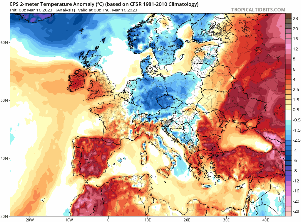
Unlike recently, it looks to be mostly mild over the next 10 days, with temperatures above average. Low pressure looks to dominate during this period, the lows and their associated frontal systems will move in off the Atlantic at times, bringing spells of rain east or northeast, interspersed by brighter but showery weather.
Cold polar air will never be too far away to the north of northern Scotland, with potential for this cold air to spread down across at least the north of Scotland but perhaps further south in the wake of low pressure systems which manage to clear east of the UK. If this cold air does move south, it will mean areas of rain moving in off the Atlantic will turn to snow over higher ground of Scotland, with a risk of frost and ice when skies clear.
But in general, away from the far north, it’s looking mild and generally frost-free the next 10 days, not overly mild, models currently indicate temperatures generally low to mid-teens, but temperatures that are still above average for the time of year. However, if lows stall out west and pressure builds to our southeast more than models anticipate, there is always potential for warmer conditions with temperatures in the high teens with sunshine, but this is not showing at the moment.
There are signs towards the end of the month of colder weather perhaps returning though, but confidence is low. This assumption is based on the persistent signal for anomalous geopotential heights at 500 hPa over Greenland, signifying high latitude blocking which maybe an imprint of the Sudden Stratospheric Warming (SSW) back in February. This morning’s 00z ECMWF ensemble mean points to anomalous positive heights / blocking over Greenland late this month perhaps connecting with a ridge building north over western Europe from a more amplified upper flow developing.
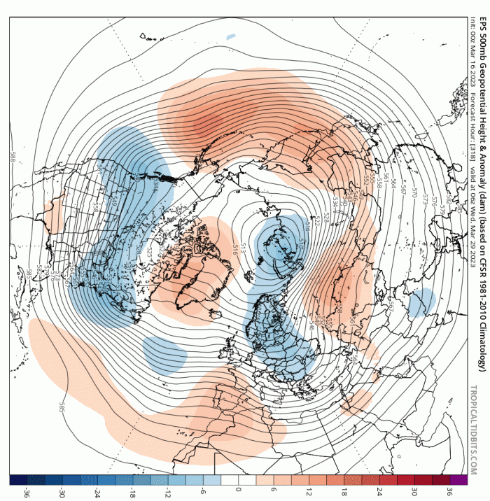
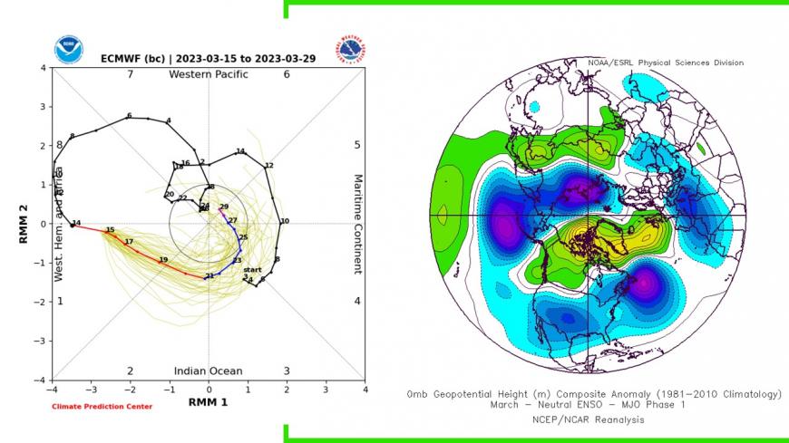
The more amplified flow perhaps the lag response to the Madden Julian Oscillation (MJO) moving at high amplitude phase 8 and 1 at the moment. The MJO wave of tropical convection in these phases over the Pacific and towards the Americas can often promote a more amplified upper flow pattern over the North Atlantic sector in the mid-latitudes after 10 days.
MJO moved into phase 1 last few days, the 10 lagged response may look something like the chart on the right, ridging to the west and northwest of the UK, thanks to a more amplified flow over N Atlantic.
So could see colder polar air return from north in the last 5 days of the month, perhaps cold enough to bring some wintriness in precipitation in the north, with a return of overnight frosts widely, though any snow mostly confined to higher ground in the north.
EC weeklies updated on Monday shows low heights / pressure near UK for rest of March, but higher heights / pressure in April
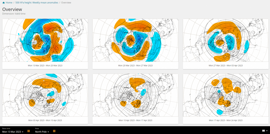
Looking further ahead into April, the ECMWF weeklies update on Monday suggests, after mostly low pressure dominated weather pattern ruling the 2nd half of March, signs of higher heights / pressure developing through the month, so the weather becoming drier and more settled, perhaps warmer too after the colder end to March and perhaps start to April.
The Netweather Spring Forecast was issued recently.
Loading recent activity...