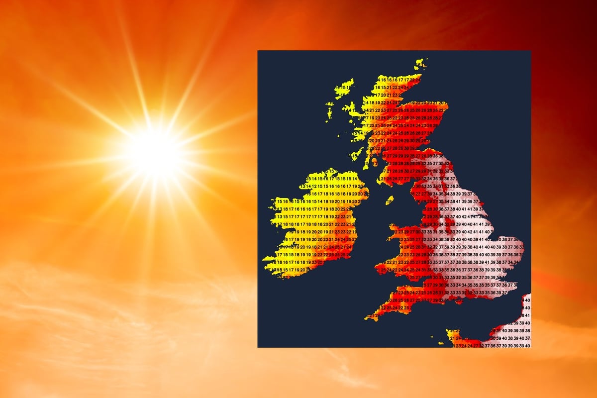
Update 1355: The 40c barrier has been broken for the first time in the UK, with Heathrow reaching 40.2c approximately an hour ago.
Temperatures rose to 38.1c yesterday, just short of the British record (38.7c) but multiple local records were broken, with Wales and Jersey also recording their highest temperatures ever. Provisionally, the UK overnight minima record has also fallen with Emley Moore not dipping below 25.9c.
Today, although cooler air is going to be edging in from the west, temperatures are set to climb even higher, with 40-42c possible in eastern England. We've started from a high base this morning, with many areas well above 20c, and even at 8am, some stations had already made it to 31c.
| Country | Highest max temperature | Highest min temperature |
|---|---|---|
| England | 38.7c | |
| Wales | ||
| Scotland | 32.9c | 20.9c |
| Northern Ireland | 31.3c | 20.6c |
With cooler air (and some thunderstorms) moving in from the west during the day today, temperatures will peak early in western regions before falling back a little during the afternoon. Further east, the all-time UK record could fall around lunchtime, with the heat continuing to build in eastern England through the afternoon. In central regions, as the cloud increases, along with the risk of some downpours, there is likely to be some easing of the heat into the mid-afternoon.
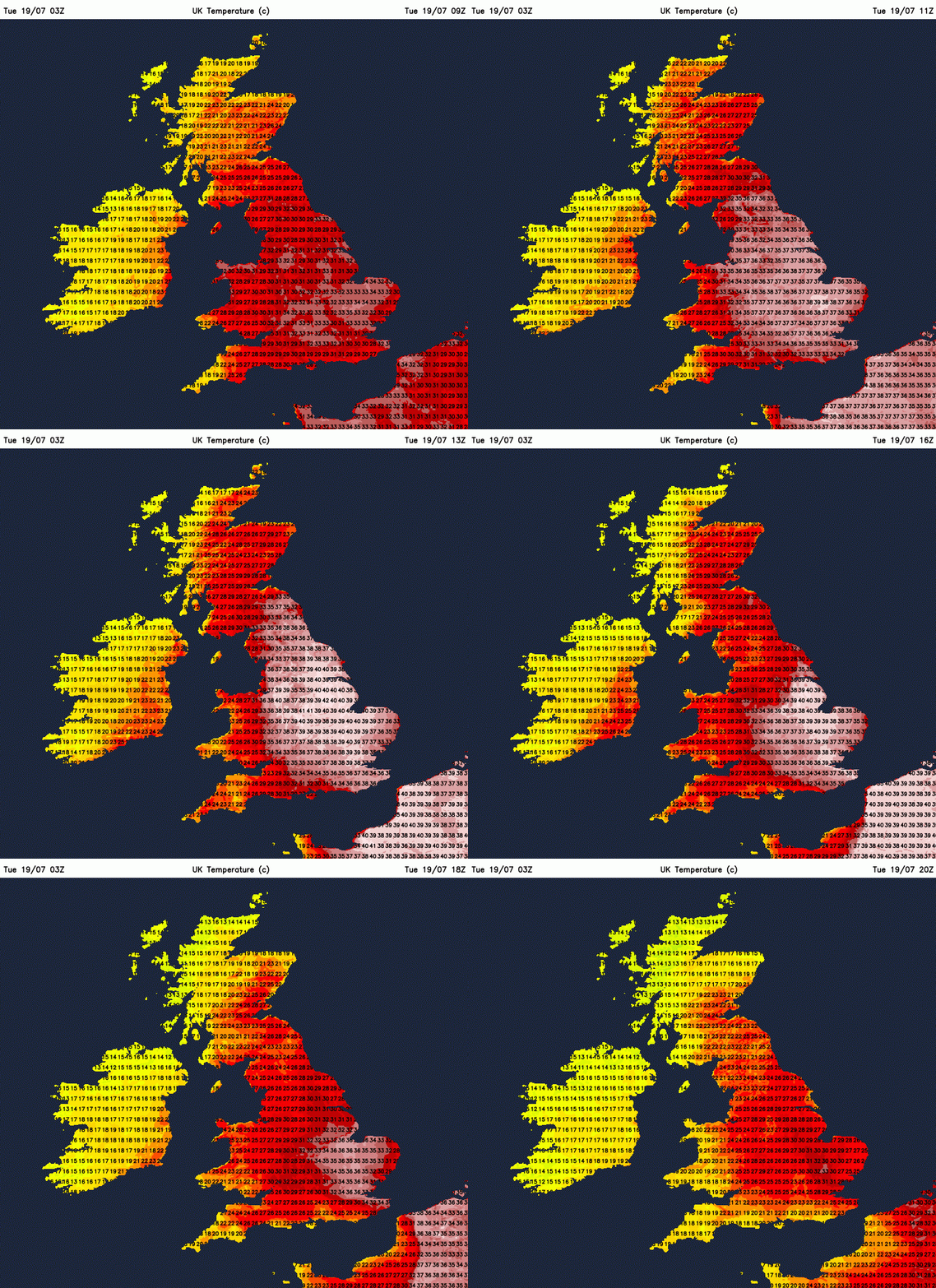
The Met Office red warning for extreme heat is still live today, so please do take precautions to protect yourself from the heat and stay well hydrated. Also, be ready for some disruption to travel and other vital services. After yesterday's heat and very little respite overnight, this is the time where heat exhaustion can become more of a factor, so do keep an eye out for symptoms of that, particularly in elderly or vulnerable people.
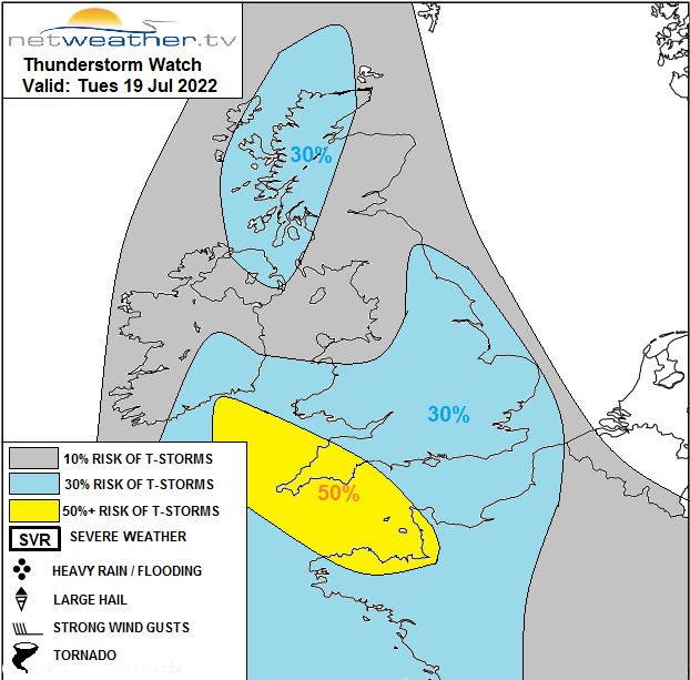
On top of the heat, we do also have the risk of thunderstorms today - they've already kicked off over Cornwall first thing today and although the threat will ebb and flow, it will spread north and east as the day wears on. A storm forecast has been issued with more details on what to expect and where.
The storm risk and slow dip in temperatures are thanks to a couple of cold fronts, one swinging up from the southwest and another larger one which will cross Ireland and into Scotland later, eventually heading across all parts tomorrow. So, with those in play, tonight isn't going to be quite as stifling as it was last night - although some parts of Eastern England and especially East Anglia will keep the hot air in situ for longer, so another tropical night with lows not dipping below 20c possible here.
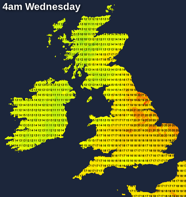
Wednesday will be a cooler day, with temperatures at least 10c down on today's maxes for many. But, even so we'll be touching into the hot category in the east of England and East Anglia with highs of 27-30c. Central England and perhaps also central and southern Scotland could reach into the mid-twenties, but elsewhere the high teens to low twenties will be more like it. It'll be a day of sunny spells and scattered thundery showers - these'll be well scattered but should you catch one it could be quite lively - especially in central, southern and eastern England.
A similar day follows on Thursday, albeit not as hot in eastern parts. Friday brings the threat of a few more showers in western parts and also the possibility of some more general thundery rain moving up into southern regions.
The GFS 18hrs has made a move towards the uninspiring ECM 12hrs run. So not great news however there is still some uncertainty with the pattern across the eastern USA which does impact the behaviour of the troughing to the west in the medium term...
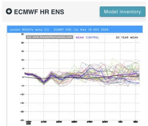
12z essembles for the south! Gfs perhaps showing something a little below average end of the month but nothing substantial at this stage! ECM AIFs no signs of anything cold! ECM maybe the coldest of them all but again nothing very cold, but...
The GFS 18hrs has made a move towards the uninspiring ECM 12hrs run. So not great news however there is still some uncertainty with the pattern across the eastern USA which does impact the behaviour of the troughing to the west in the medium term...
56 minutes ago, snowspotter said: Wow - that’s what I call a bold statement ! It's the same statements I read every single year in this forum. This timeframe holds the most interest basing on some background signals. 9 times out of 10, it turns...
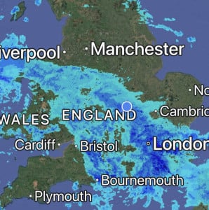
Absolutely hammering it down here, it’s so loud on the roof I can’t get to sleep 😴 Will be some big puddles in the morning, so many drains are blocked with leaves in the village 🥹
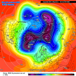
Good improvements for scandi high gefs mean