A look at what's behind the current persistent dry and settled weather, which is bringing a dry second half to April in what is a dry spring so far across much of Britain.
The second half of April continues to be dominated by blocking high pressure, bringing predominantly dry conditions across the U.K. The blocking high was initially to the northeast but over the last few days has shifted west and will continue to drift west over the weekend into early next week. The blocking high will continue to divert the jet stream and Atlantic low track to the south of Britain across southern Europe, with unsettled and cool conditions affecting France, Spain along with southern and central parts of Europe further east. To the north, high pressure bringing mostly dry and settled conditions to much of northern Europe, not just through the past week but also through this weekend and on through the last week of April.
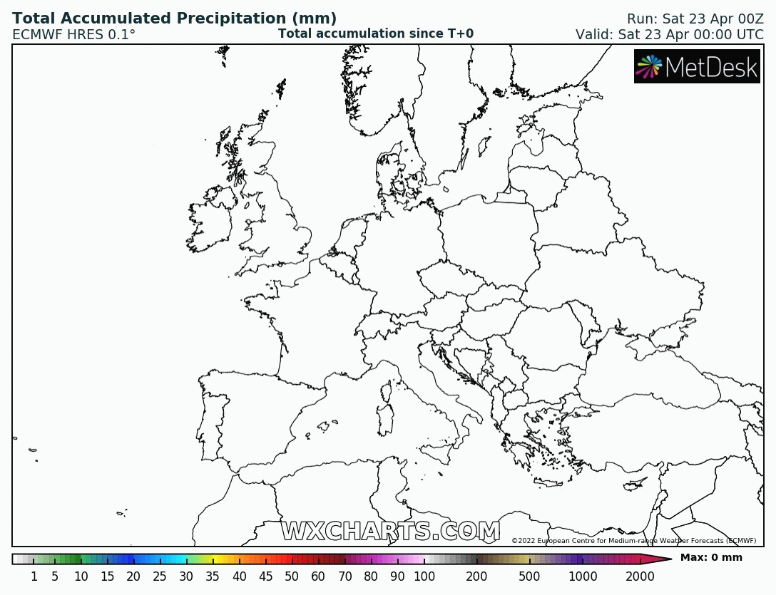
Most of the rain will be south of the UK over the next week
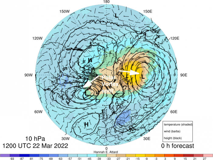
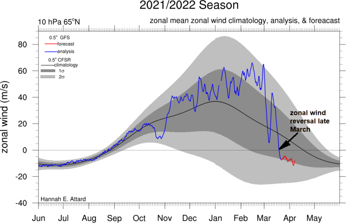
High latitude blocking high pressure that has appeared since Easter and will persist close to our north and northwest until the end of the month, bringing dry and settled weather. The northerly latitude blocking likely the result of the Sudden Stratospheric Warming and reversal of winds in the stratosphere – following the split of the Stratospheric Polar Vortex in March. Normally the reversal of westerly winds high up in the stratosphere can take a few weeks to work its way down to the troposphere - but when it does it can cause high latitude blocking as westerly winds weaken and reverse.
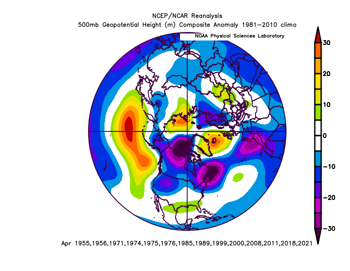
But, also, La Nina which has persisted since last year, can often lead to dry weather in April and spring as a whole – with high latitude blocking pattern in place over the far north Atlantic and northern Europe – bringing dry and settled weather. While lower heights/pressure are prevalent over southern Europe, bringing unsettled conditions here. The 500mb heights composite for Aprils during La Nina, below, shows this pattern (higher heights=yellow/orange, lower heights=blue/purple)
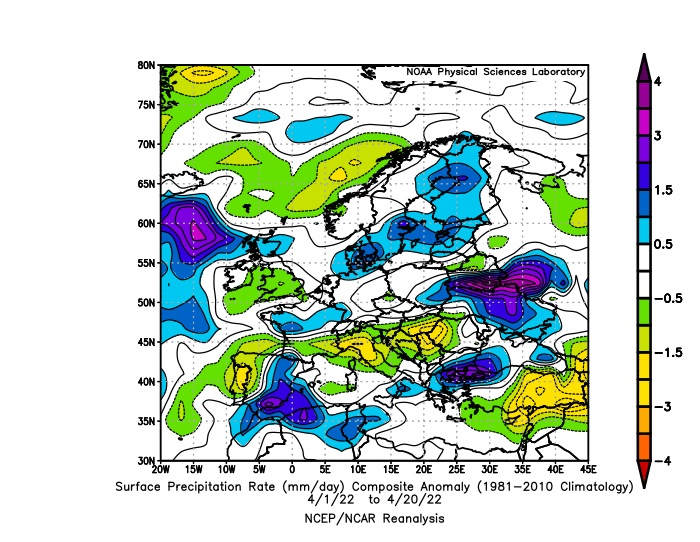
The composite anomaly chart for precipitation, below, for April so far shows much of England and Wales has been drier than 1981-2010 climatology, while parts of southern Europe have been wetter.
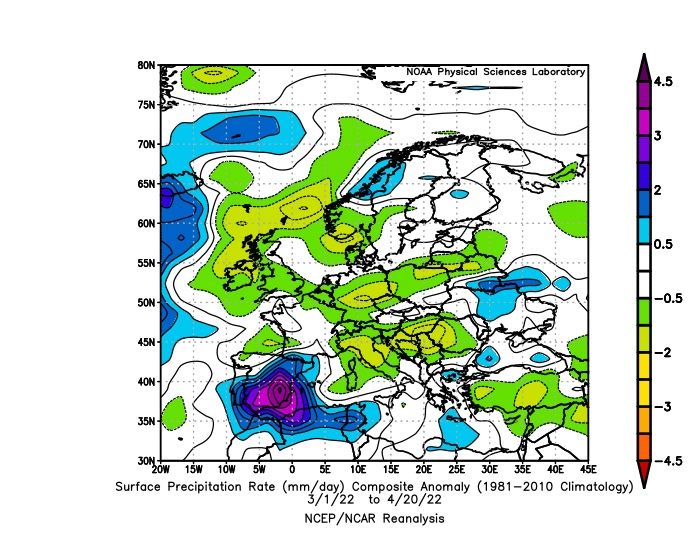
The composite chart, below, since 1st March up to 20th April, the spring so far, shows the UK has been drier than 1981-2010 climatology, while Iberia and far NW Africa been much wetter.
With high pressure to the north and low pressure to the south, the UK and Ireland will be under a brisk northeasterly wind through the weekend, bringing a cool feel out of the sun, particularly towards eastern coasts, with the North Sea surface temperatures still only 8-9C. The northeasterly will veer more northerly through next week, as the blocking high to the north drifts westwards, so it will turn cooler next week, as arctic air floods south. Temperatures will reach the mid-to-high teens this weekend where it’s sunny, highest temperatures in the west with shelter from the northerly wind. But next week highest temperatures reaching the low teens, 11-13C at best as winds turn northerly. With the cool and dry arctic air, there will even be a risk of frost in rural inland areas overnight where skies clear, so gardeners beware of putting outside tender plants.
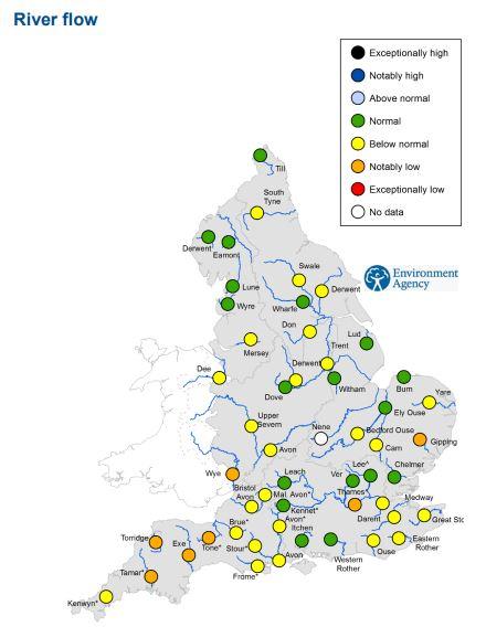
So a dry second half of April, parts of southern England have seen between just 30-40% of the average April rainfall so far, England as a whole 50% of the average rainfall so far. The England river flow map below for 13th to 19th April shows some river running below average, some notably below.
As we head into early May, the weather models hinting at the cool weather continuing, with perhaps a renewed surge of cold air from the north to start the month, looking at ensemble means, with a showery northerly flow. This perhaps eventually giving way to a more unsettled westerly regime, as high latitude blocking wanes, but a long way off. No signs of any real warmth, with temperatures in the twenties.
Loading recent activity...