January 2022 was dry with little winter rainfall. Mild in the north. It was unusually sunny, away from NW UK, with England breaking its record. High pressure dominated but with two late storms.
The January statistics have been issued by the UK Met Office (provisional) and show a dry month with record-breaking sunshine amounts for England.
Eastern Britain was especially sunny but it was dull for NW UK. Overall, it was the third sunniest January for the UK. Sunshine amounts were especially high in northeast and eastern England and Fife. It was dry across the UK. England had its ninth driest January looking at data that goes back to 1862, just 38% of its average rainfall. High pressure dominated the weather to start the year and has impacted the winter rainfall. There are signs, away from the NW of the UK, that the rainfall amounts will continue to be low into February.
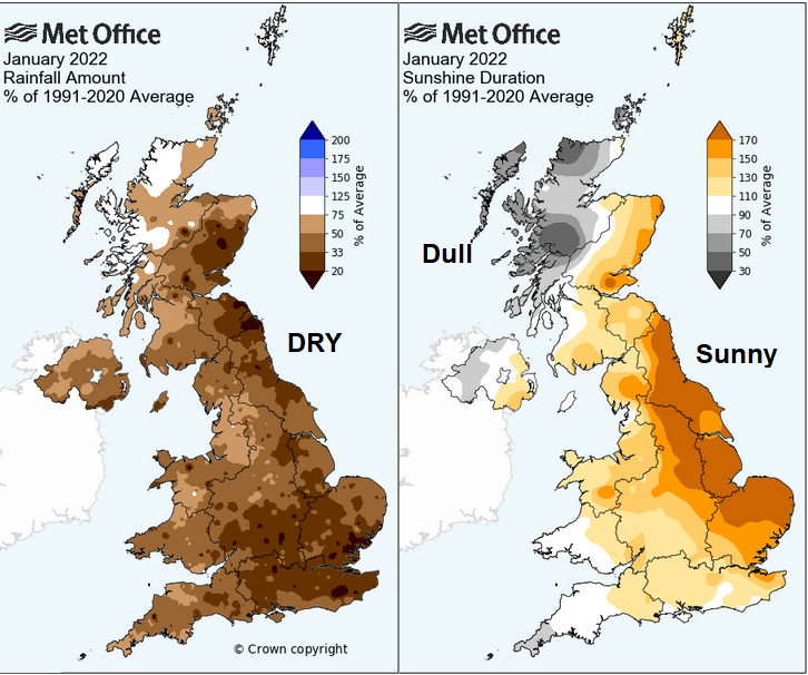
“England saw an average 80.7 hours of sunshine in January, putting it at the top of a series that dates back to 1919. East Anglia and the Midlands also saw record levels of sunshine in the month “ Met Office
Regions that broke their monthly sunshine records: North Yorkshire (88.6 hours), Derbyshire (80.3 hours), and Nottinghamshire (105.4 hours) with Notts seeing a huge 79% more than their long-term average for the month. Norfolk also exceeded its average sunshine total by 92%.
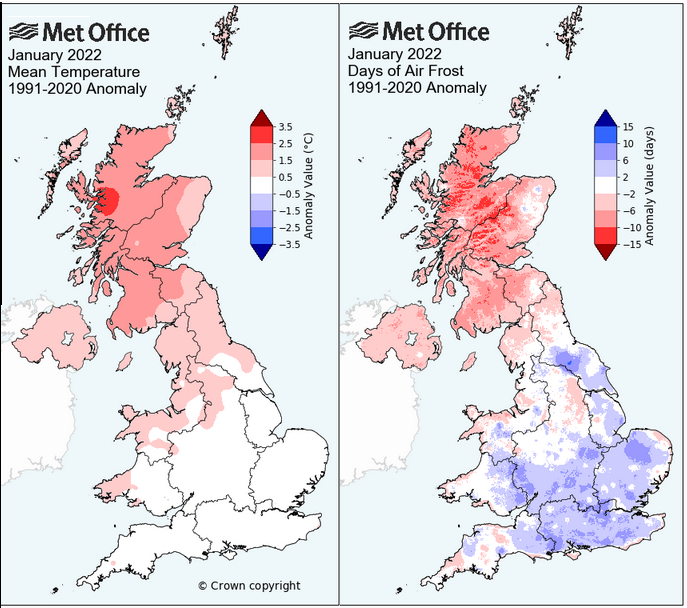
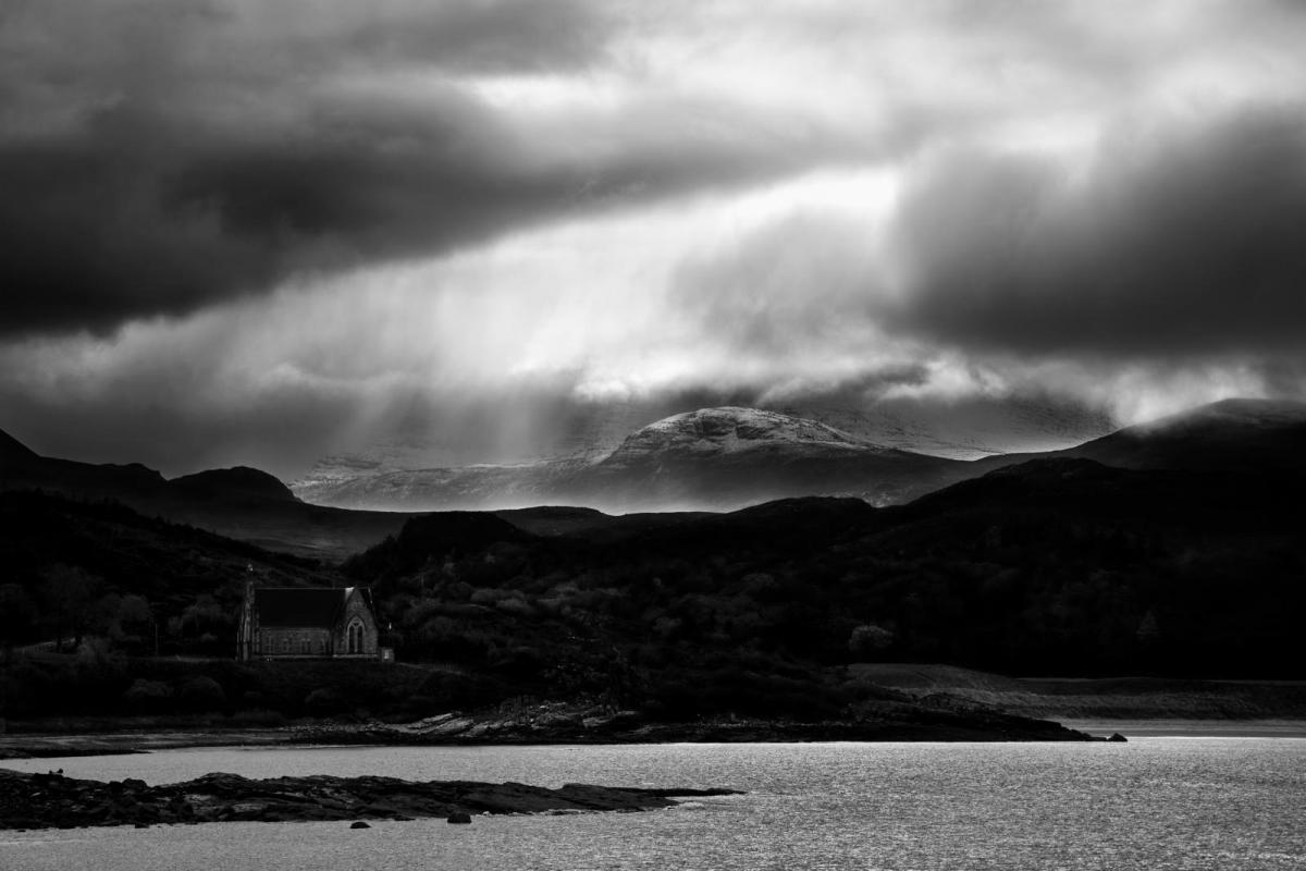
There were days of frost and fog under the stagnating anticyclonic setup. This highlighted air quality issues with Londoners being warned to "avoid strenuous physical activity on Friday (14th January) due to “very high” levels of pollution...The associated lack of air movement means emissions from vehicles and other pollutants are not blown away as they usually would be." Guardian
Two named storms affected the UK during January, both for the last weekend. Storm Malik, named by the Danish Met. Institute DMI and Storm Corrie, named by the UK Met Office. Both brought wild conditions with strong winds, high gusts up to 92mph with many trees felled, travel disruption and thousands in northern Britain with power cuts.
Overall, northern Britain and Northern Ireland were milder than average this January, very mild for NW Scotland and southern Britain around average. The days of air frost numbers show how different it was north to south. It was Scotland’s sixth warmest January on record. New Year’s Day was record-breaking for the UK with 16.3°C recorded at St James’s Park, London. For Scotland, Achnagart recorded a record high start with 15.9°C and for Wales 15.6°C at Hawarden.
The new month started on a strangely mild note. Frittenden in Kent reached 15C, Bedford 14.5C on the 1st of February. The January UK record is 18.3C.
Ireland was also dry and mild. "January was a very dry month overall with above average temperatures" The top temperature was on New Year's Day 15.0°C at Phoenix park, Co Dublin on the 1st.
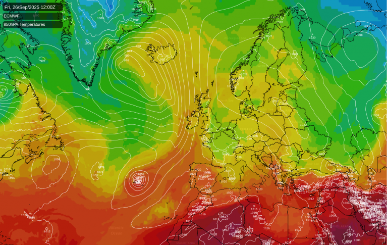
High pressure continues to lurk to the south or southwest of the UK. This does extend some influence with drier and not as windy conditions, but it isn’t the settled, still weather of January. The high pressure was over more of the UK which gave the dry weather and, seemingly, little wind for weeks. Previously, it was just the far northwest catching passing low pressures with more cloud and rain. Hence the dull conditions with low sunshine amounts. Now, with the high shifted further south we are seeing low pressure tracking across northern parts, even managing to throw their cold fronts right down to the south coast which is what will happen later on Thursday. This is leading to swings in temperature as we see changes from milder ‘tropical maritime’ air behind a mid-week warm front with more cloud to Polar maritime air behind the Thursday night cold front.
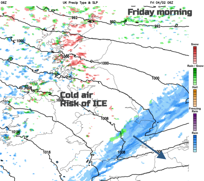
An active cold front will bring a spell of wet and windy weather across Scotland and Northern Ireland. The SW wind will pick up during Thursday with gales, even severe gales for the Western Isles by late Thursday morning. Then worth watching for the passage of the front as it will be very gusty with heavy convective rain bursts into Thursday evening. Overnight there will be hill snow along the back edge and then the risk of ice as the skies clear. Wintry showers follow with snow reaching down to low levels in the heavier bursts. Mainly for NW and western Scotland but reaching into Cumbria and Northern Ireland before dawn. Then snow showers could reach the peak District, Cambrian mountains as they extend over more of Scotland (from a NW direction) and over the Pennines. The cold front could also have left some snow on its journey south overnight for Snowdonia and the hills of northern England.
Loading recent activity...