The June weather is all over the shop. On minute heavy rain and cold then warm sunshine the next. The rollercoaster continues for the next few days although improvements from the north for next week.
There is a lot of cloud over the UK this morning with two main areas of rain. Bands stretching NE to SW. Southeast England and East Anglia stand out with sunshine and those clear skies allowed some spectacular views of the special night shining Noctilucent Clouds, only seen in the summer twilight.
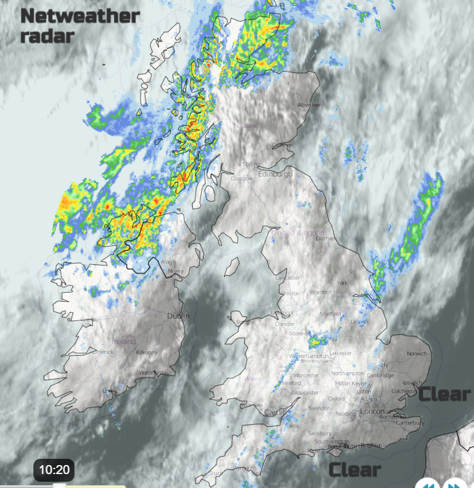
A warm front is bringing patchy rain across England and Wales along one of the bands, mostly from the Humber down to the Bristol Channel. Away to the NW is heavier rain, this is the cold front and behind this is cool air from the Arctic and brisk northerlies winds. In between in the warm sector with a slight westerly flow where the sunshine appears, temperatures will leap up. Already, there are breaks for NE England and this looks to be a favoured spot today along with Yorkshire as temperatures reach 23 or 24C.
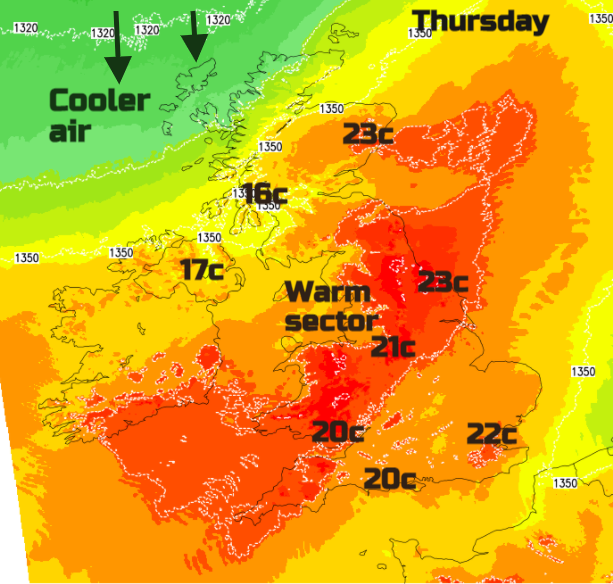
The frontal rainband in the NW will move over Northern Ireland this morning but becoming heavier this afternoon in the north and west. This rain will also affect west coast Scotland and then SW Scotland by this afternoon but be more patchy for central and eastern areas. Breaks appear in the cloud cover and again in the warm sunshine temperatures could rise in the east into the low 20s C. For the other, more showery band...
"instability combined with breeze convergence may support scattered heavy showers and isolated thunderstorms to develop, more particularly across from SW England across east Wales, Midlands and up through northern England towards the N York Moors. These heavy showers, perhaps with isolated lightning, will tend to drift further southeast across SE England and East Anglia during the evening and overnight" Convective Forecast
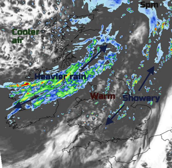
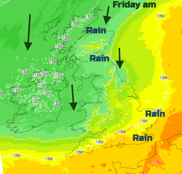
The rainband will continue its progress south-eastwards during the evening and overnight with some heavier bursts ahead of it. So, a damp start for East Anglia and southeast England for Friday. This is the clearing cold front and behind it you will feel the difference. Cool, fresh air which when combined with a brisk north wind will feel cold in places as it brings rain and murky low cloud onto exposed shores. NE and SE Scotland look to have a grim day although with big surf, shame about the wind. The low pressure centre will be slipping southwards during the day throwing showers around the Irish Sea and nearby areas. The north to NW breeze will keep the temperature down for north Wales where there will be a scattering of heavy showers also reaching NW England in the afternoon linked to the pool of cold air aloft, aiding the instability.
Another area to watch will be the far SE of England on Friday afternoon. There looks to be convective developments over Sussex and Kent with the risk of heavy downpours and even thunderstorms. This links to the clearing cold front. Temperatures will be in the high teens and low twenties across much of central and eastern England where the winds will be very light with more sunshine.
The surface low continues to edge southwards with showers swinging around the sides. Damp, cool conditions for SE Scotland then NE England even into Saturday. At the weekend there will be more rain or sharp showers over southern Britain with more change of fine, more settled weather further north. Temperatures stay in the high teens, low twenties with the potential in sunnier spells to reach 23 or 24C once more. Next week does look warmer, good news as schools in Scotland and Northern Ireland break up for summer holidays. Strong sunshine this weekend so slap on the sunscreen and watch out for the downpours as the showers pass by. The threat of heavy downpours remains for southern Britain next week as Wimbledon begins.
Noctilucent Cloud season 2021 chat in the Netweather forum