Seasonal conditions to prevail for the next week
Good afternoon- As we approach the weekend the gloomy dank conditions are set to change as developments in the jet stream of the East coast of the US allows a deepening trough in the North-west atlantic to gradually sink south-East across the country-
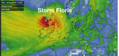
Jet stream Sunday
This transition looks to be painfully slow as the High pressure cell to the west desperatly hangs on- which is part of the reason why we dont get anything sustained- the following cold Polar air doesnt look to be as intense as initially predicted in recent runs of the american models-
The vital pressure rises over greenland will NOT occur in essence allowing a short northerly cold spell emphasised with Dry cold Wintry conditions- followed by high pressure toppling over the northern half of the country at the end of the weekend to cut of the cold feed-
The very cold air ( Sub -10c 850 HPA) looks likely to stay to the north of us as a flow of only 2 days cannot drag enough cold air south before the cut off-
Looking at current model outputs its uklikely that there will be enough of an undercut of cold air to turn the back edge of the rain to snow so for anyone hoping for some of the white stuff - realistic chances arrive with a clustering of showers / troughs late saturday and Sunday night-
The showers DONT look to be particularly heavy at the moment as there will not be enough instability in the air aloft to trigger deep cloud development-
As we move into Sunday chances of snow begin to die as a ridge topples over the country- this is demonstrated by the jet stream splitting over Sweden- with a weak arm backing to the west of the UK and one continuing into Northern Scandi-
Jet stream Sunday
The weakness of the jet stream directly to the North will allow a retrogression of the High pressure cell centred over Europe- At this stage this will be neither a particularly Cold or Mild source- as any cold air originally from the siberian high has been somewhat modified across the long track through europe-
Therefor the emphasis returns to Dry Anti-Cyclonic weather and the best of any sunshine distributed to the west and North of the country- Low Cloud & mist could plaugue the East coast pegging back temperatures- Typically recovering to between 5C and 7C during the day and patchy frost at night-
As for the outlook after that it remains questionable which way the high pressure will migrate-
The usual outcome would be a strengthening of the northern jet and a sinking of the High into Central Europe dragging up Warm southerly winds on the westrern flank-
However we have seen retrogression Northwards in the past which could send a cold pulse of air across Europe to the Uk- 1991 springs to mind-
As we can see from the chart below the jet is at its strongest to the North and if this continues there will be NO pressure retrogression northwards-
Jet stream Sunday
For this to happen the energy of the jet stream will have to flow into the southern arm- which as we have found to our cost this is the current stumbling block for any cold for the Uk-
As ever a slightly depressing prospect after the weekend but an outside chance of a colder continental flow developing towards the latter part of the week!!