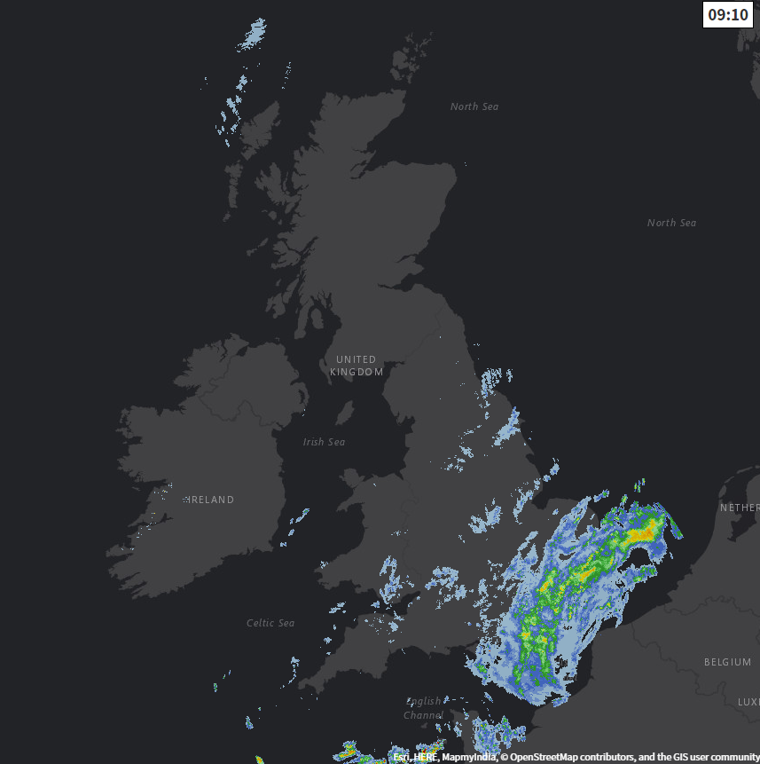
We have high pressure on the menu for a change to start the new working week but low pressure to the southeast is bringing some wet weather this morning.
We have high pressure on the menu for a change to start the new working week and as a result, England and Wales, in particular, will have a drier spell. This'll be welcome news for most, with more signs of drier but chilly weather developing next weekend.
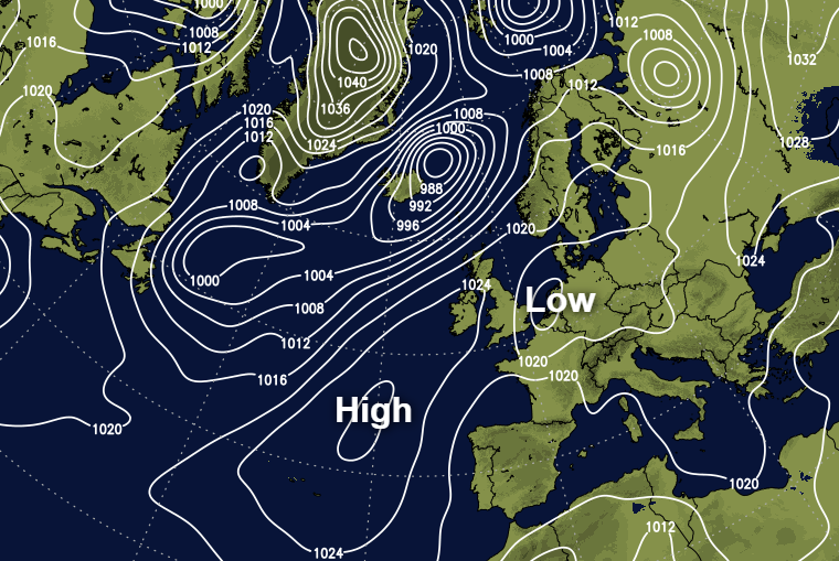
As a ridge topples over the country, many parts are finer today in light winds with some sunshine, but cloud amounts will vary. A chilly North wind is bringing a few light showers to central and eastern areas, with more persistent rain giving heavier bursts over the South East and East Anglia. This slowly clearing from the West through the afternoon. A freshening South West wind will also bring some rain to the far North West of Scotland and the Northern Isles, in an otherwise dry day across much of the country.
It'll be chilly though after an early slight frost over parts of Scotland, with top temperatures only 8 to 11C in the North and 12 to 14C further South.
Any remaining showers in eastern areas will clear after dark, to leave most of the country dry but with variable amounts of cloud. It'll soon turn chilly though especially over England and Wales, with light winds allowing a slight frost and some mist or fog patches to form later where skies clear. Temperatures will fall close to freezing in some rural areas, but where you keep cloud, you'll avoid the patchy frost and fog. Sheltered parts of Down and Armagh together with Lothian and The Borders may also have a touch of frost, but over most of Scotland and Northern Ireland cloud and a South West wind will keep it milder. There'll also be further rain at times across Highland and the Northern Isles where temperatures shouldn't fall below 7 to 9C.
Pressure remains relatively high across England and Wales on Tuesday, giving most parts another dry day. There'll be sunny spells after an early frost in places, with mist and patchy fog lifting into low cloud in some regions before finally clearing. Northern Ireland also sees sunny intervals, but cloud amounts here will vary perhaps bringing the odd shower to Tyrone and Derry later. The South and East of Scotland should also see sunny intervals, but much of Scotland will be rather cloudy with further rain at times expected towards Highland and across Orkney and Shetland.
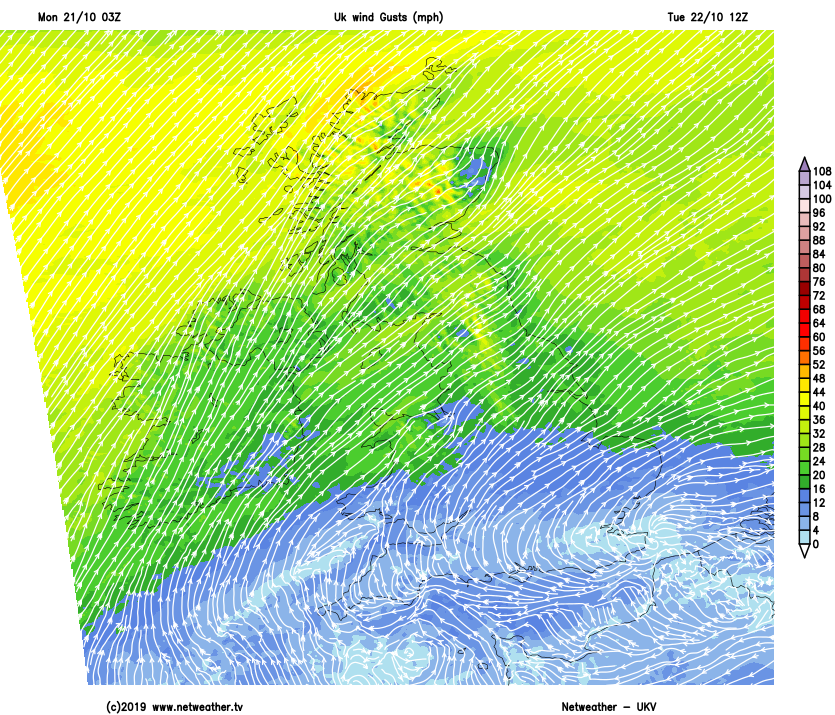
A South West wind will be blustery over the North and North West Scotland, with some strong gusts expected over exposed coasts and hills. It'll also be breezier over Northern Ireland and southern Scotland but across Wales and much of England, winds continue mostly light.
After the cold start it should feel slightly milder in most parts into the afternoon, with top temperatures 11 to 14C locally 15 or 16C in the South.
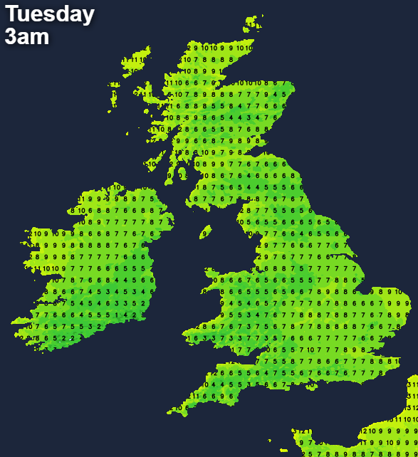
The North and West of Scotland and much of Northern Ireland stay cloudy and windy after dark with rain at times. Cumbria and the East and South of Scotland also see patchy cloud, but here it should stay. For most parts elsewhere though, it'll be a dry night again with clear spells. Light winds will allow mist and patchy fog to form again, and while a touch of grass frost is possible in the coldest spots temperatures generally shouldn't fall below 7 to 10C in the North and West and 3 to 6C in the East and South.