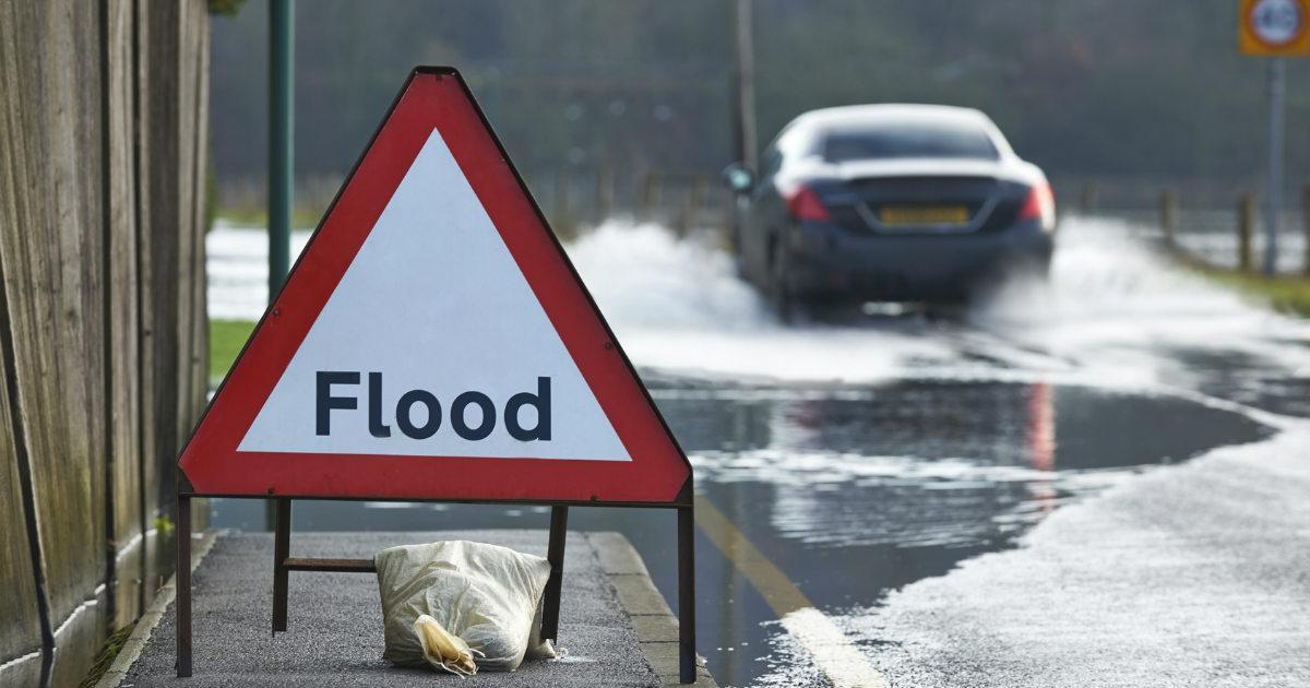
Sunshine and showers today, new Atlantic low pressure system arriving later this week will bring spells of more persistent rain into the weekend, bringing a risk of further flooding.
Crossing to other side of the world for a moment, Super Typhoon Hagibis is forecast to track north and approach Japan this weekend, possibly bringing winds equivalent to a category 3 hurricane along Japan’s eastern coast. All of mainland Japan is at risk of being hit by damaging winds, flash floods and mudslides. England and Scotland are expected to play Rugby World Cup group-stage deciders in Japan these weekend, so there is a possibility these games will be cancelled. Also it's the Formula 1 Japanese Grand Prix in Suzuku.
Across the other side of the Atlantic, parts of central U.S.A looks to see an early taste of winter arrive from the north tomorrow, with daytime temperature plunging below freezing after being in the mid-twenties today
Back home, more of an autumnal feel to the weather, as a strong jet stream running west to east from the Atlantic across the UK keeps areas of low pressure close by to the north. So the next few days will be windy and feature sunshine and showers today. Then tomorrow and Friday, a new low arriving close to the northwest will push outbreaks of rain across Britain. Wet across the south on Saturday, this rain spreading north across England, Wales and southern Scotland on Sunday. The rain will be persistent and heavy at times, so we could further problems with flooding
For now, it’s a wet morning commute for some in the west, with showers, heavy in places and merging into longer, affecting parts of SW England, Wales, NW England, the western Highlands and parts of N. Ireland. Also some heavy showers running along English Channel coasts. Mostly drier towards the east of Britain for now, with some brightness.
Through the morning and afternoon, a scattering of blustery showers will blow east, so many places not immune to catching a shower, however there will be dry and sunny spells between the showers. Showers will be most frequent and heavy across the west and also along southern coastal counties, a few getting inland further east, but eastern England and eastern Scotland seeing fewer showers with some places staying dry and sunny. Despite the strong southwesterly wind, touching gale force in the far west, it is a mild direction, so temperatures close to average, reaching 12-14C in the north, 14-15C in the south.
Remaining blustery overnight, with showers continuing across the north and west, frequent across the western Highlands, central and eastern England becoming mostly dry with lengthy clear spells developing. Fairly mild overnight, with temperatures falling to around 8-11C.
One area of low pressure pushes off to the northeast to be replaced by another area of low pressure moving in to the northwest Thursday afternoon, bringing cloud and outbreaks of rain accompanied by strong winds to the north and west of Britain during the day, a few showers running in across SW England and Wales, otherwise SE England, Midlands and East Anglia staying mostly dry and bright.
A wriggling frontal system will bring a band of cloud and rain southeastwards across England and Wales during Friday, frequent showers across the northwest, some drier and sunnier conditions in between across northern England and eastern Scotland. Temperatures reaching 12-15C across Scotland and Northern Ireland, 15-18C across England and Wales.
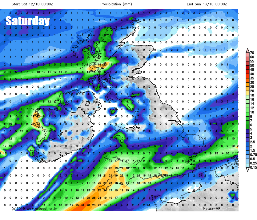
Some uncertainty over heaviness and extent of rain likely to be affecting southern areas on Saturday along a slow-moving front, but likely a cloudy and quite a wet day for southern England and south Wales, before rain edges north across England and Wales in the evening. Otherwise, away from the far south, brighter with sunny spells, but also some showers in the north and northwest.
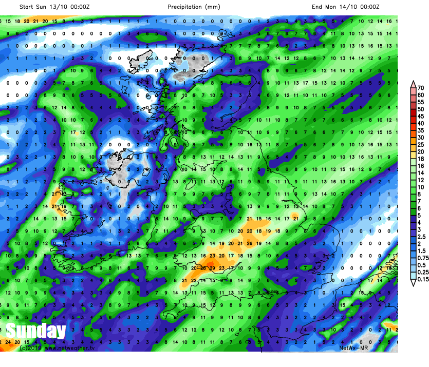
Again, some uncertainty, but outbreaks of heavy rain and strong winds look to spread north and east across many parts, followed by showers, though NW Scotland may stay dry and bright. The potential for more persistent rain this weekend could lead to further problems with flooding.