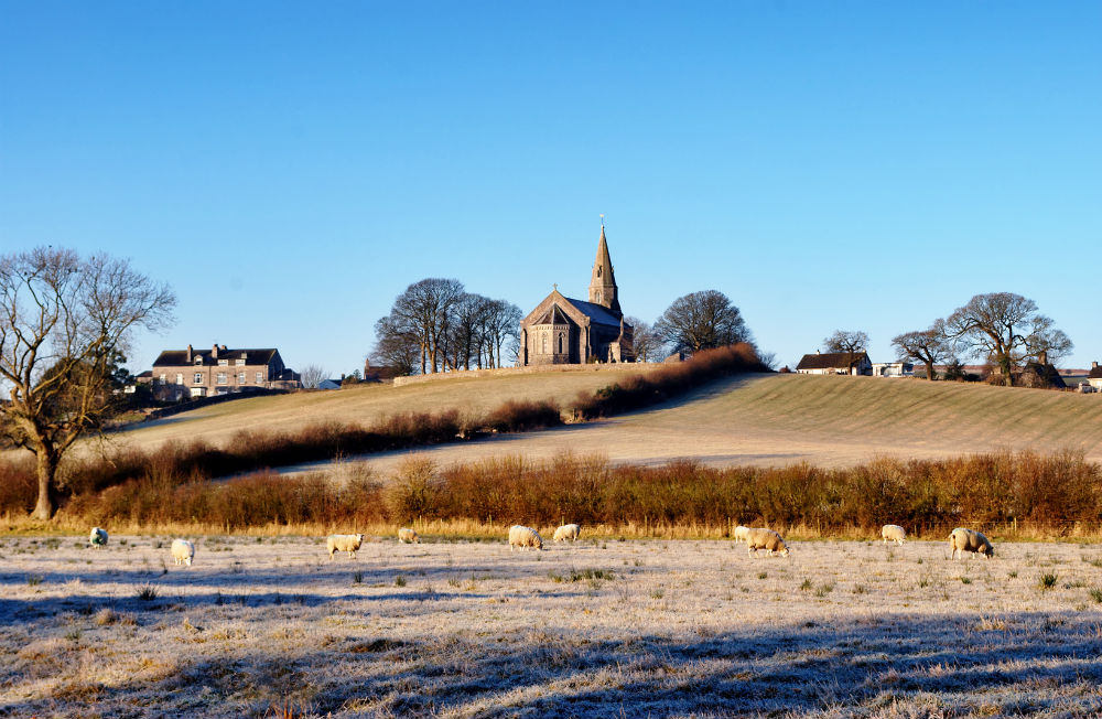
Cold air from the Arctic is working its way down the country and it will feel properly cold on Saturday in brisk norht winds with ice, frost and a few wintry showers.
A change for the rest of the week. It will be cold, feeling really cold on Saturday in the wind. There will be sunshine with sharp showers, of rain, hail, sleet and a bit of snow. There will be some ice and frost, it’s the first Arctic blast of the season. Warm clothes at the ready, those spiders will be racing inside this weekend.

Within the Netweather Radar (App or on Website) you can change the display to show precipitation type. Snow, Snow/Rain (sleet) or Hail or just rain. The inset example above is from Feb 2018 in the Beast from the East.
This morning temperatures for southern England are around 10C and for inland Scotland nearer 3C. A cold front brought a spell of rain overnight for northern Britain and Northern Ireland and is now past Wales and moving SE through the rest of England. This has introduced cold air, but even colder air will follow ready for Saturday. And there will be a fresh to strong north wind. That, you will notice!
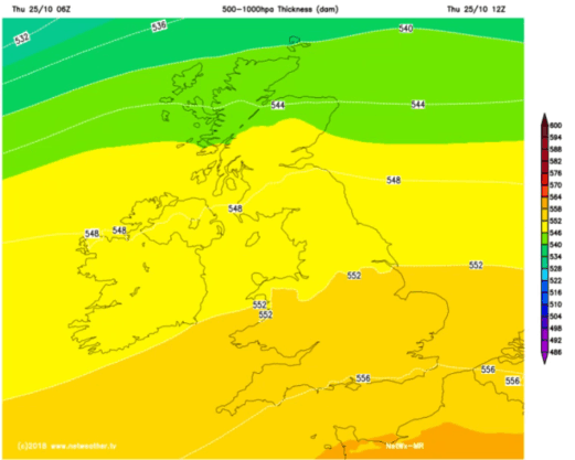
There is a low centre south of Norway heading towards Denmark. The NW to northerly flow just keeps on coming, bringing occlusions and trough lines with the hefty showers. There are not all the right ingredients for a blanket of snow just yet, but a few places might see a flurry and there will be lying snow for mountains and higher hills
The frontal band becomes lighter and more patchy as it heads towards Kent this morning. Behind that there will be sunny spells and well scattered showers. The main clusters of today’s showers feed into northern Scotland, across Northern Ireland and off the Irish Sea into Cheshire, Merseyside and Wales
The NW winds pick up this morning, with a fresh NW to N wind everywhere by lunchtime. Worth bearing in mind if you are popping out then. Air temperatures will be 7 to 11C but it will feel colder in that wind. By this afternoon some will be clipping NE England and North Yorkshire as the flow veers.

Temperatures overnight will fall down to zero. Ice will form after the daytime showers. The winds will ease off inland but there could be enough breeze to keep the frost away in Scotland. Elsewhere there is a frost risk and it will feel bitterly cold for eastern Britain where the winds keep up. Gales for NE Scotland and coastal gusts around 50mph for eastern England.
Northern Scotland will see some snow above 500m today, but sleet to lower levels this evening and overnight as the freezing level drops. Other lines of showers will graze the east coast of England and western Wales into Cornwall and west Devon. There could be hail, rain, wet snow over any hills or moors.
Saturday
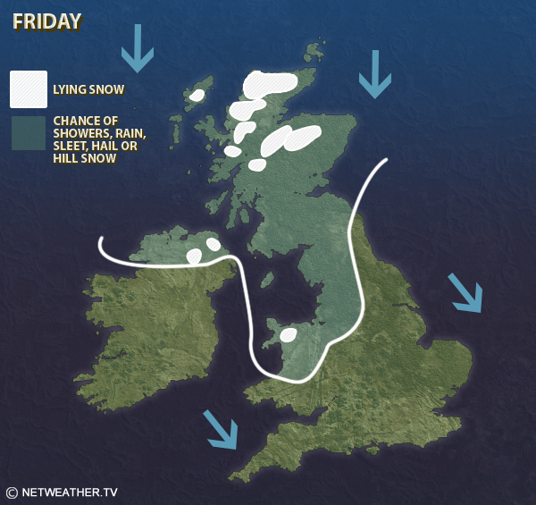
If you are standing around watching Saturday morning sports, that might be a shock to the system. Wrap up warm and get those thermals out. The winds veer more to the north and pick up again. Daytime temperatures could read as 4 to 7C but again it will feel much colder in the wind. The showers continue to feed into northern Scotland, a scattering for Northern Ireland and more clipping eastern England where there will be strong winds.
Saturday night
During Saturday night, as the winds turn to the NE, this will push the shower feeds inland, off the North Sea. Most showers remain as rain but as they reach say the eastern Pennines there could be a bit of snow. Temperatures fall below zero for western Britain and Northern Ireland quickly after dark. Further east it will be windy during the evening as a little low pressure moves into the southern North Sea. Gusty too. This feature could bring some interesting weather during the night. Gales and high gusts and perhaps hail showers across SE England. It will bring more cloud and save the temperatures over eastern and SE England but elsewhere it will be clear with lighter winds and the risk of frost. The feed of showers continues over the SE through the night into Sunday with sharp, even thundery ones. Over say the Downs there might be a spell of sleet caught in the headlights, causing a ripple of excitement or whiteness from hail.
Sunday
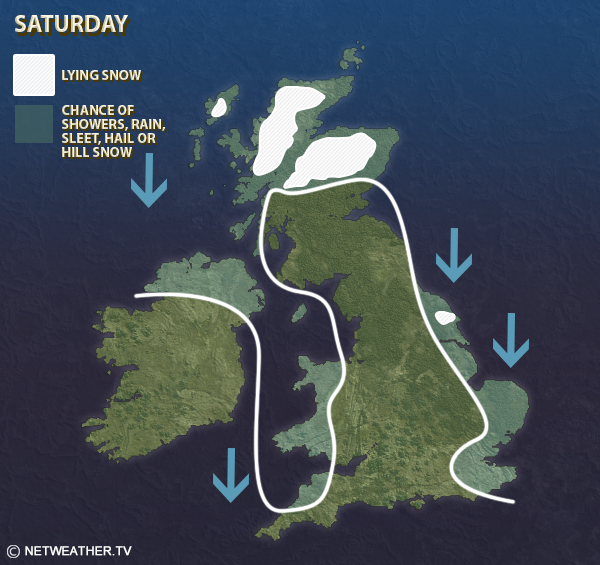
High pressure then topples in from the NW for Sunday. Many areas will be dry and bright but still nippy. A fresh NE wind will blow on Sunday morning over southern Britain at the edge of the high but even this eases by the end of the weekend. So not feeling as raw as on Saturday. There will still be showers coming in off the North Sea, mainly as rain but still a few wintry bits, flurries for Cairngorms and Cheviots. The showery feed in the southeast eases during the day.
Next week
Not as cold and the UK often sits in-between weather systems, in a col, with lighter winds. At times there will be a cool wind off the North Sea but not as chilly as this Arctic snap.