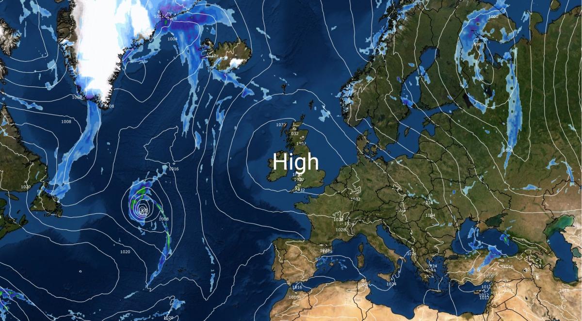
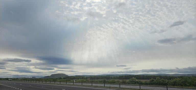
High pressure is currently on top of the British Isles, but as many of us saw yesterday, at this time of year high pressure often doesn’t necessarily mean plenty of sunshine, although it does tend to mean dry settled weather and not much wind. Most regions were cloudy yesterday, but much of eastern Scotland had a sunny day. Today so far, the brighter weather has extended southwards down the eastern side of Britain as far as Lincolnshire, but it remains cloudy in the south and west.
This is because solar heating is weaker at this time of year than in late spring and summer. It is often said that cloud “burns off” in anticyclones during the summer half-year, but really, the sun warms the lower layers of the atmosphere, causing the air temperature to rise above the dew point in the layers where clouds have formed, causing the clouds to dissipate. While this is possible at any time of the year, cloud in anticyclones is more likely to dissipate during the day if the solar heating is stronger, and thus the nearer the summer solstice we are.
Indications from forecast models suggest that more of us will probably see the sun during this weekend than on Friday, as some of the cloud over the British Isles will tend to dissipate. Sunday in particular has potential to be a sunny day for the majority of the country.
Some slight shifts in the positioning of the high are forecast to result in shifts in the cloud cover distribution into next week. With highest pressure becoming centred over north-western Britain, a slight easterly or north-easterly airflow will develop over England and Wales, and this is forecast to send plenty of cloud into England and Wales, especially the eastern half of England, off the North Sea. Meanwhile, much of Scotland and Northern Ireland will miss the North Sea cloud and so have a greater chance of seeing a fair amount of sunshine next week.
Towards next weekend, the high pressure is forecast to move to the east of Britain, bringing predominantly southerly and south-westerly winds. This will change the distribution of cloud cover again. Eastern, especially north-eastern, parts of Britain are likely to become relatively sunny in this setup, as a “cloud shadow” effect will tend to happen to the north and east of high ground. It may also turn quite sunny in the south at times if we pick up a feed of dry continental air. However, north-western Britain will turn cloudier and there may be some rain coming into the north-west off the North Atlantic towards the end of next week.
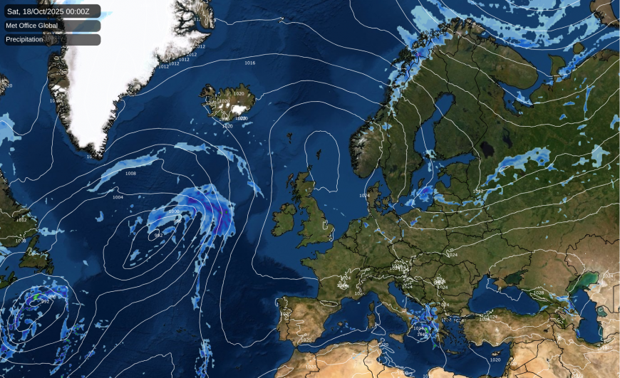
This has potential to bring about a change to more unsettled conditions, as the high pressure could move far away enough eastwards to allow low pressure systems to head in off the North Atlantic. But a recurring theme in 2025 has been the forecast models being too quick to break down anticyclonic spells. There were numerous occasions during the spring in particular when a regime shift to unsettled and wet weather with low pressure was widely predicted by the models, and in the event we got just a few days of low pressure and then the high pressure swiftly returned. There were suggestions that the wet start to September 2025 might signal a shift towards generally wetter weather, but after around the 20th September, once again we moved into a much drier, quieter regime, with a few interruptions, notably Storm Amy last Friday/Saturday which evolved from remnants of tropical hurricane Humberto.
The high pressure around Britain will be serving as a “blocker” which will keep sending any ex-tropical storms away from the British Isles, most likely well to the north of Scotland, or possibly deflecting them south towards Spain and Portugal. So far we are yet to see a tropical hurricane retain hurricane status as it reaches the British Isles, although Storm Ophelia on 16 October 2017 (coincidentally, on the 30th anniversary of the destructive storm that hit the south-east in 1987) came close, only transitioning into an extratropical depression 11 hours before it hit Ireland. Much of England missed the strongest winds, and in England the event was generally most memorable for an unusual orange sky that was triggered by a mix of Saharan dust and wildfire smoke that were sent northwards on the eastern flank of the low.
But it has been known on rare occasions for tropical hurricanes to hit south-western Europe before they transition into extratropical lows. The most recent was Subtropical Storm Alpha, which hit Portugal on 17-19 September 2020 and was the first recorded instance of a subtropical cyclone hitting mainland Portugal. The general consensus is that as sea surface temperatures rise, we will probably see tropical and subtropical cyclones, including hurricanes, extend further north as time goes on, so they may become more frequent in south-western Europe in the coming decades, but the climate would probably have to warm considerably for any to reach the British Isles without first transitioning into extratropical lows.
Loading recent activity...