Plenty of fine weather for the SE and getting warmer. Wind and rain further north Saturday night and then watching ex-Helene for Tuesday. Heavy rain, gales and heat all possible for the UK next week.
Lots going on with the weather, here in the UK and around the world. If you have rain this morning, the day should improve, slowly. Chilly tonight then a fine day for Britain on Saturday but turning wet and windy for Ireland during the afternoon. Not that nice as the wind and rain move across the northern half of UK Saturday night but everything eases down through Sunday.
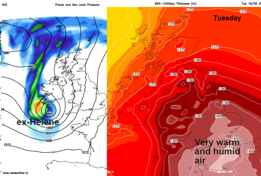
Next week we’ll be watching the progress of what once was Hurricane Helene. Not US #Florence. By Tuesday this will be a post-tropical storm but could still bring a spell of very wet weather with gales if it moves over the UK. Also sucking up some very warm and humid tropical air, so high 20sC on the cards.
Today
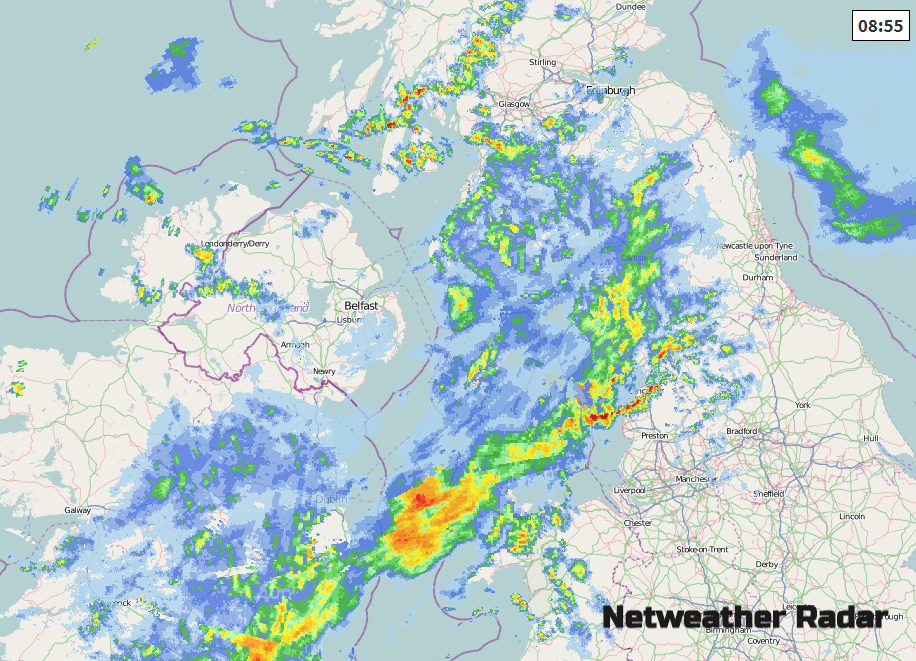
We have two frontal bands working their way SE today, with cooler air in the far north. The heaviest rain this morning has been around the Irish Sea. This band fades through the day but there will be more patchy rain for Wales, NW England, the north Midlands into Lincolnshire. Another band of cloud and more showery rain moves over Northern Ireland, southern Scotland and just into the far north of England. In between all these, there will be brighter skies, sunny spells and blustery showers for western areas. There will be a moderate to fresh westerly wind keeping it feeling cool and temperatures of 13 to 19C.
Tonight
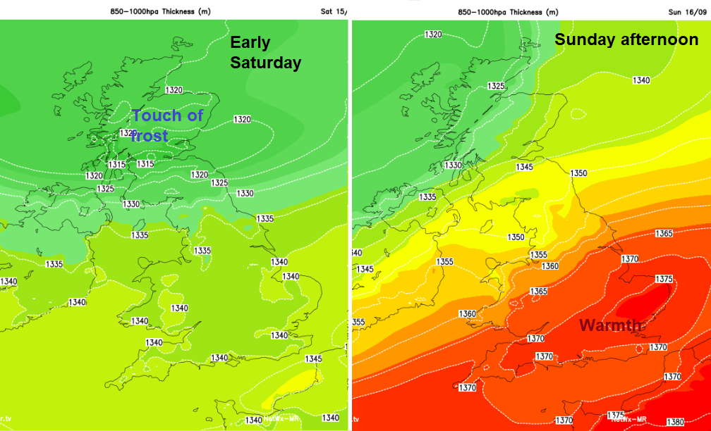
The weather settles down and most of the showers disappear, just a few blown into western counties. It will turn chilly with a touch of frost for inland and NE Scotland with the clearest skies. The winds also ease off. This is the coolest air for the weekend, it will become much warmer especially in the south by Sunday
Saturday
Saturday morning looks fine with the bright weather lasting over central and eastern Britain. There will be a cool start but with lighter winds and some sunshine, it will seem okay. Cloud begins to increase from the west and then frontal rain moves over Northern Ireland by the afternoon. That rain really gathers itself over Ireland and Scotland by Saturday evening with fresh to strong southerly winds.
Saturday night looks a bit wild with wind and rain through the Irish Sea and across Scotland and by morning there could still be a trailing cold front across the UK, probably Wales into northern England with blustery SW winds. Through all of this SE Britain will stay dry and fine up to 24C
Monday sees pressure rising and a lot of fine, sunny weather, feeling a bit warmer with rain skirting the far west and NW.
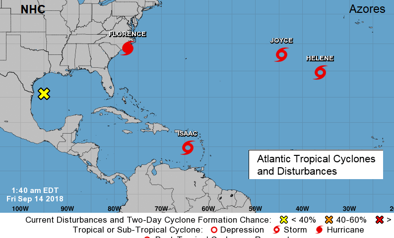
Tropical Cyclones
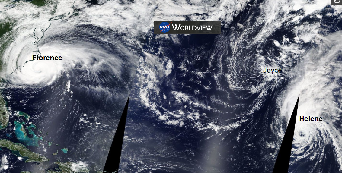
Hurricane Florence is now affecting the east coast of the US with
LIFE-THREATENING STORM SURGE AND HURRICANE-FORCE WINDS OCCURRING ALONG THE NORTH CAROLINA COAST... CATASTROPHIC FRESHWATER FLOODING EXPECTED OVER PORTIONS OF NORTH AND SOUTH CAROLINA -NHC
Typhoon Mangkhut, aka Typhoon Ompong will hit Luzon, north Philippines tonight (Saturday local time)
Winds of greater than 121 kph up to 170 kph may be expected in at least 18 hours. Many coconut trees may be broken or destroyed. Almost all banana plants may be downed and a large number of trees may be uprooted. Rice and corn crops may suffer heavy losses. Majority of all nipa and cogon houses may be unroofed or destroyed and there may be considerable damage to structures of light to medium construction. PAGASA
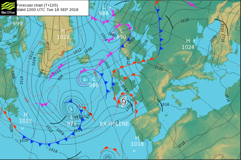
What forecasters in the UK are watching is Helene. This was a hurricane in the mid-Atlantic and is moving towards the Azores this weekend. As it moves over the cooler waters further north it will undergo changes, move into its post-tropical phase or maybe just get mixed up into other Atlantic systems and its remnants then head our way. It does look like the tropical energy will result in heavy rain and gales but there are variations in the path and timings, so if this stormy weather will reach the UK or miss. Tuesday looks most likely, but the forecast could still change.
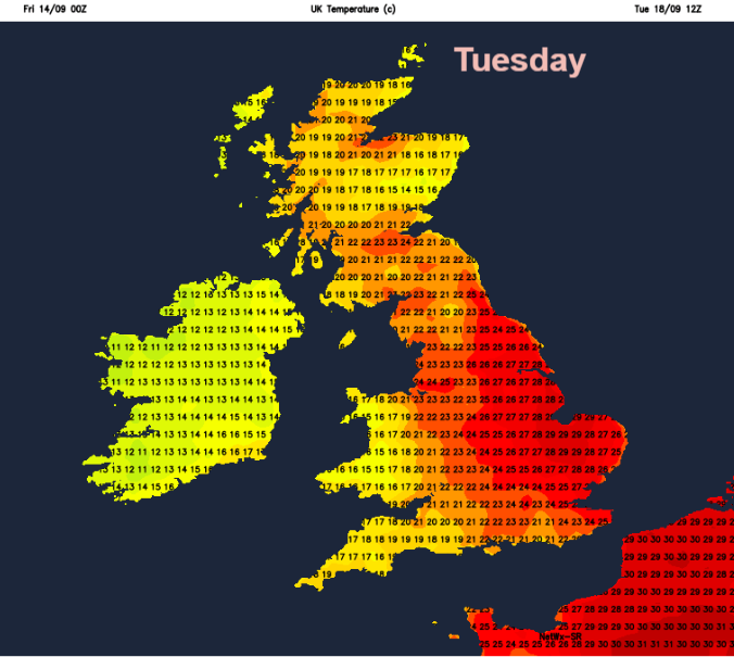
Along with the potentially wet and windy weather, there could be some real heat, very warm and humid air drawn up ahead of the system with temperatures up into the high 20sC. Don’t put away your summer clothes just yet.