It was chilly last night in the NE with a frost. As we move into autumn there will be more nippy nights but we still have warmth to come this weekend and sunshine. Settled for next week too.
All is dry and settled this morning if rather chilly or misty in places. During the weekend there are a few interruptions from cloud and rain bands, but high pressure takes over again next week to bring a longer steady spell. It will be much warmer at the weekend particularly for England and Wales.
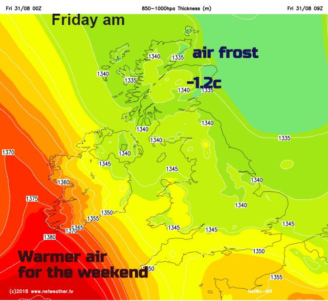
Temperatures have dipped down to near freezing in Scotland and northern England, -1.3C in Braemar, so frost in places, yes frost. But staying in double figures for the south of England.
Friday looks dry and bright with plenty of sunshine. There will be increasing cloud over Northern Ireland the first signs of a weather front heading in, but the patchy rain shouldn’t arrive over CO Fermanagh and Co Tyrone until Friday evening so staying fine by day. Across Britain, there will be sunshine and just a small chance of a shower for the Home Counties this afternoon.
England and inland Wales will have a cooler night with clear skies but milder for Northern Ireland and Scotland with more cloud.
For Saturday there will be early rain for Northern Ireland, which moves over Scotland, Isle of Man, Anglesey and Cumbria. Northern and western UK will have more cloud and feel cooler but with light winds. Ahead of the front in the sunshine, there will be a light/moderate south wind and temperatures into the low 20s C so more fine weather. The cloud and damp weather will spread over Cornwall and Devon during the day and a bit more of western Wales.
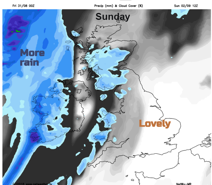
A milder night Saturday into Sunday with a southerly breeze. Again, much of England and Wales is in for a fine day with warm sunshine, along with north-eastern/eastern Scotland. Warmer air will flow up through the UK but another set of fronts heads in from the Atlantic, bringing more cloud and outbreaks of rain.
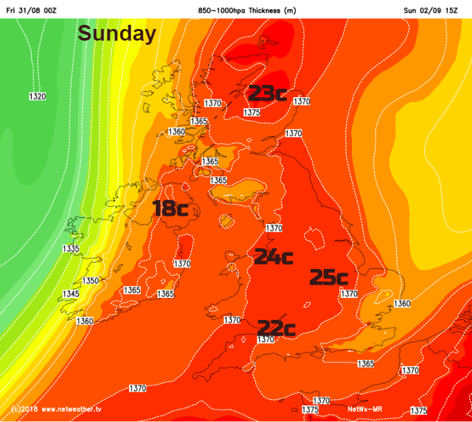
It turns much cooler during Sunday night for Northern Ireland and Scotland as the cold front sinks south-eastwards through the UK. It does then get rather stuck, so the warmth remains in the SE with temperatures still up into the twenties C but behind the waving front, it will feel much fresher and out of the sunshine, distinctly cool.
That is the theme for next week as high pressure takes hold. Cooler air for most with the warmer, more humid air not far away from the south coast of Britain. The Channel Islands will heat up as the week progresses. There will be more cool nights during the week with frosts in the north. September the first marks the start of meteorological autumn and it’s back to school for more children.