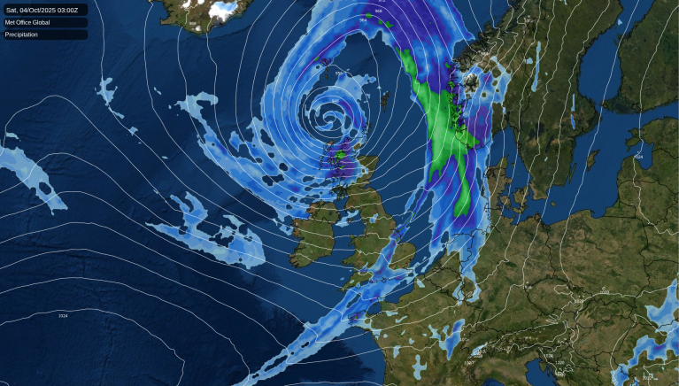
The Met Office named Storm Amy on Wednesday, and it's has been more potent than many expected. Scotland has been most strongly affected. A gust to 96mph has been recorded at Tiree in the Western Isles of Scotland, it is estimated that 62,000 people are without power. Various train services have been disrupted or cancelled, and part of Glasgow city centre has been closed when a derelict building collapsed.
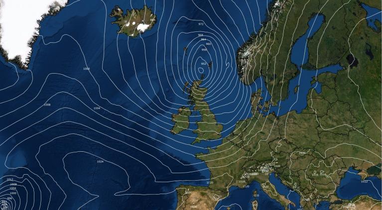
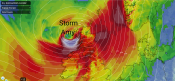
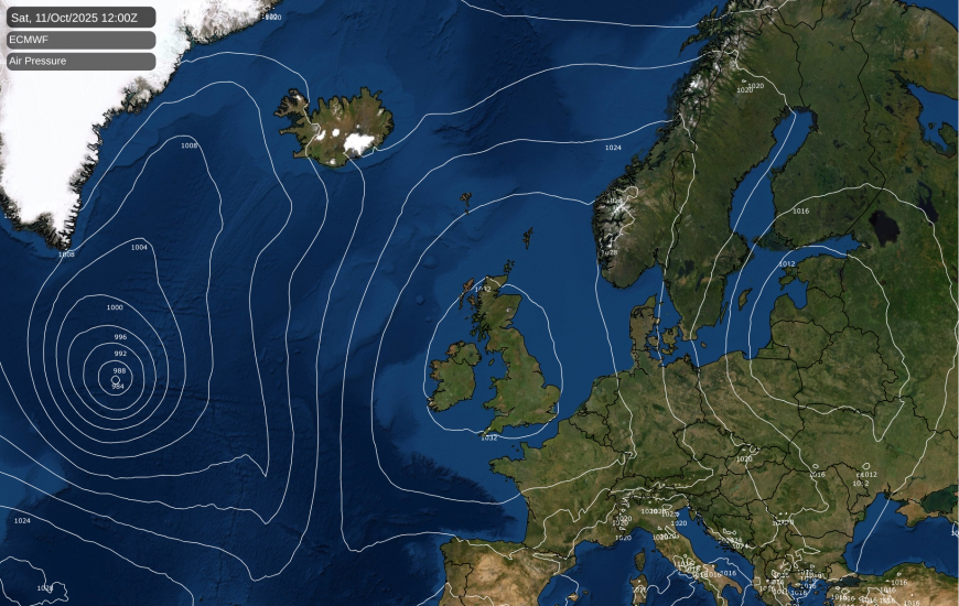
In my last update I mentioned Hurricane Humberto having potential to send remnants our way. In the event, another hurricane, Imelda, entered the North Atlantic in very close proximity to Humberto, and while they both transitioned into extratropical depressions as they headed east through the North Atlantic, their interaction helped to produce Storm Amy. The depression that has been named Amy was relatively shallow as it headed into the eastern North Atlantic, but quickly deepened through Thursday and Friday as it approached north-western Britain. It has set a new record for the lowest pressure recorded over the British Isles in October, with a measurement of 947.9hPa beating the previous record of 950.9hPa in October 1988.
The weather will remain windy over the weekend with a mix of sunshine and blustery showers for most of the country, with the showers generally heaviest and most frequent in the west. But the winds will ease on Sunday, and showers will become isolated, as high pressure will start to push in from the south-west.
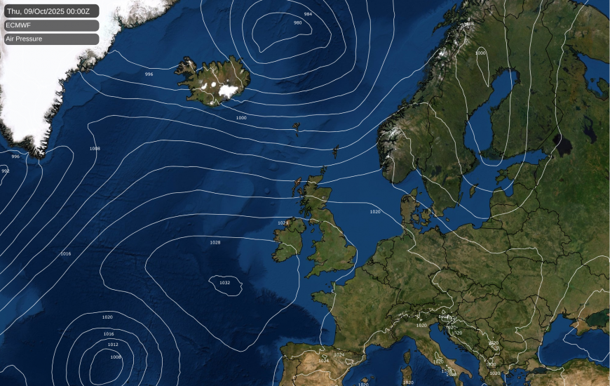
Storm Amy will likely be an unsettled blip for much of the country, as the longer term outlook has high pressure pushing northwards. During much of next week, there will be a northwest-southeast split, with westerly and south-westerly winds affecting northern Britain and bringing cloud and rain into the north-west. The south will be affected by the high pressure, and so the south and especially south-east of Britain will be predominantly dry.
But by next weekend, it looks probable that high pressure will dominate across the whole of the British Isles, bringing the generally dry, settled conditions into the north-west of Britain as well. At this time of year, the sun is often not strong enough to shift banks of low cloud, so it is probable that sunshine amounts will be variable, with some days being sunny and dry and others being predominantly cloudy.
A depression containing remnants of Hurricane Imelda will be crossing the North Atlantic during the next few days, but due to the high pressure building over the south and south-east, it will take a more northerly track than Storm Amy as it approaches the British Isles, and it is also not forecast to deepen as it approaches north-western Britain. Thus, this depression is looking set to bring an ordinary band of cloud and rain and moderate winds to north-western Britain, and towards the south-east it may well not have any substantial impact on the weather.
September 2025 was the first month since January 2025 not to have temperatures substantially above the 1991-2020 long-term normal. Temperatures were overall very close to the long-term average, a bit above average in the east but near or slightly below in the west. It was a wet September in most parts of the country, but slightly drier than average in parts of northern Scotland and eastern and south-eastern England. Despite the rain, it was quite a sunny month in northern and eastern Scotland and eastern England, but sunshine was near or rather below normal in most western counties.
The month also had a marked step-change around the 20th, from generally unsettled weather in the first two-thirds, and some strong winds around midmonth, to a generally quiet, rather cold pattern for the last third of the month. The first half was also quite thundery across much of England.
Averaged globally, September 2025 is looking set to come in as the third warmest September on record, quite close to 2024 but cooler than September 2023. Global temperatures have generally been running below those of 2023 and 2024 in recent months, but still higher than any previous year in the instrumental records. There are invariably local variations around the global average. For example, both spring and summer 2025 were the warmest on record for the UK, but averaged globally, although they were warm, they were not record warm. At the other end of the spectrum, January 2025 was a colder than average month for the UK, while averaged globally it was a record warm January.
Loading recent activity...