A fine summer's day but with rain in the west later. Temperatures will rise for SE UK later this week, just into the 30sC. Red Planet, Mars is very close to Earth tonight, some clear skies.
It’s another day with that SW wind. For London and SE Britain, the winds will be light, very light for Essex and Suffolk. It will be more blustery this morning for Scotland with a fresh SW then southerly wind for Northern Ireland and around the Irish Sea.
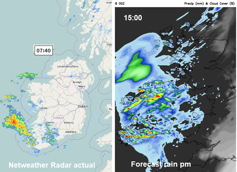
There is a mostly dry start across the UK. There are bands of thicker cloud and some of these, in western Britain are bringing a little light rain or dampness. Away over SW Ireland there is rain, the first signs of the next weather system moving in off the Atlantic which will bring a wet afternoon to Northern Ireland, NW Wales, SW Scotland and the Isle of Man.
It will be worth looking for Mars tonight. It was prominent during the lunar eclipse, last Friday, as it is currently close to Earth but this evening it the at its closest point since 2003 and won't be this close again for a couple of hundred years. Worth a look for the red planet, although there will be cloud about. Even areas in the north and west could see some gaps to the lee of high ground in the SW wind.
It does still look like it will be hotter for southern Britain at the weekend. Temperatures will widely be into the mid/high twenties with a few spots nudging into the low thirties. Currently not any more than that so quite not as hot as the end of last week when the UK reached 35.3c
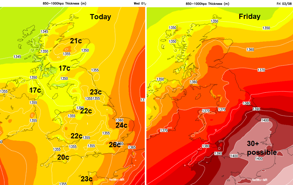
A jumble of fronts make their way across the UK during Thursday and Friday. If you divided the UK in half NW to SE, then the SE half would stay drier with more sunshine and the rising temperatures and the NW half is more prone to cloud, outbreaks of rain (especially in the west) and a fresher feel although still with strong sunny spells (mostly in the east). Temperatures in the NW half will be high teens to low twenties, so feeling fine but with more mixed weather.
Friday will feel noticeably hotter and more humid for southeast England and East Anglia. Southern England stays hot for Saturday and then the heat will start to build over SW Britain on Sunday lasting into the new week. High pressure is building for the weekend so there will be a lot of fine, bright and dry weather with strong sunshine and light winds. Keep slapping on that sunscreen.
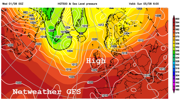
Monday looks warmer for more of the UK and hot on Tuesday for Britain as frontal changes appear over Ireland. That’s a far way off so we’ll see how that western transformation develops.
Iberian Heat- Into the 40s C for Spain and Portugal