How was the heat last night, could you sleep? The cold front has worked its way over Wales and northern England now into the West Midlands and SW England, so it doesn’t feel as humid and muggy here with a comfortable night for Northern Ireland and Scotland down to 11C. Ahead of the front it is still gruesome with overnight mins in the mid to high teens and air like a swamp.
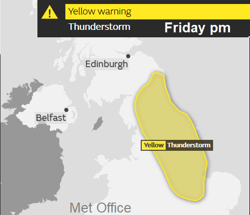
The front is weak now with not much cloud and much of the UK has a fine, bright start with just some high cloud. Away to the far NW there is rain this morning and more cloud, dampening the Outer Hebrides. This is the first signs of an Atlantic system which will bring rain and blustery winds to the far west but will gradually work its way across the UK for the end of the working week bringing thunderstorms. So that’s not a band of rain for everyone, it will be cells and clusters of heavy downpours potentially drenching some areas but missing others. It will be Radar watching time when they do begin to bubble up. The Met Office does have a Yellow warning for the thunderstorm risk on Friday afternoon and overnight.
Today looks fine and warm, again hot for SE Britain. It’s dry with light winds. Temperatures up to about 32C in the muggy areas, spanning the twenties C elsewhere.
By Thursday the frontal band will bring freshening southerly winds to Northern Ireland and parts of Scotland as the rain grazes western Ireland. Ahead of that there are signs that hefty showers and thunderstorms could break out over eastern Britain, Cumbria and the Southern Uplands. This threat is through the afternoon and evening with more storms perhaps appearing across the English Channel on Thursday night. The rain band will move over Northern Ireland later in the evening.
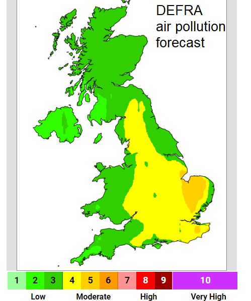
Thursday looks very hot, up into the mid-thirties possible for the Midlands and SE Britain. Even with a bit more of a breeze to mix up the air, pollution levels will be rising.
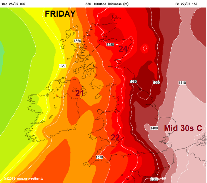
Friday could be even hotter still with 36 to 38C being mentioned. The UK record is 38.5C, July 36.7C. The frontal band staggers across the Irish sea bringing cloud and patchy rain to western Britain early on Friday with a S to SW wind. Another occluding front will head in from the Atlantic brining another spell of rain over Ireland, but it is ahead of both areas that could see significant rain. Thunderstorms are expected over eastern England on Friday bringing the risk of hail, frequent lightning, gusty winds and sudden flooding, on fields, pavements and roads. Within the downpours conditions on the roads will be horrible. If you do catch one of these storms it will be such a change from the recent drought conditions. The Yellow area highlighted on the Met Office warning is most at risk, but other parts of central and eastern Britain could be affected and as always, many parts of the yellow warning area will miss out.
This thundery episode and the extreme heat last through Friday, finally shifting on Friday night, as the storms move off into the North Sea along with the hottest and most humid air.
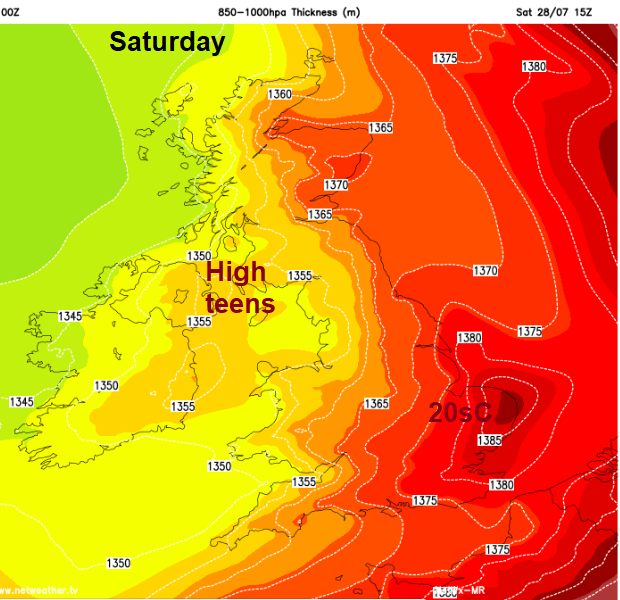
The weekend will feel fresher but still very warm for England. There will be more sunshine but also showers moving in from the Atlantic and perhaps a longer spell of rain from the SW on Sunday. So not as settled, not as intensely hot but still a good amount of fine weather. Saturday seeing more showers over Northern England and Sunday drier in SE but unsettled elsewhere.
After easing off with the extreme heat over the weekend and for the start of the new week, there are signs that temperatures could rise once more, up into the thirties over parts of England. So, if you are travelling or off camping this weekend there could be slight respite but it’s not over yet.
On 11/11/2026 at 16:17, damianslaw said: Yes shades of Nov 2024 perhaps in the offing. Very dry first half cancelled out by a wet second half. An unusual combo as Nov is normally consistently wet. Am I correct in remembering that the only...
1 hour ago, Paul H said: It was 30°C at 1 a.m. here on a couple of nights in June this year. Good grief... I considered it hot in Greece when I saw a 28C reading at 11pm !
The ICON 12 hrs run is an improvement at T120 hrs both upstream and the high to the ne is aligned more favourably. It’s now ground to a halt at T135 hrs !
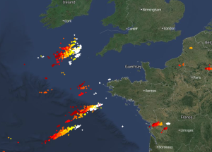
Thundery system headed over actually igniting to the south , hopefully lasts as it hits us tonight Doesn't feel likely but I can always hope :)
1 hour ago, Dark Horse said: It's not just the weather that's gloomy so is the general mood in the model thread haha. A good 12z and 18 runs and it'll be jumping in there 😆 I've no idea why so many people in there get so emotional and are...
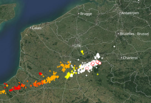
21 hours ago, Kent Storms said: Popping off now at the France/Belgium border, can anyone on the SE coast see it? I was out 'chasing' last night, Mainly Leonids but also stormage but ended up with nothing! 🤣 I was out anyway doing a mate a favour...