Stay in, cancel things, close the door, stay warm. Do not venture out in SW Britain this evening and overnight (unless you are an emergency worker)
Most of the UK is now covered by severe weather warnings. The most intense cold air has now passed over the UK in the middle of the week, but the bitter cold wind-chill remains thanks to the strong easterly winds. The Beast from the East continues to bite. Scotland had its first Red warning for Snow since the new Met Office warning system started in 2011 and much of northern Britain and parts of Northern Ireland remains under an Amber warning.
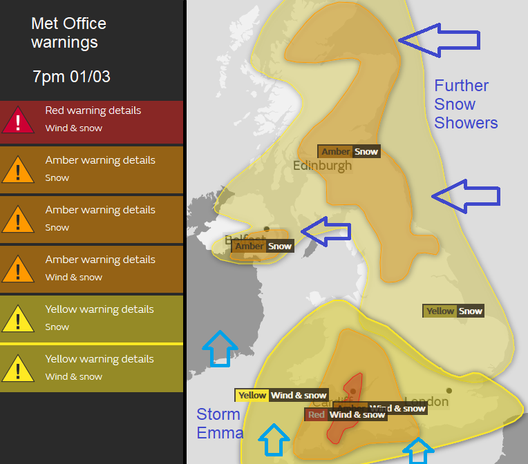
Added to that we now have Storm Emma in the mix, a low pressure moving up from the south. Another Red warning is in place for Snow and Wind over inland SW England and parts of SE Wales.
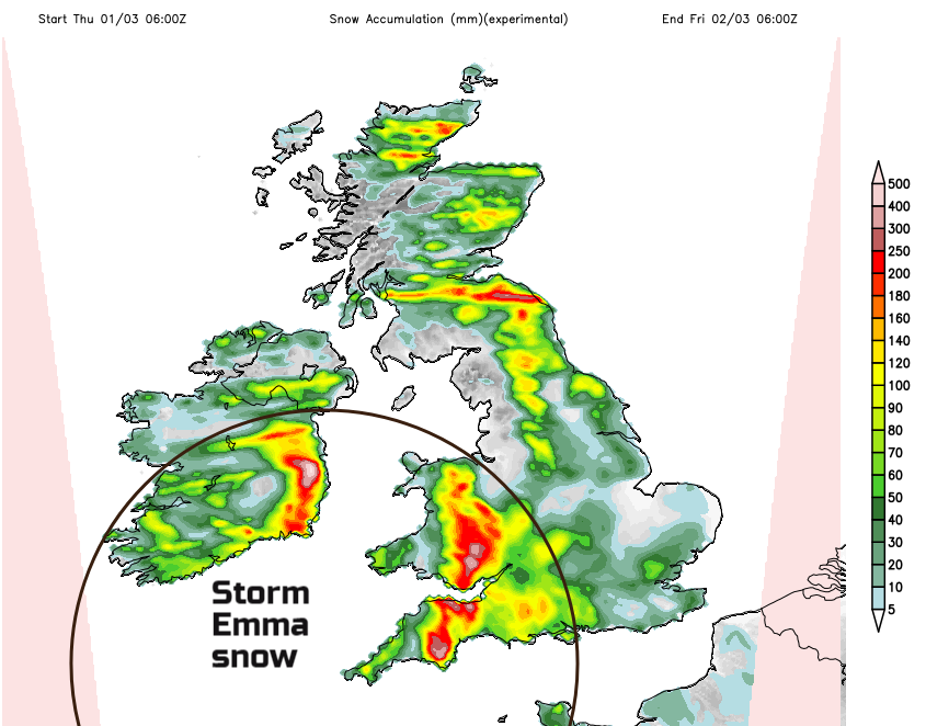
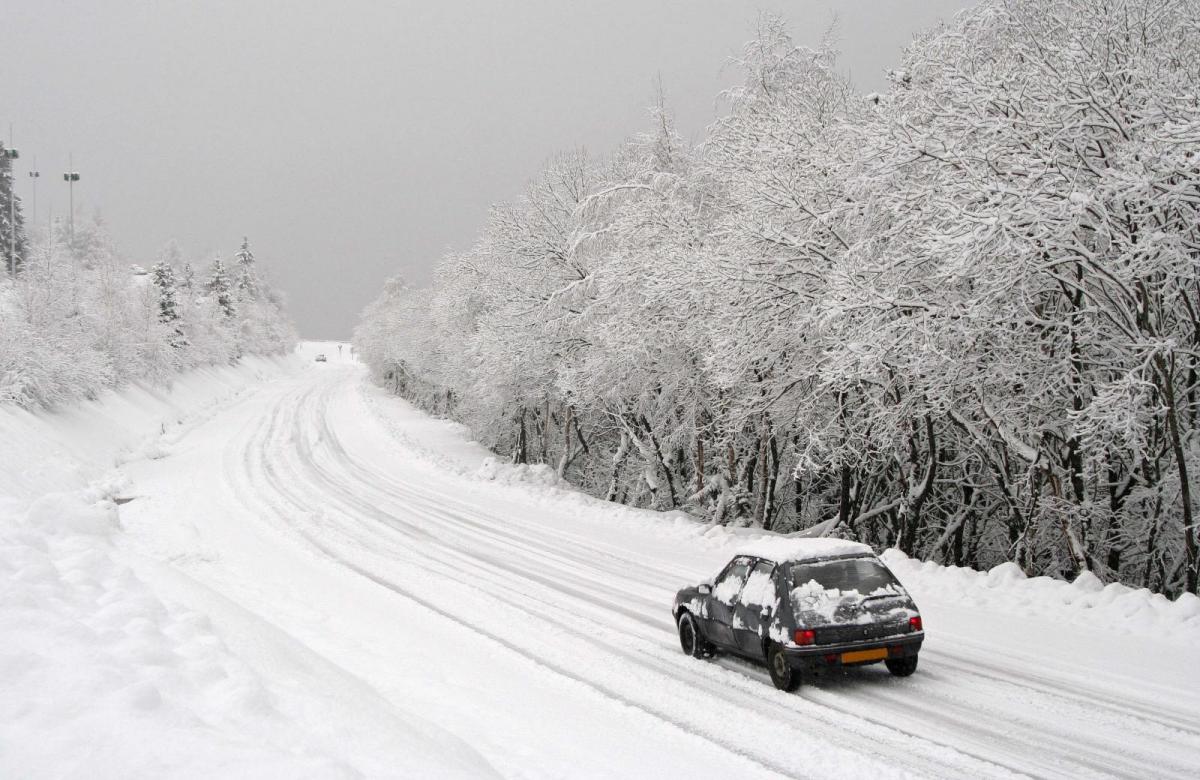
Heavy snow is forecast, from a frontal band moving over SW Britain and central southern England, so Cornwall across to Hampshire, the West Country and up into Wales. This is different to the feed of snow showers which other areas have seen over recent days. This will be a widespread snow risk as the band moves up from the Channel. Significant snow will fall, particularly over the Moors and cause drifting, blizzard and at times whiteout conditions. The wind chill will be perishing This is why there is a Red warning, to Take Action, as in go home, send employees home, don’t go out again.
Red Met Office warning: Extreme weather is expected, you should take action now to keep yourself / others safe from weather impact. Widespread damage, travel and power disruption and risk to life is likely. You must avoid dangerous areas and follow advice of emergency services and local authorities.
Over the moors, 30 even 50cm of snow is possible, that would be 20”. Elsewhere 5- 20cm is expected quite widely. Even within the Amber area, there is still severe weather.
Experiencing that will be enough of a winter blast, but the forecast is quite complicated as this low pressure interacting with the unusually cold air, forcing milder air towards the south coast of Britain.
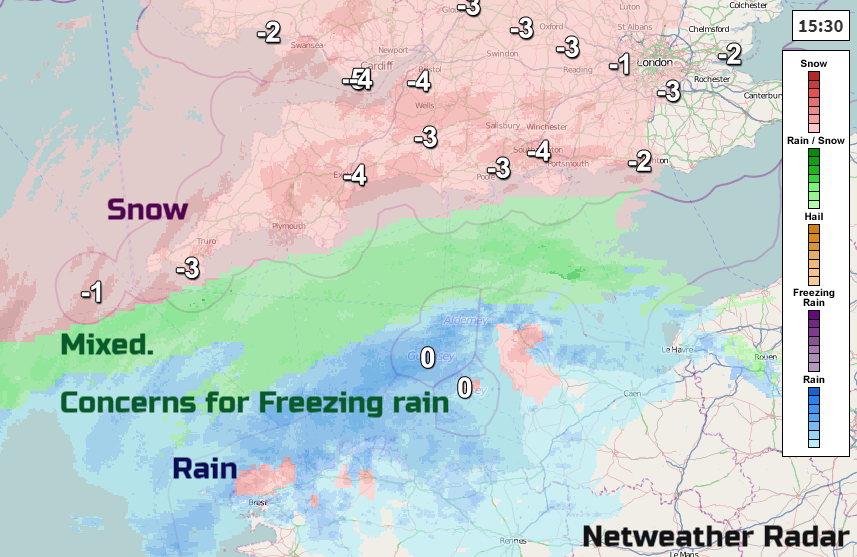
When will it turn to rain? That change from pure snow to a mix of rain and snow (sleet) and then to rain it tricky anyway to pin point. Also added into this situation is the possibility of freezing rain, a nasty precipitation which causes treacherous conditions very quickly. It is very difficult to forecast as small variations in temperatures mean you can get rain, sleet, it all stays as snow or freezing rain occurs. It usually falls in a narrow band, so Snowfall first then sleet, then freezing rain and finally rain as the warm front approaches.
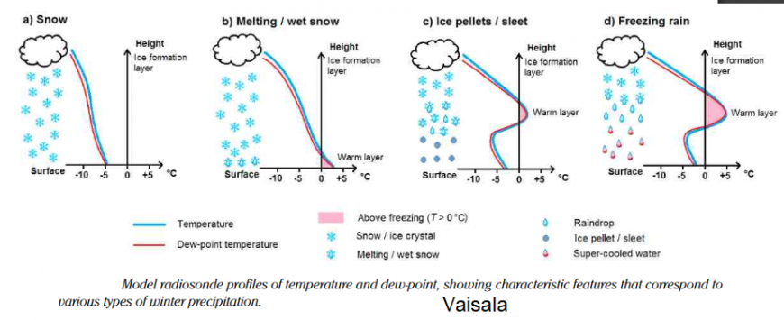
Essentially snow falls and can turn to rain if there is milder air near the surface. If the air is all cold, it stays as snow. Sometimes, when the land is very cold, snow falls and encounters a nose of warm air above the surface and melts early. It then falls into the shallow cold layer, becomes supercooled liquid, hits cold surfaces like roads, runways and powerlines and freezes instantly. It will weigh down cables and it is a lethal surface to move on, even more dangerous as forecasting it is precarious and tricky.
This can lead to power supply cuts, find your candles and a torch now. The worst of this should have passed later on Friday although further snow is likely. There is a gradual easing of the intense cold for the far south by the weekend but for the north, it stays bitter with even more snow showers.
Loading recent activity...