It may be mild now, but it's increasingly likely that much colder weather is on the way from midweek.
There's no getting away from it in weather circles at the moment, the talk of the town is the recent SSW. It's thrown the cat amongst the pigeons, and it's looking increasingly likely that we're in for a very cold end to winter and start to spring.
After our recent spell of model mayhem, caused by the SSW, things are starting to settle down a bit in that respect. But, there's still volatility, and each model and update is bringing a different version of events. So, although the odds are tipping in favour of the 'beast from the east' waking up and giving us a blast, it's still not nailed on. The current modelling is suggesting, that after a milder end to the weekend and start to next week, the first cooldown will be from the northwest. From midweek, we need to start looking east as the first wave of cold arrives. But, it's the weekend and next week that the much colder air is currently expected to arrive.
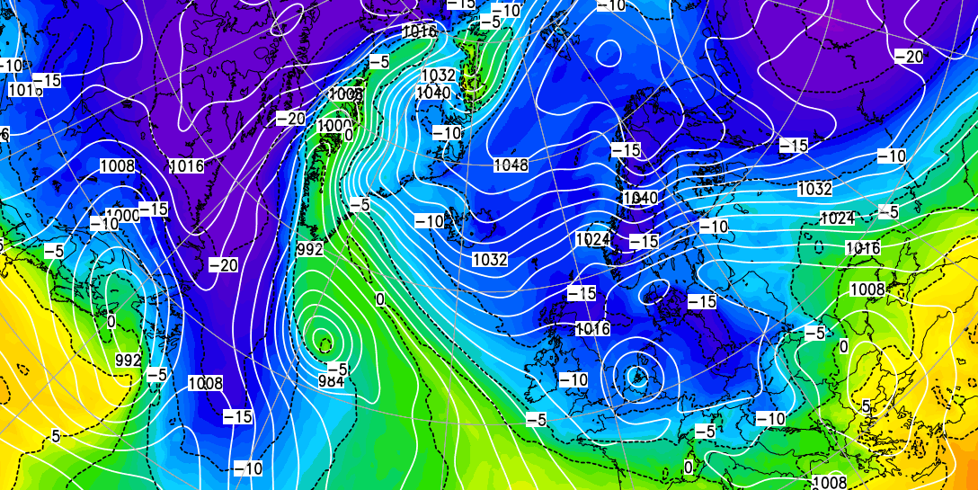
Here's one take on it from the GFS this morning:
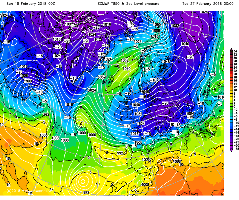
Another model, ECMWF has a different way of getting there, but by next week has very cold air across the whole of the UK and Ireland.
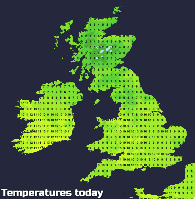
 Jumping back in time to today, it's quite a different picture. We have a southerly flow of air, bringing milder temperatures across the whole country. Even Scotland, which saw a colder start to the weekend and yet more snow showers in the highlands, will get a breather from that today.
Just because it's mild, doesn't mean it's especially spring-like or sunny out there though, as we have a lot of cloud across the country. Best places for sunshine will be the southeast corner and also the north of Scotland. There's also some rain about - mostly across Ireland to start the day, but some patchy outbreaks will spread further east as the day wears on, with some showers likely to pop up ahead of it, over the Pennines in particular. Temperatures will reach 8-12c for a good part of England, Wales and Ireland. 6-9c for Scotland and Northern Ireland.
Overnight, those bits and pieces of rain continue to move east into Britain, so a cloudy, murky night on the way, with just the southeast corner perhaps keeping clearer skies long enough for an early touch of ground frost.
Monday then continues in a similar vein - loads of cloud and murk, drizzly, patchy rain coming and going but mild. The cloud and clag will slowly clear from the west though, so maybe a few brighter or sunnier spots in the southwest at least by the end of the day. Further north, a weather front will be arriving, bringing some further rain, and eventually re-introducing some colder, clearer air behind it, for the northern half of the UK at least.
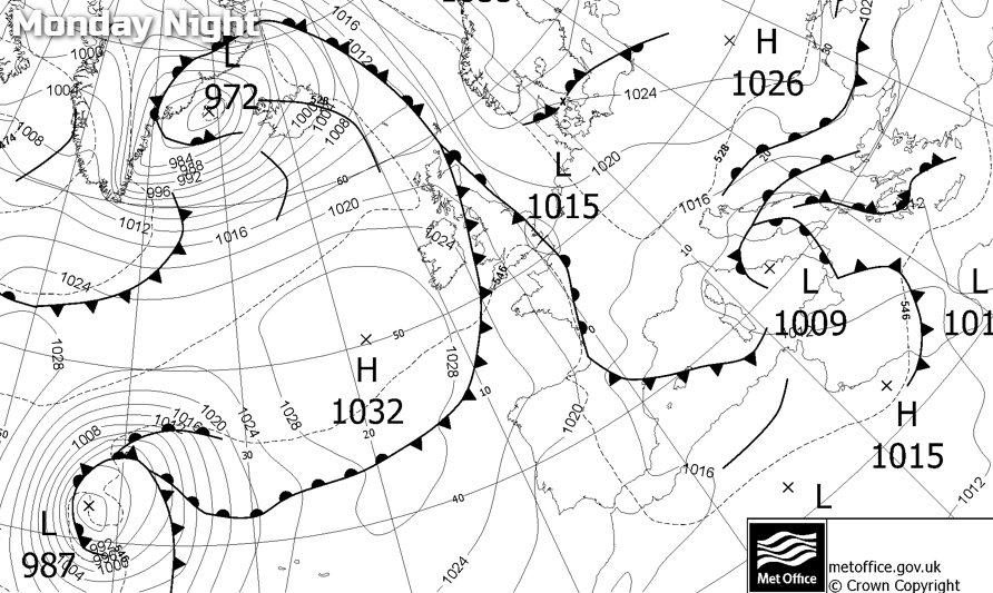
The process continues Monday night, but the front is going to struggle to make too much progress southeast, as high pressure begins to move up from the southwest, turning winds more into the east and stalling its progress. That'll mean Tuesday is likely to keep a good amount of cloud and murk across central and eastern parts of England especially. Further west it may be brighter though, and into Scotland, there'll be colder, clearer weather with some wintry showers in the north.
It's from here on in, as the high pressure drifts ever further northeast that we start to draw in those easterly winds. There's some uncertainty as to the details at this point. Some models keep a decent nose of high pressure over the UK for longer, keeping the easterly winds lighter. One or two others take that nose further northeast and bring a stronger easterly quite soon after midweek, for a time at least. This would increase the chance of wintry showers in the east, but the most likely outcome is the more settled option up until the weekend or early next week at least. That means lots of dry and often sunny weather, with widespread overnight frosts, and just a relatively limited shower risk in eastern regions.
So, lots to keep an eye on and talk about - if you want to get involved head over to the Netweather community, where there are a number of discussions on the go about this potential for an SSW induced cold spell.