The next named storm has been announced, #StormCaroline, for gales across Scotland on Thursday. As that ends the UK will become cold with an ice risk and snow showers for some.
As midweek turns very windy, #StormCaroline has been named by the UK Met Office with Scotland on Thursday being most at risk from gale force winds. Then colder conditions will bring snow showers and ice to some parts of the UK in a chilly NW wind.
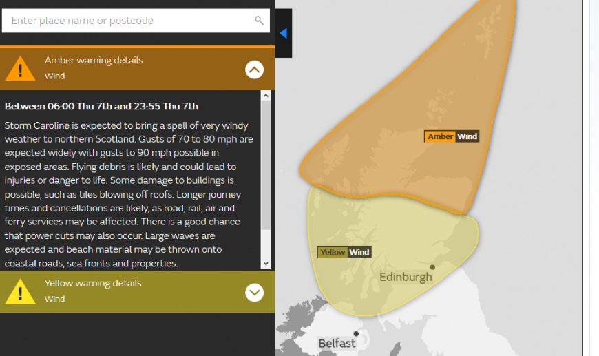
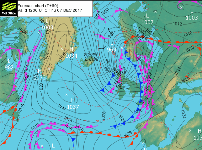
After a wet and windy Wednesday night, the Amber Be Prepared and Yellow Be aware warnings for strong winds relates to gales and storm force winds around a low pressure centred just to the north of Scotland which heads towards western Norway. The warning begins on Thursday morning and lasts well into Thursday night, although very windy conditions could last until dawn on Friday morning. Gusts of 60 to 70mph are expected across many parts with gusts over 80mph possible for exposed coasts and mountains of N & NE Scotland.
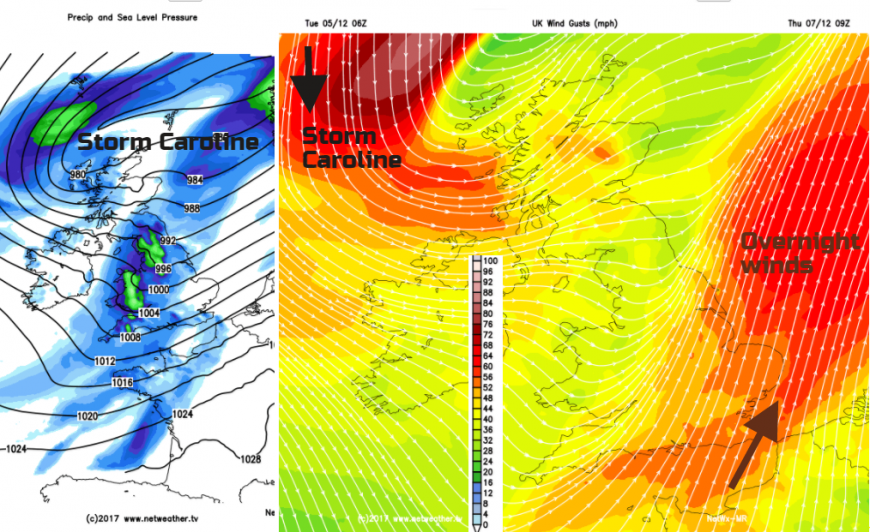
Areas, particularly at risk, will be the Northern and Western Isles, NW Highlands and Grampian region. The fresh to strong SW winds will veer powerfully to a north-westerly. Gale or severe gales will reach the Western Isles and west coast of Scotland during the morning and at lunchtime on Thursday. It will be windy across the UK with strong winds for Northern Ireland and northern Britain, but the gales will transfer across the far north of Scotland affecting the Northern Isles and NE Scotland in the afternoon and possibly the evening rush hour.
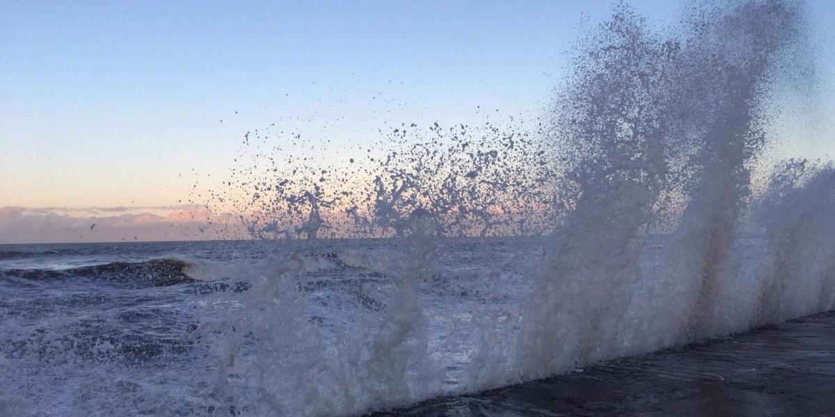
The A96, northern parts of the A9, A90 and A1 for SE Scotland into NE England could see disruption in the second half of Thursday. Ferry services to the Islands may well be affected, it will be worth keeping an eye on @CalMac_Updates @StenaLineUKIE and @NLFerries. There could also be disruption and cancellations on the rail network- Scotrail. Power services could also be interrupted, which in turn affects other services and around the coasts, there will be large waves and wild conditions.
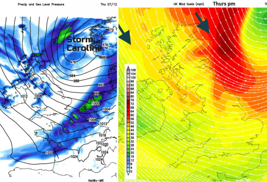
It remains windy on Friday but not with the gales or high gusts, it will be the wind chill getting noticed by then.
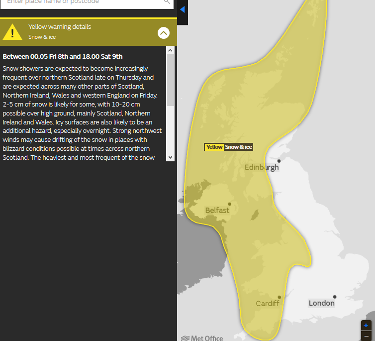
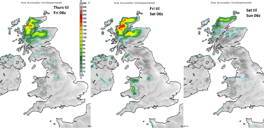
Once Storm Caroline pulls away to Scandinavia, the UK will be left in a cold NW air flow. Temperatures will plummet and snow showers will appear for NW Scotland on Thursday. Another Yellow Be Aware warnings has been issued for Snow and Ice. this runs from Thursday night until later on Saturday. This covers areas exposed to the brisk NW wind.
Cold end to the week
It is going to feel very cold by the weekend. Daytime temperatures will be in low single figures with a widespread frost overnight and temperatures down to -7C. There will be an ice risk and it will feel much colder in the breeze.
The NW Highlands should see plenty of snow with 10s of cms likely. Snowdonia should also catch a decent covering with several cms on Friday. The Antrim Hills, Cambrian mountains, maybe reaching the Peaks, the far west of the Southern Uplands also. For other northern and western areas, it is a case of watching the showers line up. From flurries to a dusting to a proper covering, it will depend on the wind direction, how the showers lines converge, especially filtering in from the Irish Sea.
After Saturday, there is low confidence in the forecast but it will be worth keeping an eye on, with lingering cold air and a low pressure or frontal system heading in from the Atlantic.
Why Name our Storms? A look at this year's name selection
Wind strengths a guide
Loading recent activity...