The alerts are buzzing, the solar wind is high, skies seem to be clear and nature's amazing lightshow, is out there.
Aurora spotting, what do you need?
This is a fickle business; it’s like forecasting snow. If you are in northern Scotland, you are more likely to see decent snow or a northern lights show but you could be there for weeks and not see anything. Other nights there can be reports from Wales, East Anglia, occasionally southern England.
Electrically charged particles are released from the sun, brought towards earth on the solar wind, then enter the earth’s atmosphere and collide with gases such as oxygen (green and higher up -red) and nitrogen (blue/purple). As a result of these collisions, we get the Aurora, or Northern Lights. The lights are seen around both magnetic poles and sometimes, in major storms, are visible as far south as the UK
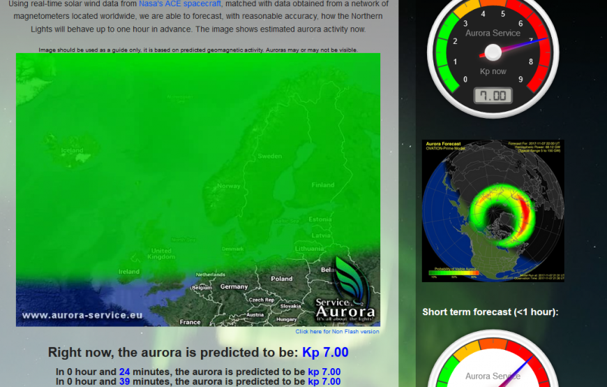
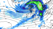
Is the Aurora ON? It’s worth signing up for aurora alerts, which come on apps, Facebook and by email. You may notice other people posting about activity, but it could be too late. It may take some time to work out which levels you need to for your location before you decide to head out. The above graphics are from the NASA Europe Aurora site; I particularly like the view of the northern hemisphere with the aurora intensity colours.
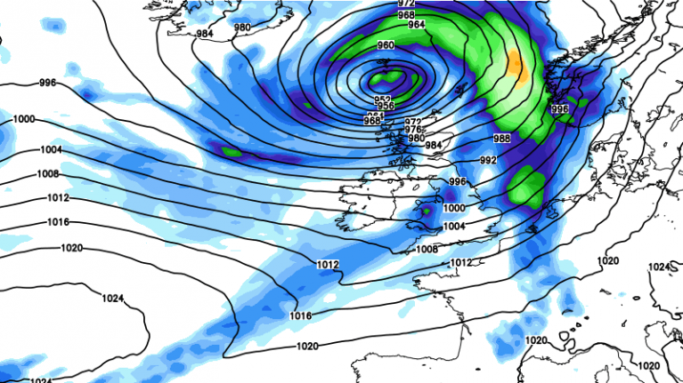
Geomagnetic and Aurora Forecast: Minor (G1) to Moderate (G2) geomagnetic storming will be possible during the next 24-48 hours while a high speed solar wind stream near 700 km/s remains geoeffective. Sky watchers should be alert for visible aurora once dark outside. Solarham.net
Obviously, it can't be cloudy, but even thinner cloud or scattered cloud can affect your viewing. It can add interest to photos, but most of the time it is just plain annoying. The darker the skies and your setting the better the view, and do give your eyes time to adjust. It is better if there isn't much moonlight. However, conditions change over the hours, and there have been great photos from cities such as Edinburgh and Aberdeen.
If you live with a good dark view, then you can take your chances popping out and in, when the alerts pipe up. If a storm is going on you may travel some way to set up for a particular view or photo setting. Also, even though you may think you will just go and have a look for 10 minutes, it can be a bit like fishing, “just a little bit longer, just in case”. Take lots of clothes.
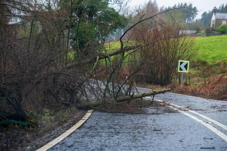
The weather does not care that there is an incredible aurora going on. So many times, the UK is shrouded in cloud and rain. Even on a clear night, fog can form and obliterate your view of the near horizon.
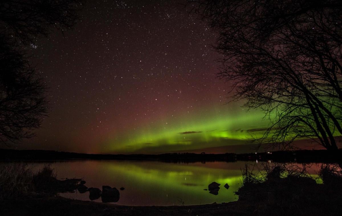
What you actually see, especially here in the UK, isn’t quite what the amazing brightly colourful photos show. I’ve watched across the Forth into the darkness over Fife, as a pale growing streak reached across the sky. You would think it was just a bank of cloud, but perhaps you could say it had a green-ish tinge. Others who have been before can spot it more easily. You need to let your eyes adjust, and over time, things change, and I could identify a lighter area with a green/blue colouring.
That might be it, that’s the issue, how long to wait, will it come to anything, have you missed the peak, or if you go home will you wake up in the morning to incredible photos and the best storm ever seen.
I’ve seen them once, and it was emotional. I did cry; I have wanted to see the Aurora for years, even going to Lapland for the day with quiet hopes and plea for Santa. My viewing was just down the road in SE Scotland.
.png?w=641)
The alerts were high; photos were beginning to appear on Twitter. It was out there. The greeny lighter band up from the horizon brightened and then began to pulsate. Glory, that was the word that came to mind. Like something accompanying a nativity scene with a host of angels but in the wrong colour. It danced, radiated and pulsated with columns of light reaching upwards. There it was across the Forth, me with the photographer aurora spotters and all their mega gear. It was moving.
What showed up on the tripod, long exposure cameras was quite different. The skies were much lighter, it was actually really dark. There were more colours and shades visible that I hadn’t seen. The stationary photo didn’t capture the pulsating rhythm of how the lights had danced and entranced me. Had those colours all been there? Some of the photos you see are altered to enhance the colours. Most just capture more than human eyes’ night-time vision can manage.
Still what I did see was very special. I tend to look at the NASA Europe Aurora site and Lancaster University Aurora alerts. I heard mention of Glendale alerts too. There is some great advice on the website, super photos and starter tips for aurora photography.
Even if you aren’t in the right place or the cloud is being annoying, you can look at the view in Shetland on their webcams.
From spaceweather.com
What made Nov 7th 2017 display so strong? A solar wind stream hit Earth's magnetic field on Nov. 7th. The leading edge of the stream contained a co-rotating interaction region (CIR). CIRs are transition zones between slow- and fast-moving streams of solar wind; they hold density gradients and strong magnetic fields that do an extra-good job sparking auroras. The arrival of the CIR sparked a G2-class geomagnetic storm and a surprisingly good show
More chat and information on the Netweather Solar & Aurora activity thread
Loading recent activity...