This week looks mixed with bouts of rain, but it will become milder as we lose the chilly flow from the north. It’s half term for some and there will be times of fine, autumn weather, but potentially wetter and windier weather for Thursday and Friday into Saturday.
For Monday, the UK is sitting between a low pressure over Scandinavia and an Atlantic high pressure to the west. The week starts with a zonal jetstream moving straight across the Atlantic. After the clear, sunny and nippy start on Monday morning, there is a new Atlantic system heading our way. This will bring a change for Northern Ireland, but for much of Britain, Monday will be a fine day.
Temperatures in England and Wales will be around 12 to 14C. Scotland and parts of northern England exposed to a brisk NW wind will be colder. The Arctic influence remains, and temperatures will be only 8 to 10C even with the sunshine. A scattering of showers will continue for the far north of Scotland and a few clipping the North Sea coasts until early afternoon. There has been a feed of showery rain over Lancashire, Manchester to the Peak District this morning, brought in on the northwesterly flow. And damp for north Wales and Cheshire with more cloud here.
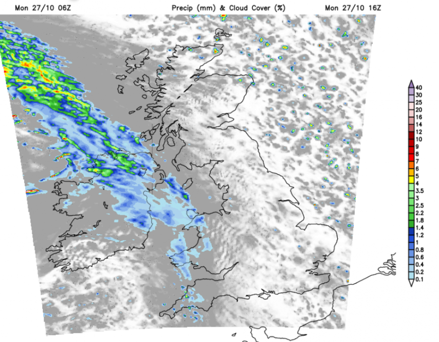
The wind will ease off and back to a westerly so these areas should brighten up. For Northern Ireland, temperatures will remain at 10 or 11C with increasing cloud and further outbreaks of rain as the warm front arrives. There have been a few showery bits, but the main frontal rain is expected this afternoon, extending into western Wales with showery outbreaks over SW England by teatime.
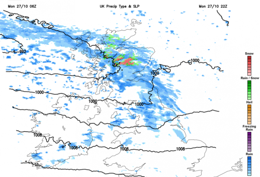
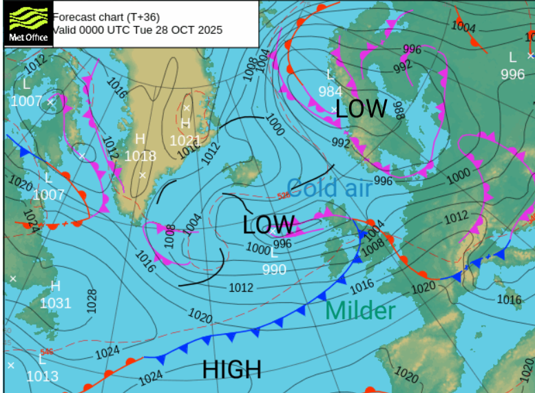
The frontal band will head eastwards with heavier rain for western Scotland and the Lake District, accompanied by a fresh westerly wind. As it meets the still, cold Arctic air, there will be snow over the Scottish mountains and by Tuesday morning, we will be left with the occluded front stretched across Scotland with cloud and outbreaks rain.
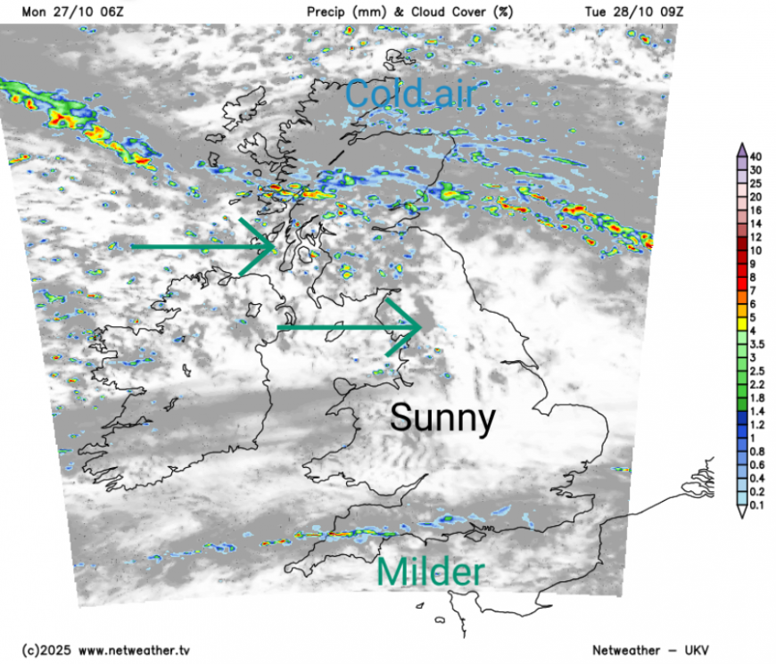
There will also be a thin line of sharp showers over the southern counties of England from the cold front and sunshine in between. The southern line will edge down to the Channel coast and the northern band will bring blustery showers to Northern Ireland and across the Solway Firth.
Heavier showers will arrive on Tuesday evening from the west, wrapped around the occlusion which will still be trailing behind, lasting into Wednesday morning with heavy rain showers and snow for the NW Highlands. The line of showers in the far showers will wave into frontal rain for south Wales on Tuesday night across central England, and then another pulse looks likely from the southwest ready for Wednesday. Around these bands, there will still be fair weather, mild overnight in the south, but still chilly further north.
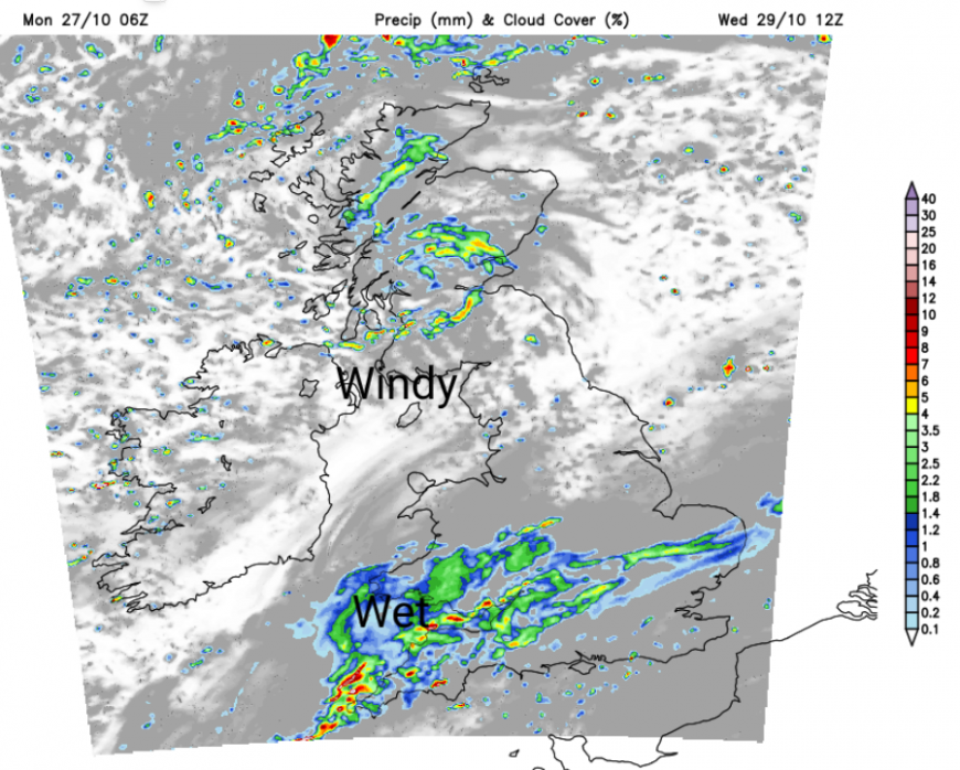
By Wednesday, there will be wet and windy weather rotating around the occlusion and low centre for parts of Scotland and Northern Ireland with some heavy bursts including hail and lightning, also wintry across the Scottish hills.
For the rain band over southern England, there will be some uncertainty about how this will sway north and south, so bear that in mind if you are planning outdoor activities. A weather app might say dry, which is because it is showing one model solution that has the rain band 15 miles to the south, currently.
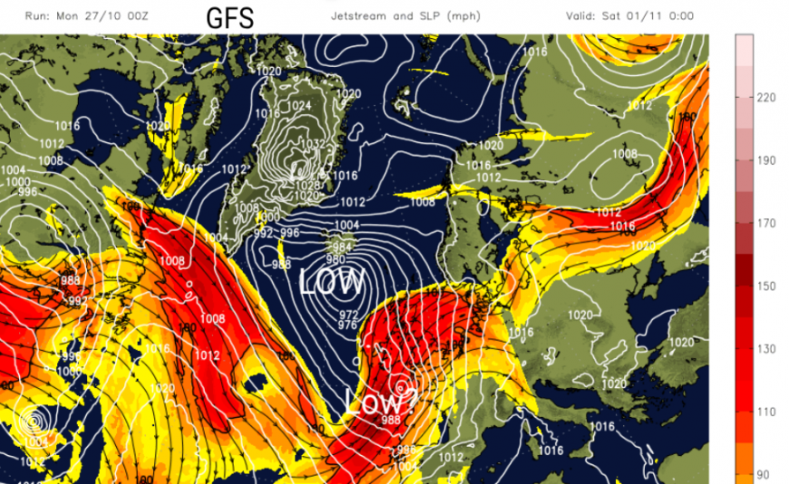
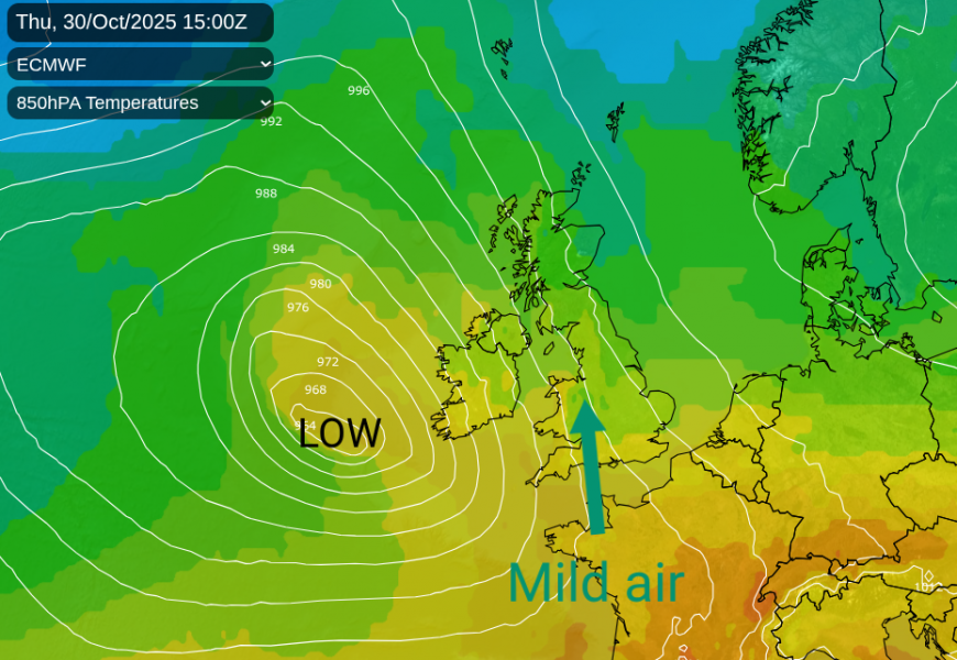
Later in the week, the jetstream buckles, and there are signs of deepening low pressure being caught up in its meanders. One low close to southern Ireland on Thursday, which will draw milder air up from the south and potentially another one Friday night into Saturday. It looks like it could be a blustery, even wet time for some on Friday evening for those heading out for Halloween. This signals a change to windier weather but times of heavier and more persistent rainfall. This is good news for the areas still in drought, crying out for autumn rains. There is some uncertainty around the developments for Friday into the start of the weekend. Temperatures in the north will be back into double figures and for southern Britain 14 to 17C but tempered by any rain and the wind.
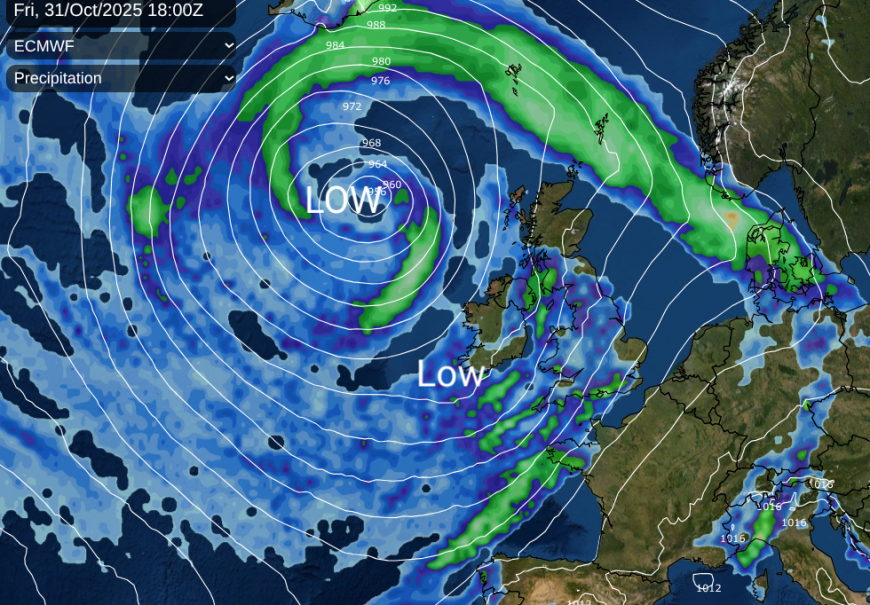
The ECM and UKV global model show a secondary low over northern Britain early on Saturday after the first low stays to the west of the UK on Thursday. Something to watch later this week with milder but potentially very wet and windy conditions.
Loading recent activity...