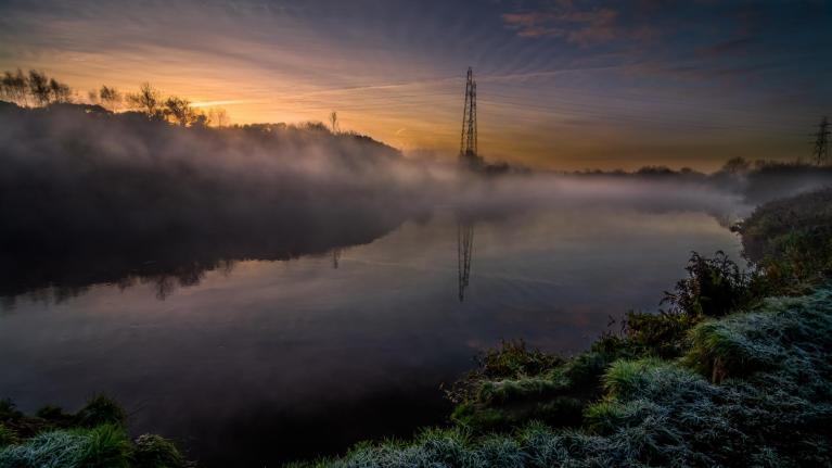
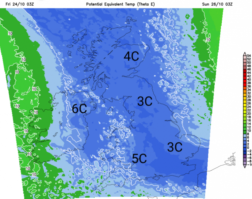
We have a cold northerly for the start of the weekend. It is already feeling chilly but you will notice the difference by Saturday morning. Saturday will feel cold in the brisk winds, even with some sunshine. It will be colder overnight with clear skies and lighter winds, leading to a patchy frost. There is a bit of mountain snow in the forecast, gales for eastern Britain and rain which has to be welcome in the drought areas.
The clocks change on Saturday night, so that is an extra hour in bed. There will be another change during Sunday as the Atlantic influence returns with cloud, frontal rain and a milder westerly flow replacing the northerly.
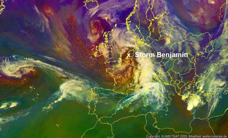
This cold air is coming from the Arctic in a flow behind two linked low pressures, one named Benjamin by Météo France for a storm early on Wednesday, which is still impacting the North Sea with red wind warnings for northern Germany on Friday morning. This same low will bring gales along North Sea coasts overnight into Saturday as the storm just rotates around.
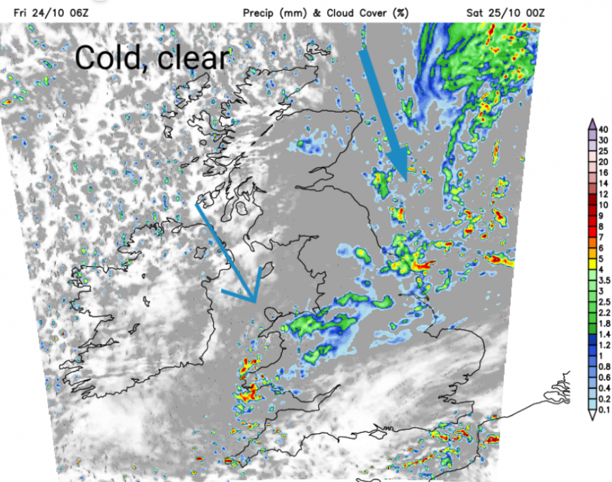
The other smaller low has been bringing windy weather to northwest Scotland but as it moves southwards over Ireland, there is an occluded front heading south. This band of rain will move from Scotland and Northern Ireland to north Wales tonight, with clearing skies following.
As the skies clear, the wind will veer from a westerly to the northerly and it will feel cold in the fresh N/NW flow. The winds will be strong for Grampian and the Northern Isles by Saturday morning with Aberdeen feeling more like 1C than 7C.
“a risk of some localised coastal flooding impacts due to high waves on the coasts of Moray, Easter Ross and north-facing coasts of Aberdeenshire on Friday, and in the South East on Saturday” Scottish Flood Forecast
The N/NW flow will bring sharp showers into Northern Ireland and parts of Scotland that are exposed to the wind. The last of the occlusion will be clearing from SE England on Saturday morning with a damp, chilly feel. There will be a lot of sunshine behind the rain. Some of the showers will manage to filter down to Wales but it should be a fine day for most of the UK, just cold, especially in the brisk wind.
 Environment Agency “Local coastal flooding is possible in parts of the East of England on Saturday and Sunday. Locations most affected will be low-lying land and roads near rivers or on the coast.” Large tides this weekend with the onshore wind from the north.
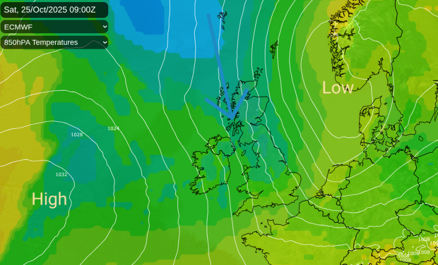
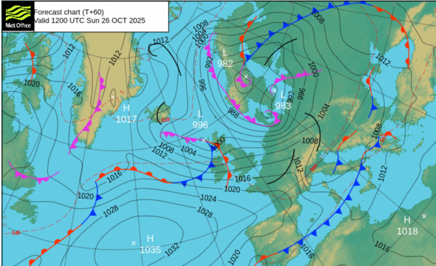
Low pressure will be over Scandinavia with high pressure out west from the UK. A small low pressure system will nip over the high and bring frontal rain to Northern Ireland early on Sunday and even mountain snow to the NW Highlands and then the Cairngorms by lunchtime. As Sunday turns windy, the cold air will remain over northern Scotland but elsewhere temperatures will recover a bit, 10 to 13C. Eastern England, London and the Home Counties should have a fine Sunday morning, although nippy.
The low pressure over Scandinavia will steer this little low southeastwards over the UK, which clears the rain but keeps the colder air over northern Britain for another night.
It will be half term holidays for some as October comes to an end. Monday starts off cold again but with clear skies and sunshine. Southeastern Britain will have a cold northwest breeze, adding to the chill. Another Atlantic front looks to wave in from the west later on Monday, leaving Tuesday in a westerly flow
There will be some hefty showers about, but a good deal of fine, bright weather. Western Scotland will see heavier showers from the west coast and in the far north.
The ECM model wants an Atlantic low pressure by Thursday, bringing wet and windy weather into Friday. The GFS model has milder air from the south by midweek but bands of rain from nearby low pressures for Thursday and Friday. It doesn't look as cold as this weekend but there isn’t high pressure with spooky fog and frost either. It looks unsettled and it’s too far ahead to pin down the detail at this stage.
Loading recent activity...