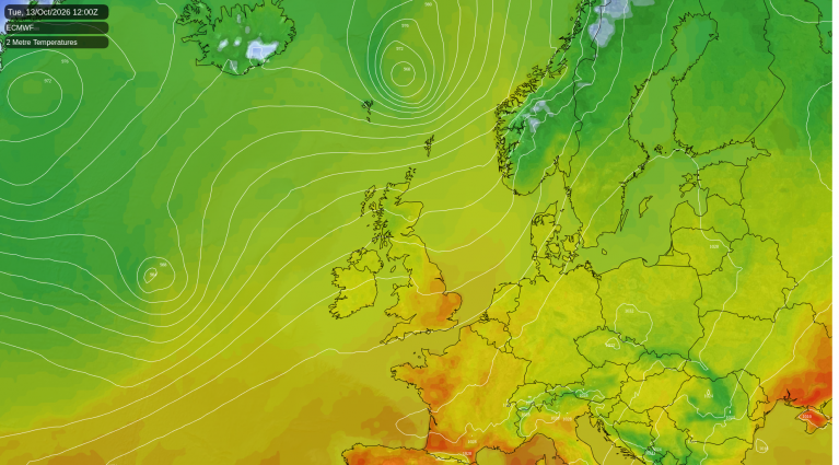
Many forecasts have gone for a wet autumn, but September was another dry month in eastern and southern Britain, and October has so far continued in the same vein. There are signs that high pressure will remain close to the south and/or west of Britain for at least another ten days, though there will be some changeable west to south-westerly types, chiefly affecting the north-west of Britain. Parts of north-western Britain, particularly western Scotland, have been rather wet, indicating a heightened northwest-southeast split associated with frequent westerly winds.
This is not uncommon in years with a strong El Nino event. Both September and October 1997 were drier and sunnier than average in most parts of the country. Many areas had drier than average months in September and October 2009, and in September and October 2015. It doesn't always happen this way - October 1982, during the very strong 1982/83 El Nino, was a wet month in most regions - but it is common.
The recurring theme in these El Nino years is that the Novembers are usually wet and windy, and often feature a strong east Atlantic trough and south to south-westerly winds. November 2009 in particular was remarkably wet, when southerly tracking lows brought frequent rain during the first half, and around the 19th, a powerful weather system often referred to as an "atmospheric river" delivered very persistent rain to Cumbria, and widespread and severe flooding. The longer range outputs from the American GFS model are suggesting support for an east Atlantic trough establishing towards the last few days of October. The ECMWF 42-day model has a weak signal for late October and early November, but points towards low pressure dominating in the middle part of November.
El Nino winters tend to be mild and wet early in the winter, followed by Greenland blocking and colder weather during late winter and early spring. 1982/83 was a stark example, and 2015/16 also saw this pattern but the Arctic was exceptionally warm during the first three months of 2016 and so our northerlies didn't come to much. There were, however, a couple of notably potent northerlies for the time of year in April 2016.
But some winters have run counter to this. The winter of 2023/24 showed similarities with this pattern, but in early 2024 a strong jet stream powered through Britain, beneath a Greenland blocking high, and as a result much of Britain, particularly the south, was mild and wet, while persistently cold weather ended up bottled up over Scandinavia.
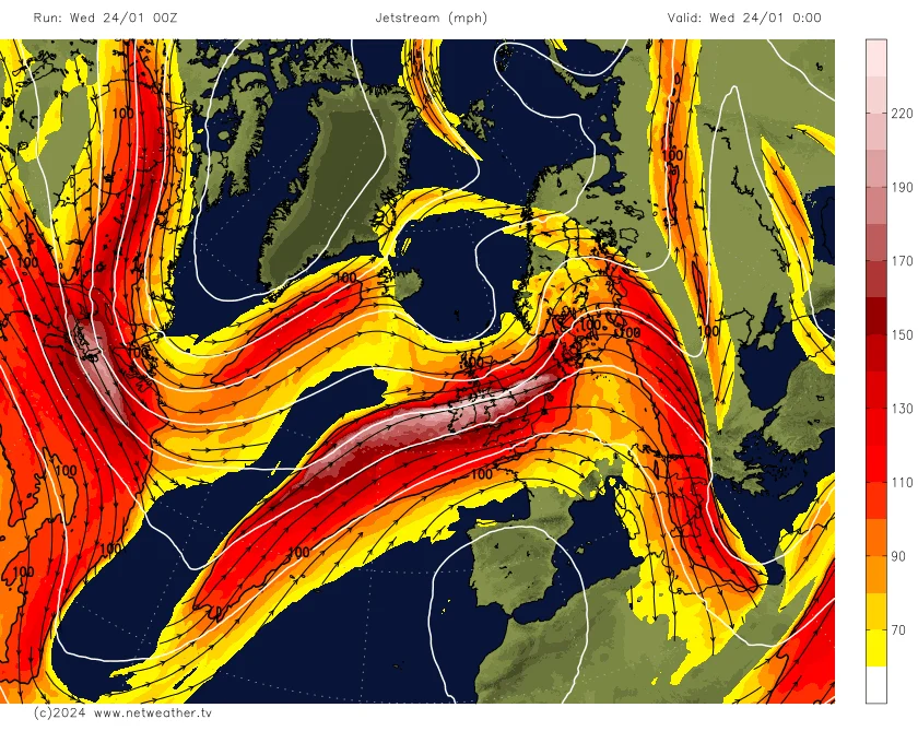
The winter of 1997/98 looked to be going the traditional El Nino route until the beginning of February, but then a large blocking high became established over central Europe, giving persistently mild south-westerlies to Britain - indeed, over a large area of northern Britain, February 1998 still stands as the warmest February on record. Conversely, in the winter of 2009/10, the mild and wet pattern fizzled out by mid-December and the rest of the season was predominantly cold with a persistent Greenland blocking high.
Current model predictions for winter 2026/27 so far are tending to suggest a "west based negative North Atlantic Oscillation" setup with a blocking high over west Greenland and Canada, and low pressure in the eastern North Atlantic. This is not necessarily conducive to cold or snowy weather over Britain. It can produce a similar result to what we saw in the latter stages of winters 2023/24 and 2025/26, with mainly southerly winds over Britain keeping the weather relatively mild, while cold north and east winds affect Scandinavia and Iceland and sometimes head into central Europe.
Mediterranean summers are normally hot, dry and sunny, but it is quite common for showers and thunderstorms to become relatively frequent in the region during the autumn months. The Mediterranean is currently having a thundery spell, and on 9 October, a tornado pushed through Marsala and Petrosino in Sicily, causing substantial damage and injuring two people. There were widespread evacuations, houses were damaged and vehicles were overturned.
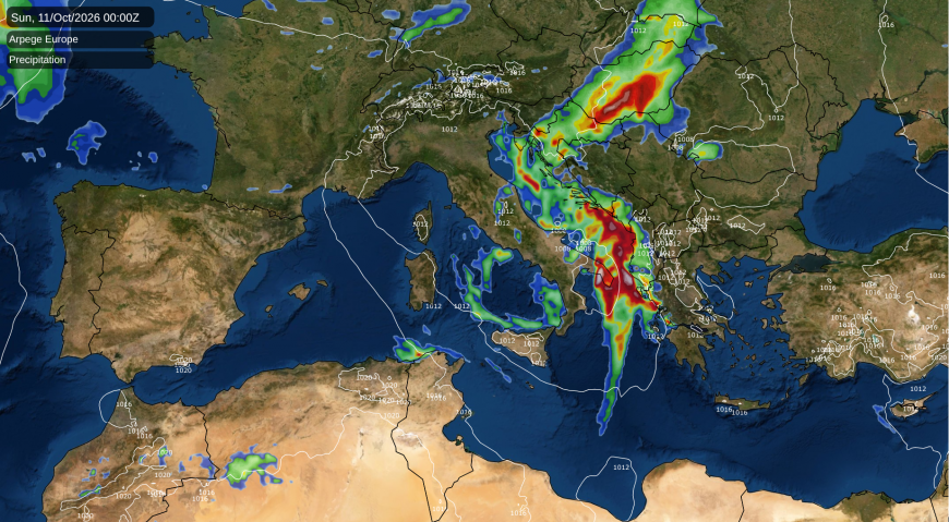
Showers and thunderstorms are expected to persist over the eastern Mediterranean for another few days, but the longer term outlook is for them to fizzle out, with predominantly dry weather establishing starting around midweek next week as high pressure pushes south-eastwards into the region. There is potential for more thundery outbreaks to develop over the western Mediterranean in about 7 to 10 days' time, associated with troughs developing around Spain and Portugal.
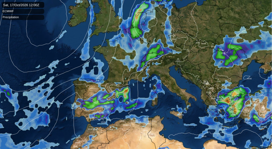
The chances of wet and unsettled weather over Spain and Portugal may increase towards November if we move into a pattern with a marked east Atlantic trough, while the eastern Mediterranean often stays relatively dry in those setups.
Loading recent activity...