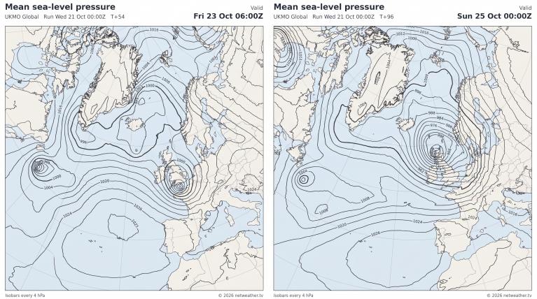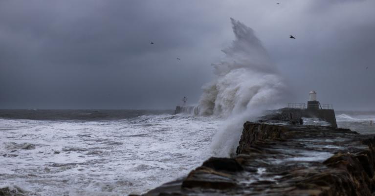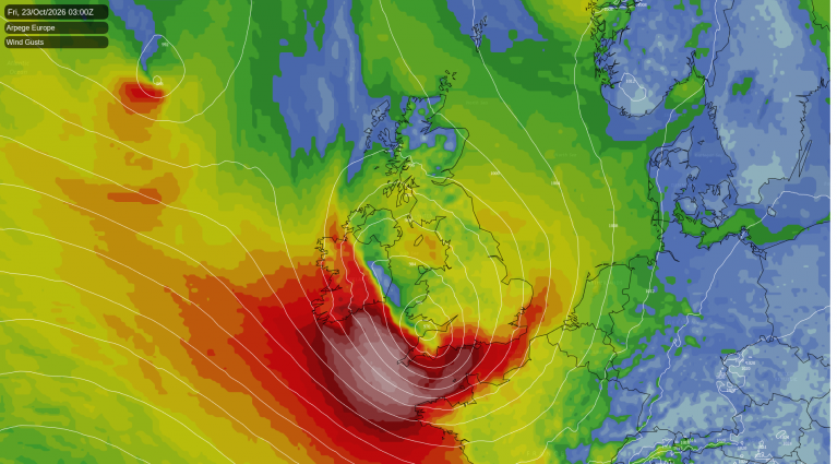
The Sunday papers have a few ‘eye-catching’ Christmas Day weather stories today, most notably the Sunday Express with “Christmas weather: White Christmas? No, A Christmas Day snow SUPERSTORM” or the Mirror’s: “Odds of a white Christmas slashed as Storm Barbara threatens wild winds”
Firstly, the Met Office haven’t named Storm Barbara yet and secondly, from the models I’ve seen, lying snow on Christmas Day is looking unlikely for most unless you are up the mountains of the north and west. Having said, the weather models have been consistently indicating the potential for a deep depression to pass close to Scotland next weekend, bringing heavy rain, severe gales or even storm force winds in the north and west. Also there is a chance that colder polar air behind one depression on Friday and another deeper low early Sunday could bring wintry showers to Scotland, with some wet snow falling, though perhaps not settling on Christmas Eve and again later on Christmas Day.
For many people, a white Christmas means a covering of snow to wake up to Christmas Day. However, the definition used most widely, notably by those placing and taking bets, is for a single snow flake (perhaps among a mixed shower of rain and snow) to be observed falling in the 24 hours of 25 December.
2010 saw the last white Christmas in the sense of widespread lying snow, though snow falling on the actual day was confined to some snow showers in the east. Christmas 2009 was white in several places too, then we have to go back to 2004 for the last notable white Christmas, with widespread lying snow across northern and western parts. Since 2010 we have seen fairly mild Christmas weather. Christmas 2011 was exceptionally mild, with 15.1C recorded at Aberdeen and Northern Ireland has its warmest Christmas Day on record, with 14.3C at Murlough, County Down.
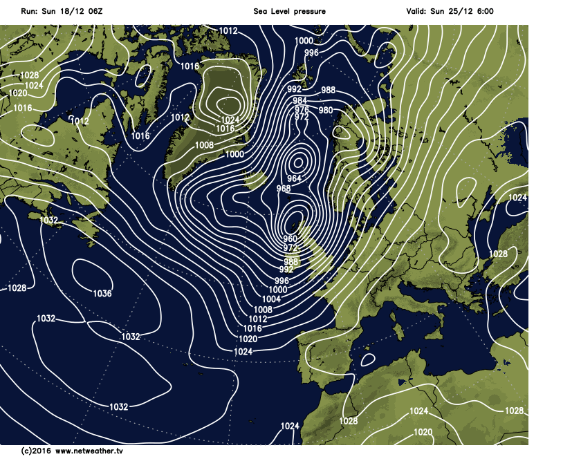
Stormy weather affected the festive periods in both 2013 and 2015 and the current weather model outlook suggests unsettled conditions arriving off the Atlantic mid-week will continue into the Christmas weekend. The models and their ensembles are also currently pointing to a particularly stormy period next weekend, with a deep low passing north of Scotland at some point – which would bring gales or severe gales to the UK, the worst of the strong winds across northern and western areas. At this range it is not wise to forecast too much detail with regards to wind strengths and rainfall, as 7 days away the timing, depth and track of such Atlantic depressions indicated to affect the UK next weekend may change during the coming week. However, it’s worth highlighting that we are entering a period of sometimes wet and windy weather over the Festive Period, with potential of one or two of these Atlantic depressions rapidly deepening and bringing severe gales or storm force winds – which may bring some disruption.
The Altantic re-awakens mid-week, with spells of wet and windy weather into the Christmas weekend
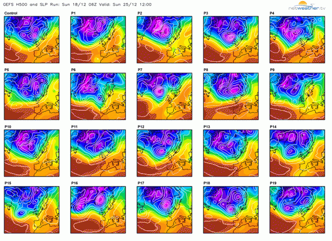
Quite a few GFS ensemble members show a deep low near Scotland on Christmas Day:
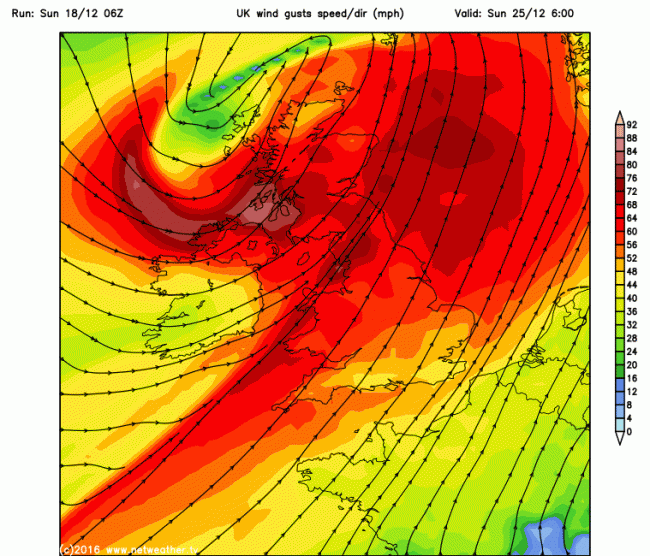
At the moment, both GFS and ECMWF high resolution runs indicate a deep depression move NE between Scotland and Iceland on Friday, EC closer to Iceland, bringing gales or severe gales to northern and western areas – GFS has 50-65mph gusts for Scotland, N Ireland and Irish Sea coasts. But it’s a second perhaps deeper low that gets closer to Scotland modelled by both GFS and EC that arrives early Christmas morning that is currently looking more concerning. 06z GFS shows 70-85mph wind gusts across Scotland, N. Ireland, N England and Irish Sea coasts Christmas morning, before winds ease markedly from the west in the afternoon. Again, it must be stressed that it’s too far away to have certainty that it will be as windy as this and spread false-alarm this early on unlike some tabloids have done this morning. But it does look like it will be, at least, wet and windy over the Christmas weekend.
Sunday's 06z GFS high-res run shows 70-85mph wind gusts for northern areas on Christmas Day
So what about chances of snow on Christmas Day? In the wake of Friday’s modelled deep low passing to the north near Iceland, cold and showery polar air sweeping in from the west on Saturday (Christmas Eve) will likely bring snow to higher ground in the north, lower levels in the north perhaps seeing a wintry mix. Then as that next deeper low sweeps in for Christmas Eve night, milder air will be sucked in ahead of it, so unlikely many away from the Highlands of Scotland will open the curtains to a covering of snow on Christmas Day morning. However, like Friday’s low, colder polar air sweeping in wake of this deep low may bring some sleet or snow showers to Scotland in the evening. However, this far off subject to great modification before then. Certainly most of England and Wales and lowland Scotland seeing a green Christmas weekend.
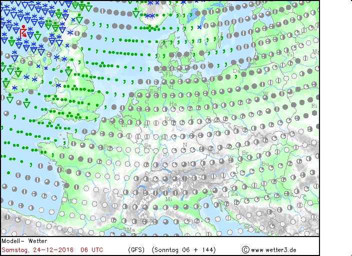
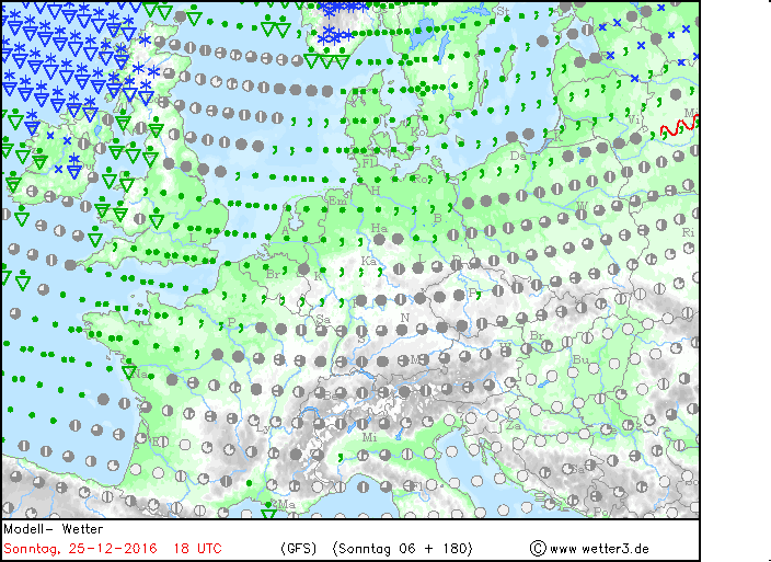
Some snow for Christmas? Too far off to forecast with any accuracy for now, but just for fun, GFS indicates potential for snow showers in the north Xmas Eve and, after turning milder evening and overnight, again later on Xmas Day
Before then, there is a continuing risk of fog thickening across southern England and parts of south Wales tonight and again Monday night, which, like the last few mornings, could bring some tricky driving conditions and also delays or cancellations at airports in SE England. So not a great start to those trying get away for Christmas or for travel to work before the festive holidays begin.
Loading recent activity...