Thursday 25th has a lot of weather phenomenon going on:
Foehn effect in the east of the UK
Very warm yet humid stable air coming up from the SW, giving unusually high thicknesses - 564 DAM today.
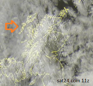
Looking at the visible satellite picture today, particularly over northern Scotland you can see lines on the white clouds. These are mostly running N/S with northern Britain sitting in a fresh westerly wind (orange arrow). It is westerly at the surface and up through the atmosphere
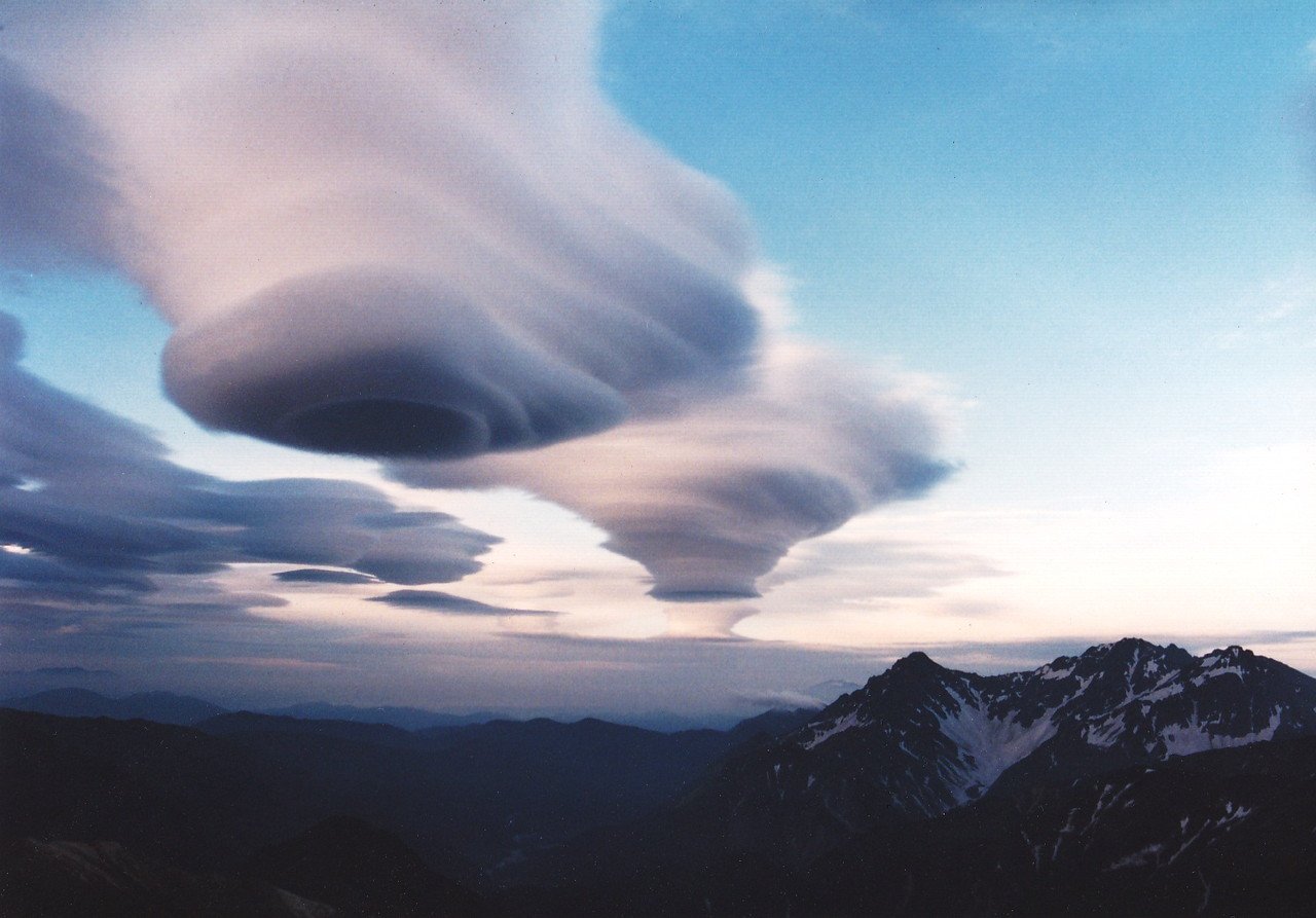
This kind of set up is ripe for Spaceship clouds - Lenticular clouds
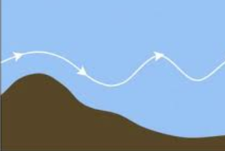
As a brisk wind blows over higher ground, such as the NW Highlands or the Grampians, its quick path is interrupted by the mountains and it sets off an undulation. The air has to be stable and there has to be some moisture to create the clouds. The Foehn effect seems to have dried out most of the air over Grampian, but there is still a chance os seeing clouds this evening. In the up draught part there are the cloud lines and in the downdraught part it is clear, these lines are standing lee waves and can include lenticular clouds.
Lenticularis (len) – clouds having the shape of a lens or almond, often very elongated and usually with well-defined outlines; they occasionally show iridescence. Example: Altocumulus lenticularis
In model terms, this is quite a small scale feature yet can be very dangerous for aircraft, with the lee waves and rotor streaming. Modelling of orography is included in the forecast model, but is not perfect and often smoothed slightly. However the conditions are quite formulaic, stable layer with lower stability above and below, wind direction perpendicular to mountain range (westerly over NW Highlands which run N/S). Strong enough winds, in similar direction up through the atmosphere. If the 'lennie' lenticular cloud’s do form they are a great visual indicator to pilots of the difficult atmospheric conditions, but the lee waving doesn’t always form these clouds and the up/down draughts, icing and possible rotor streaming are too dangerous to rely on seeing one type of cloud.
If you in north or eastern Scotland, or maybe parts of N.Ireland and Northumberland, worth a look this evening, it will be warm enough standing outside, in some shelter from the wind.
Lenticular photograph credit: By Alpsdake (Own work) [CC-BY-SA-3.0], via Wikimedia Commons
Loading recent activity...