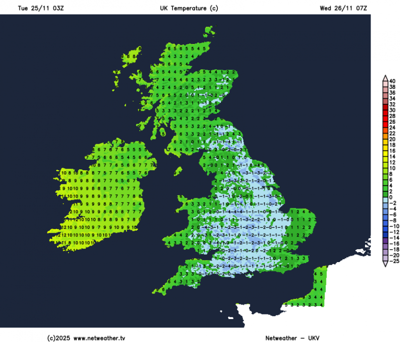
It’s a chilly start to this week, in the northerly flow, though not as cold as last week, and at least will be dry for many today, with some decent spells of sunshine, as a ridge of high pressure builds in. With clear skies tonight for many, a widespread frost will greet many tomorrow morning, before thickening cloud and patchy rain in the west spreads east.
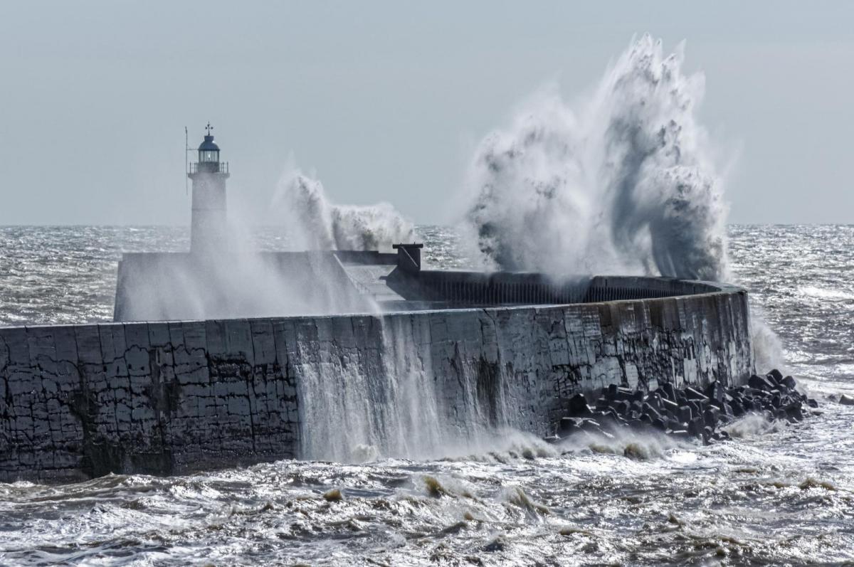
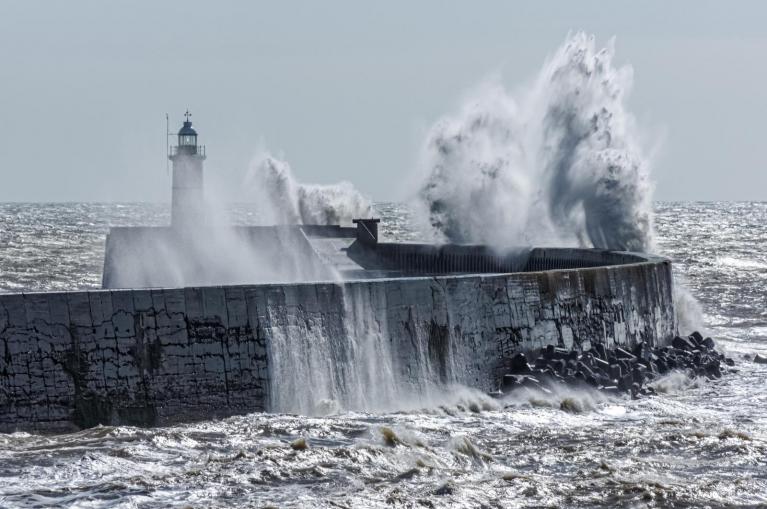
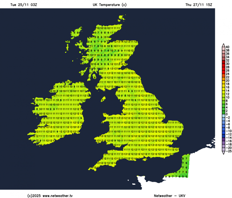
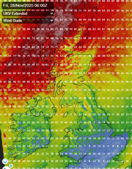
It will turn much milder from Thursday, as a strengthening southwesterly wind develops - with temperatures widely reaching the low teens, perhaps 13-14C in places on Thursday and Friday. Changeable both days, with showers or brief spells of rain blowing through, but also some sunny spells. Generally windy, but becoming very windy across the far northwest for a time Thursday night / Friday morning, as a deep low tracks northeast near the Faroes, gusts of 70-80mph forecast for the Western Isles.
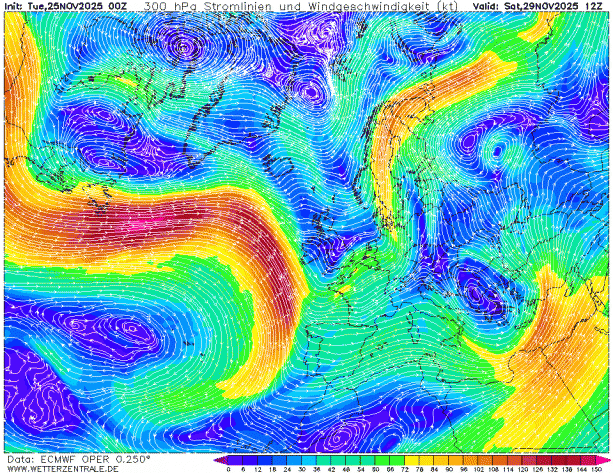
A strengthening jet streak arrives over the weekend, heralding the start of a protracted unsettled and sometimes stormy spell into early December.
The UK Met Office model continues to forecast a rapidly deepening low as it approaches SW England on Saturday, with gales developing here. ECMWF doesn’t rapidly deep the low and so takes it further south across the far north of France, while GFS takes a shallow low northeast across England & Wales, with a spell of rain, then deepens the low over the North Sea.
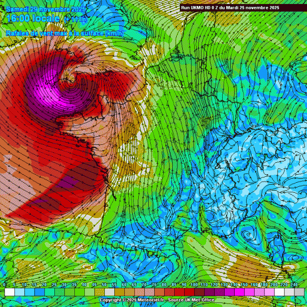
Models differ over whether or when the low engages shortwave trough arriving from the west and strong diffluence aloft in the left exit region of a strong jet streak arriving off the Atlantic across the SW.
Not much support for such a deep low moving across the far south in the ECMWF ensemble postage stamps, so I would think the UKMO solution is unlikely for now, but worth keeping an eye on. A spell of heavy rain possible moving northeast across southern UK on Saturday, as slowly deepening low moves northeast seems most likely for now.
Then staying rather unsettled, windy and mild as we head into the first week of December, thanks to the tropospheric polar vortex organising and strengthening to the northwest over Greenland and northern Canada driving a strong westerly flow across the North Atlantic. This will manifest in a strong zonal (westerly) jet stream aimed at the UK and Ireland through much of next week, becoming very strong as the week wears on.
This will mean it will be often windy, with gales around coasts along with increasingly frequent spells of rain along frontal systems moving off the Atlantic across all parts, heavy in places. Perhaps a rapidly deepening low at some point moving northeast too, given the strong jet stream nearby, which may become a named storm, but too far off to have any confidence for now on this occurring.
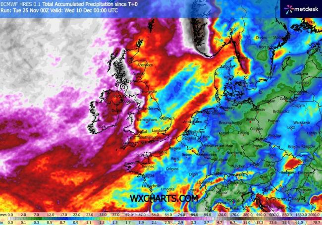
Highest rainfall totals across the west next week, where we could see well in excess of 100mm fall, also could be quite wet across the far south, as secondary lows run across here. So we may start to see an increase in flooding issues in the west and perhaps far south. Spring tides end of next week / following weekend could bring a risk of coastal flooding too should there be strong winds.
Loading recent activity...