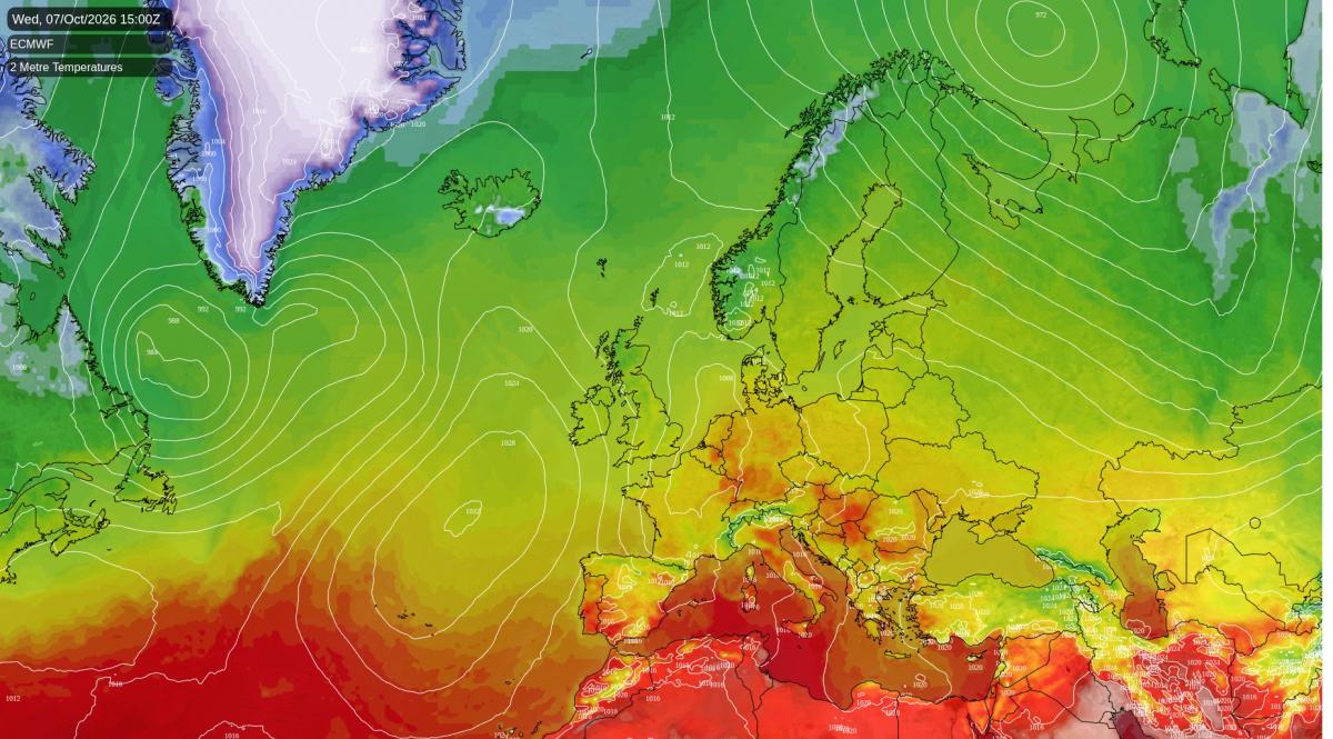
A cold front, the leading edge of fresher air, is sinking slowly south-east across northern England this evening. It is expected to bring a band of rain from the Irish Sea across north-west England and Yorkshire, briefly heavy over the south Pennines early in the evening. Showers are likely this evening in Wales, the south-west, the Midlands, northern Scotland and on the Isle of Man. Belfast is most likely dry, while southern Scotland, East Anglia and the south-east have a 30 to 40% chance of a shower.
Overnight the band will sink south, so northern England, the Midlands and the south-west start Wednesday wet. It will be a very mild night in London, where temperatures should stay at around 16C, some six degrees above normal. Further north it turns chilly, with Dumfries and the Borders dropping to about 4C, and the Grampian glens around Tomintoul may see a touch of ground frost by dawn.
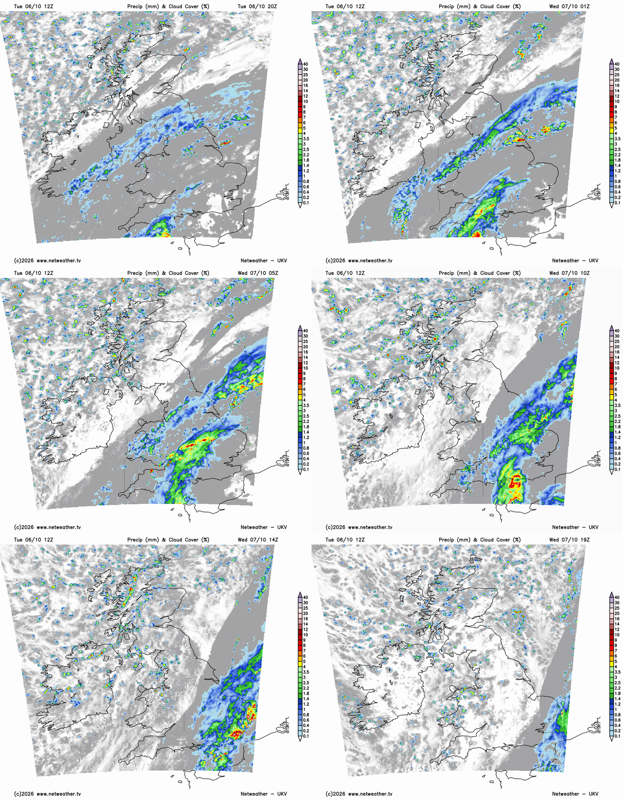
A small area of low pressure running north-east past East Anglia then holds the rain over south-east England and East Anglia from late morning on Wednesday. The heaviest of it is expected through the early and middle part of the afternoon along north Kent and the Sussex coast, and north Kent could see 15 to 20mm over the day. The rain should clear Kent during the evening. A brisk northerly follows, with gusts of 40 to 45mph on the exposed north Kent coast and in Cornwall.
Northern England should brighten up on Wednesday afternoon, and Wales stays showery into the evening. Scotland, Northern Ireland and the Isle of Man have a 60 to 70% chance of a shower on Wednesday. It is likely to feel noticeably fresher in the northerly, with 12 to 17C across England and Wales and 11 to 13C in Scotland. Kent should hold about 18C.
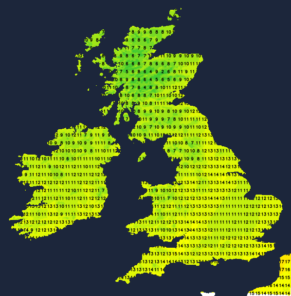
Skies clear on Wednesday night as a ridge of high pressure builds in from the Atlantic, and Thursday starts cold. Temperatures are expected to fall to around 2C in Dumfries and Carlisle and close to freezing on the Southern Uplands, with a ground frost in the north Pennines around Alston, around Biggar and Hawick, and in upper Deeside around Braemar. A few showers may brush the Norfolk coast early on Thursday. Through the morning and early afternoon East Anglia, the south-east and north-east England should see the most sunshine. Thursday will be chilly everywhere, with 12 to 16C in England and Wales and 10 to 13C in Scotland, two to three degrees below average.
Rain from an Atlantic front is expected to reach Northern Ireland, western Scotland, Wales and Cornwall by early evening on Thursday. Some heavy bursts are likely over south-west Wales and Cornwall later that evening. The south-east has a slightly better than evens chance of the rain arriving before midnight. After midnight the band should cross Yorkshire, the Midlands, the south-west and East Anglia, heaviest for a time over the western Highlands and the Lake District and then over mid and north Wales around dawn on Friday. It is likely to clear the east coast by mid-morning on Friday.
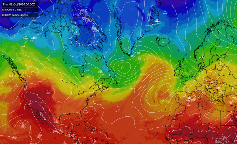
Friday should turn milder in a westerly, with 18 to 19C from the east Midlands across to East Anglia and London once the rain has gone, and 10 to 14C in Scotland. A deep low near Iceland tightens the wind on its southern flank. Gusts of 30 to 40mph are likely across much of England and Wales on Friday, with 40 to 45mph in Shetland and over the Pennine hills. Showers follow in the afternoon, with a good chance of one in Scotland. Belfast has about an even chance of a shower on Friday.
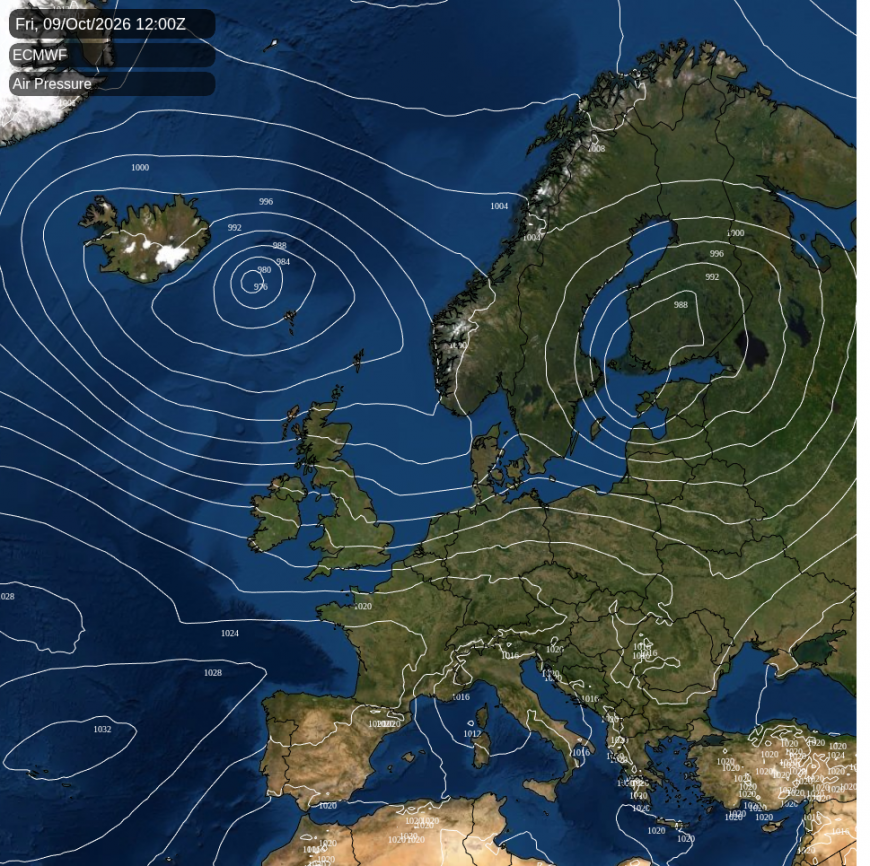
That low is expected to pass north of Scotland on Friday night and Saturday before pulling away into the North Sea. ECMWF and the American GFS each make it deeper than the Met Office's global model, which the figures here follow. Gusts of 40 to 45mph around the Hebrides, Argyll and Caithness on Saturday morning could therefore be exceeded. Over the open sea west of the Hebrides they could reach 50 to 60mph.
Saturday should be cooler and showery in the north. Showers are almost certain in northern Scotland and likely in southern Scotland and northern England. The Isle of Man and the Midlands have about a 40% chance of one and Wales and the south-west a lower risk, while East Anglia and the south-east should stay dry. Temperatures could reach 15 or 16C in the south-east on Saturday but only about 10C around Inverness, some five degrees below normal.
Loading recent activity...