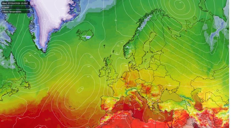
South-east England and East Anglia will stay dry and bright this afternoon, with about 22C from London across Essex to Suffolk, four to five degrees above normal for early October. The Midlands and the south-west should be mostly dry this afternoon too. A weak front is bringing patchy, light rain to Northern Ireland and central Scotland, where rain is likely around the Clyde and the Forth. Rain is likely in north-west England by this evening, with an even chance in north-east England. Wales and northern Scotland have nearer a 40% chance of a shower, and Shetland will be gusty, with 45 to 50mph on exposed coasts.
Tuesday will be another warm day in the south-east, with London around 22C again in light winds. Further north the front sinks slowly south-east. Rain is expected to reach Cumbria and Lancashire in the early evening, then spread across the Pennines to Durham and North Yorkshire by late evening, heaviest on the hills.
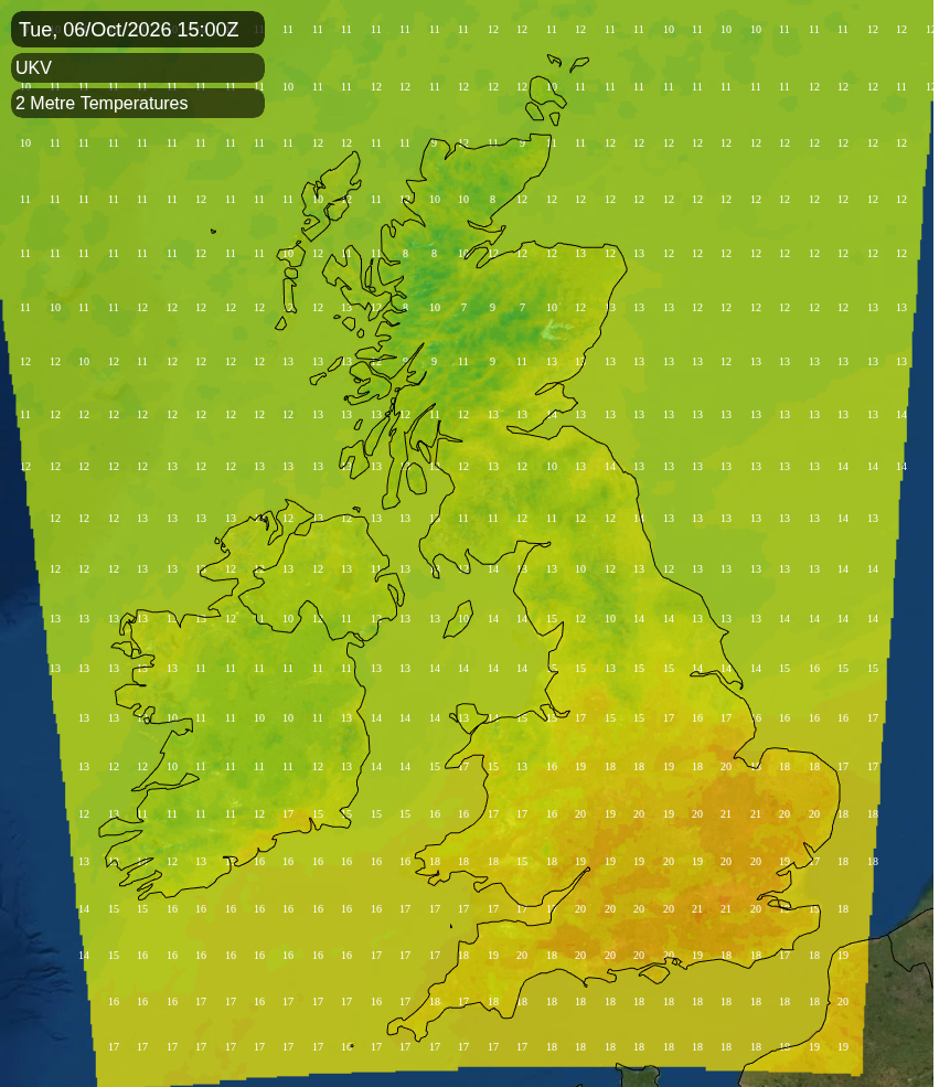
Behind the front, much of Scotland and Northern Ireland will be fresher at 12 to 14C. Rain is likely at times on Tuesday in northern Scotland, Northern Ireland, Wales and southern Scotland. The Midlands, East Anglia and southern England are most likely dry, with a 30 to 40% chance of a shower, mainly in the evening.
On Wednesday a small area of low pressure forming on the front over northern France is expected to throw rain back across southern England. A heavy burst is likely on the Dorset and Hampshire coast and the Isle of Wight before dawn. The rain will then spread north-east across Hampshire, London, the Home Counties and East Anglia during the morning, clearing Kent and Suffolk early in the evening. There could be a rumble of thunder in the heavier bursts. Rain or showers are likely at some point on Wednesday across northern England, the Midlands, Wales, the south-west and northern Scotland, mostly overnight and in the morning. Northern Ireland may see a shower, the Isle of Man more probably, while southern Scotland stays mostly dry with a 40% chance of one.
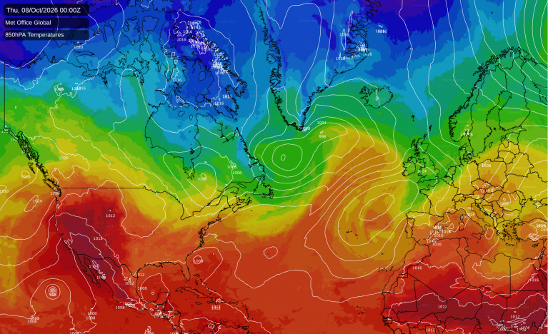
There is some disagreement about that low. The Met Office's global model, which our figures follow, closes it off over northern France on Wednesday. ECMWF and the American GFS keep only a weaker trough there, so how long the rain lingers in the south-east is less certain than its arrival.
Behind the front a cooler north to north-westerly is expected across England and Wales on Wednesday afternoon, with 12 to 17C for most and up to 20C in Kent before the rain clears. Thursday then starts clear and cold under a ridge of high pressure from the Atlantic. Temperatures are likely to fall close to freezing on the Southern Uplands and to 2 or 3C in the coldest towns of southern Scotland and northern England. There should be a ground frost in the north Pennines around Alston, around Biggar and Hawick in the Southern Uplands, and in upper Deeside around Braemar.
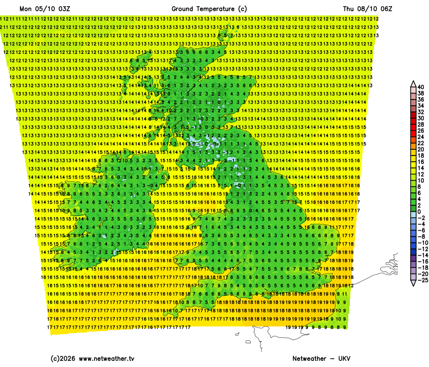
Thursday afternoon will be chilly, with 11 to 15C in England and Wales and 9 to 13C in Scotland. That is about three degrees below normal. East Anglia and the south-east should see plenty of sunshine on Thursday.
A few showers may linger over the Midlands early on Thursday. The next Atlantic front then brings rain to Northern Ireland and the Western Isles by mid-afternoon, and to western Scotland, the Isle of Man, Wales and Cornwall by the evening. It could reach north-west and north-east England and the south-west before midnight. Overnight into Friday the rain should cross all of Scotland, Northern Ireland, the Isle of Man, northern England and Wales, heaviest over the Argyll and Lochaber hills and the Lake District. It is expected to clear the Midlands, the south-west, East Anglia and the south-east during Friday morning. Our own longer-range model holds it over north Wales and north-west England for a few hours longer.
Friday is likely to be breezy, with a west to south-westerly wind strongest across Scotland on the southern flank of a deep low that stays near Iceland. Gusts are likely to approach 50mph along the north coast and in Shetland. Sunny spells and showers should follow the rain, the showers most frequent in north-west Scotland. It could be milder in the south on Friday, with 17 to 20C across East Anglia and the south-east and 11 to 14C in Scotland.
Loading recent activity...